Property Record
349 State Route 57 W, Washington, NJ 07882


NEARBY LISTINGS FOR SALE OR LEASE
Property Detail
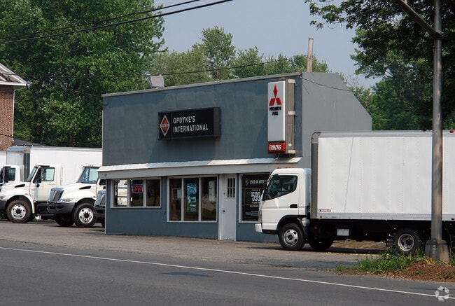
349 State Route 57 W
22-00067-0000-00063-04
Warren
Storebuilding
New Jersey
AE
63.4
34041C0238E
3.45 AC
2024
Warren County
2025
Northern New Jersey
032000
Allentown-Bethlehem-Easton, PA-NJ
1,156 SF
DEMOGRAPHICS near 349 State Route 57 W
1 Mile
3 Mile
5 Mile
2024 Total Population
4,970
15,223
26,440
2029 Population
5,005
15,499
26,921
Pop Growth 2024-2029
+ 0.70%
+ 1.81%
+ 1.82%
Average Age
43
43
43
2024 Total Households
1,986
5,934
10,447
HH Growth 2024-2029
+ 0.50%
+ 1.74%
+ 1.79%
Median Household Inc
$65,045
$84,472
$86,946
Avg Household Size
2.50
2.50
2.50
2024 Avg HH Vehicles
2.00
2.00
2.00
Median Home Value
$247,852
$290,971
$308,948
Median Year Built
1966
1970
1971
Nearby Places
Map Layers
Map Styles
 Street
 Aerial
- Restaurants
- Banks
- Shops
- Fitness
- Groceries
PUBLIC TRANSPORTATION
AIRPORT
Lehigh Valley International
DRIVE
WALK
Distance
Lehigh Valley International
44 min
26.6 mi
Freight Ports
New York Container Terminal
DRIVE
WALK
Distance
New York Container Terminal
75 min
57.3 mi
SALE & LEASE HISTORY
LISTING DATE
SALE/LEASE

Aug 22, 2022
For Sale
Nearby Properties
Address
Land Use
TOTAL SIZE
Lot Size
Zoning
Address
Land Use
TOTAL SIZE
Lot Size
Zoning
Address
Land Use
TOTAL SIZE
Lot Size
Zoning
Address
Land Use
TOTAL SIZE
Lot Size
Zoning
77.78 AC
ED
Address
Land Use
TOTAL SIZE
Lot Size
Zoning
46.85 AC
R-40
Address
Land Use
TOTAL SIZE
Lot Size
Zoning
29.81 AC
HC
Address
Land Use
TOTAL SIZE
Lot Size
Zoning
Address
Land Use
TOTAL SIZE
Lot Size
Zoning
32.90 AC
PL
Address
Land Use
TOTAL SIZE
Lot Size
Zoning
22.84 AC
HC
Address
Land Use
TOTAL SIZE
Lot Size
Zoning
17.20 AC
IP
Address
Land Use
TOTAL SIZE
Lot Size
Zoning
20.43 AC
R4
Address
Land Use
TOTAL SIZE
Lot Size
Zoning
6.24 AC
PVD
Address
Land Use
TOTAL SIZE
Lot Size
Zoning
Address
Land Use
TOTAL SIZE
Lot Size
Zoning
Address
Land Use
TOTAL SIZE
Lot Size
Zoning
15.80 AC
I
Address
Land Use
TOTAL SIZE
Lot Size
Zoning
1,280 SF
240.85 AC
PVD
Address
Land Use
TOTAL SIZE
Lot Size
Zoning
1.87 AC
PVD
Address
Land Use
TOTAL SIZE
Lot Size
Zoning
5.40 AC
OR
Address
Land Use
TOTAL SIZE
Lot Size
Zoning
5.50 AC
OR
Address
Land Use
TOTAL SIZE
Lot Size
Zoning
5.08 AC
HC
Address
Land Use
TOTAL SIZE
Lot Size
Zoning
9.50 AC
PL
Address
Land Use
TOTAL SIZE
Lot Size
Zoning
4.89 AC
R4
Address
Land Use
TOTAL SIZE
Lot Size
Zoning
4,082 SF
9.58 AC
R2
Address
Land Use
TOTAL SIZE
Lot Size
Zoning
11.77 AC
VR
Address
Land Use
TOTAL SIZE
Lot Size
Zoning
1.98 AC
PVD
Address
Land Use
TOTAL SIZE
Lot Size
Zoning
2,648 SF
4.97 AC
R-20
Address
Land Use
TOTAL SIZE
Lot Size
Zoning
1.70 AC
HC
Address
Land Use
TOTAL SIZE
Lot Size
Zoning
7.93 AC
R4
Address
Land Use
TOTAL SIZE
Lot Size
Zoning
7,500 SF
6.05 AC
HC
Address
Land Use
TOTAL SIZE
Lot Size
Zoning
2,010 SF
1.68 AC
B1
Address
Land Use
TOTAL SIZE
Lot Size
Zoning
5.52 AC
R4
The World's #1 Commercial Real Estate Marketplace
Connect with us
© 2026 CoStar Group
The information above has been obtained from sources believed reliable. While we do not doubt its accuracy we have not verified it and make no guarantee, warranty or representation about it. It is your responsibility to independently confirm its accuracy and completeness. Any projections, opinions, assumptions, or estimates used are for example only and do not represent the current or future performance of the property. The value of this transaction to you depends on tax and other factors which should be evaluated by your tax, financial, and legal advisors. You and your advisors should conduct a careful, independent investigation of the property to determine to your satisfaction the suitability of the property for your needs.