Property Record
341 Sturbridge Rd, Brimfield, MA 01010
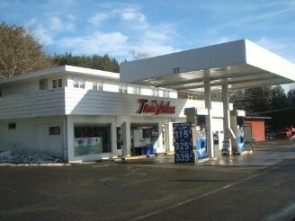

Property Detail
341 Sturbridge Rd
BRIM-000015-B000000-000010
HAMPDEN
Commercialofficeresidentialmixeduse
Massachusetts
AR
10
B and X Area of moderate flood hazard, usually the area between the limits of the 100-year and 500-year floods.
1.88 AC
2025
Hampden County
2025
Hartford
813802
Springfield, MA
NEARBY LISTINGS FOR SALE OR LEASE
-
-
View all Brimfield listings for sale on LoopNet.com
DEMOGRAPHICS near 341 Sturbridge Rd
1 mile
3 mile
5 mile
2025 Total Population
588
2,986
12,309
2030 Population
592
3,023
12,650
Pop Growth 2025-2030
+ 0.68%
+ 1.24%
+ 2.77%
Average Age
46
45
44
2025 Total Households
238
1,203
4,965
HH Growth 2025-2030
+ 0.84%
+ 1.16%
+ 2.82%
Median Household Inc
$98,557
$101,709
$96,433
Avg Household Size
2.50
2.50
2.50
2025 Avg HH Vehicles
2.00
2.00
2.00
Median Home Value
$403,571
$396,406
$379,175
Median Year Built
1987
1986
1984
Nearby Places
Map Layers
Map Styles
 Street
 Aerial
Layers
 Traffic
 Biking
Places
Listings with unknown addresses are not visible on the map
- Restaurants
- Banks
- Shops
- Fitness
- Groceries
PUBLIC TRANSPORTATION
AIRPORT
Worcester Regional
Drive
Walk
Distance
Worcester Regional
40 min
25.0 mi
Bradley International
Drive
Walk
Distance
Bradley International
72 min
39.1 mi
Freight Ports
Port of Davisville, RI
Drive
Walk
Distance
Port of Davisville, RI
98 min
76.2 mi
Nearby Properties
Address
Land Use
TOTAL SIZE
Lot Size
Zoning
Address
Land Use
TOTAL SIZE
Lot Size
Zoning
127,762 SF
19.28 AC
Address
Land Use
TOTAL SIZE
Lot Size
Zoning
Address
Land Use
TOTAL SIZE
Lot Size
Zoning
40,910 SF
25.36 AC
Address
Land Use
TOTAL SIZE
Lot Size
Zoning
1,846.93 AC
AR
Address
Land Use
TOTAL SIZE
Lot Size
Zoning
10.65 AC
B
Address
Land Use
TOTAL SIZE
Lot Size
Zoning
189.22 AC
B
Address
Land Use
TOTAL SIZE
Lot Size
Zoning
68,898 SF
49.02 AC
Address
Land Use
TOTAL SIZE
Lot Size
Zoning
36,220 SF
1.42 AC
Address
Land Use
TOTAL SIZE
Lot Size
Zoning
4,888 SF
12.33 AC
Address
Land Use
TOTAL SIZE
Lot Size
Zoning
51,006 SF
10.54 AC
Address
Land Use
TOTAL SIZE
Lot Size
Zoning
73,136 SF
7.70 AC
Address
Land Use
TOTAL SIZE
Lot Size
Zoning
35,281 SF
2.68 AC
Address
Land Use
TOTAL SIZE
Lot Size
Zoning
28,371 SF
1.85 AC
Address
Land Use
TOTAL SIZE
Lot Size
Zoning
180,013 SF
6.84 AC
Address
Land Use
TOTAL SIZE
Lot Size
Zoning
2,752 SF
0.22 AC
Address
Land Use
TOTAL SIZE
Lot Size
Zoning
14,671 SF
1 AC
Address
Land Use
TOTAL SIZE
Lot Size
Zoning
54,599 SF
5.37 AC
Address
Land Use
TOTAL SIZE
Lot Size
Zoning
65.96 AC
AR
Address
Land Use
TOTAL SIZE
Lot Size
Zoning
5.90 AC
1B
Address
Land Use
TOTAL SIZE
Lot Size
Zoning
3,812 SF
3.26 AC
Address
Land Use
TOTAL SIZE
Lot Size
Zoning
20,965 SF
1.40 AC
Address
Land Use
TOTAL SIZE
Lot Size
Zoning
4,168 SF
1.01 AC
Address
Land Use
TOTAL SIZE
Lot Size
Zoning
13,528 SF
1.70 AC
Address
Land Use
TOTAL SIZE
Lot Size
Zoning
46,729 SF
1.39 AC
Address
Land Use
TOTAL SIZE
Lot Size
Zoning
813.97 AC
Address
Land Use
TOTAL SIZE
Lot Size
Zoning
29,430 SF
2.50 AC
Address
Land Use
TOTAL SIZE
Lot Size
Zoning
10,740 SF
15.50 AC
Address
Land Use
TOTAL SIZE
Lot Size
Zoning
16,320 SF
2.64 AC
Address
Land Use
TOTAL SIZE
Lot Size
Zoning
29,400 SF
4.63 AC
AR
Address
Land Use
TOTAL SIZE
Lot Size
Zoning
0.33 AC
The World's #1 Commercial Real Estate Marketplace
Connect with us
© 2026 CoStar Group
The information above has been obtained from sources believed reliable. While we do not doubt its accuracy we have not verified it and make no guarantee, warranty or representation about it. It is your responsibility to independently confirm its accuracy and completeness. Any projections, opinions, assumptions, or estimates used are for example only and do not represent the current or future performance of the property. The value of this transaction to you depends on tax and other factors which should be evaluated by your tax, financial, and legal advisors. You and your advisors should conduct a careful, independent investigation of the property to determine to your satisfaction the suitability of the property for your needs.