Property Record
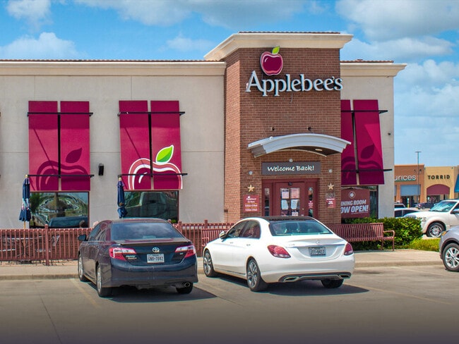
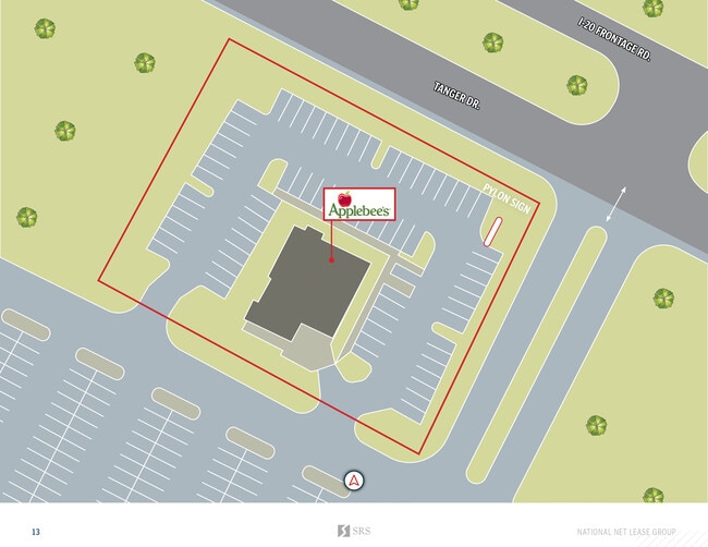
341 E Interstate 20, Terrell, TX 75160

Property Detail
341 E Interstate 20
Dallas-Fort Worth-Arlington, TX
TANGER ADD BLOCK A LOT 4R
39640
KAUFMAN
Commercialnec
Texas
B and X Area of moderate flood hazard, usually the area between the limits of the 100-year and 500-year floods.
4r
2024
1.09 AC
2025
Southeast Outlying
050300
Dallas/Ft Worth
4,800 SF
NEARBY LISTINGS FOR SALE OR LEASE
DEMOGRAPHICS near 341 E Interstate 20
1 mile
3 mile
5 mile
2024 Total Population
1,275
15,256
30,125
2029 Population
1,638
19,538
38,523
Pop Growth 2024-2029
+ 28.47%
+ 28.07%
+ 27.88%
Average Age
43
37
37
2024 Total Households
500
5,107
10,000
HH Growth 2024-2029
+ 26.40%
+ 25.61%
+ 25.32%
Median Household Inc
$62,132
$64,283
$71,150
Avg Household Size
2.20
2.70
2.80
2024 Avg HH Vehicles
1.00
2.00
2.00
Median Home Value
$238,750
$247,243
$258,871
Median Year Built
2000
1995
1995
Nearby Places
Map Layers
Map Styles
 Street
 Aerial
Transit
 Traffic
 Biking
Places
Listings with unknown addresses are not visible on the map
- Restaurants
- Banks
- Shops
- Fitness
- Groceries
SALE & LEASE HISTORY
LISTING DATE
SALE/LEASE

Sep 03, 2025
For Sale
Jan 27, 2021
For Sale
Aug 13, 2025
For Lease
Aug 07, 2020
For Sale
Nearby Properties
Address
Land Use
TOTAL SIZE
Lot Size
Zoning
Address
Land Use
TOTAL SIZE
Lot Size
Zoning
12,220 SF
132.50 AC
Address
Land Use
TOTAL SIZE
Lot Size
Zoning
360,972 SF
10.85 AC
Address
Land Use
TOTAL SIZE
Lot Size
Zoning
726,275 SF
39.64 AC
Address
Land Use
TOTAL SIZE
Lot Size
Zoning
9,017 SF
2.34 AC
Address
Land Use
TOTAL SIZE
Lot Size
Zoning
599,850 SF
63.09 AC
Address
Land Use
TOTAL SIZE
Lot Size
Zoning
60,637 SF
18.91 AC
Address
Land Use
TOTAL SIZE
Lot Size
Zoning
134,992 SF
23.21 AC
Address
Land Use
TOTAL SIZE
Lot Size
Zoning
212,800 SF
15.74 AC
Address
Land Use
TOTAL SIZE
Lot Size
Zoning
2,968 SF
8.35 AC
Address
Land Use
TOTAL SIZE
Lot Size
Zoning
48,884 SF
10 AC
Address
Land Use
TOTAL SIZE
Lot Size
Zoning
83,749 SF
20.83 AC
Address
Land Use
TOTAL SIZE
Lot Size
Zoning
41,862 SF
10.19 AC
Address
Land Use
TOTAL SIZE
Lot Size
Zoning
1,334 SF
8.38 AC
Address
Land Use
TOTAL SIZE
Lot Size
Zoning
115,805 SF
20.73 AC
Address
Land Use
TOTAL SIZE
Lot Size
Zoning
72,470 SF
8.42 AC
Address
Land Use
TOTAL SIZE
Lot Size
Zoning
185,069 SF
23.72 AC
Address
Land Use
TOTAL SIZE
Lot Size
Zoning
3,750 SF
44.52 AC
Address
Land Use
TOTAL SIZE
Lot Size
Zoning
73,355 SF
4.48 AC
Address
Land Use
TOTAL SIZE
Lot Size
Zoning
55,575 SF
4.21 AC
Address
Land Use
TOTAL SIZE
Lot Size
Zoning
137,064 SF
16.86 AC
Address
Land Use
TOTAL SIZE
Lot Size
Zoning
46,320 SF
1.84 AC
Address
Land Use
TOTAL SIZE
Lot Size
Zoning
58,911 SF
6.63 AC
Address
Land Use
TOTAL SIZE
Lot Size
Zoning
3,750 SF
23.62 AC
Address
Land Use
TOTAL SIZE
Lot Size
Zoning
47,612 SF
1.65 AC
Address
Land Use
TOTAL SIZE
Lot Size
Zoning
51,928 SF
1.66 AC
Address
Land Use
TOTAL SIZE
Lot Size
Zoning
70,600 SF
7.75 AC
Address
Land Use
TOTAL SIZE
Lot Size
Zoning
146,900 SF
14.42 AC
Address
Land Use
TOTAL SIZE
Lot Size
Zoning
49,234 SF
30 AC
Address
Land Use
TOTAL SIZE
Lot Size
Zoning
191,152 SF
15.28 AC
Address
Land Use
TOTAL SIZE
Lot Size
Zoning
94,800 SF
18.38 AC
The World's #1 Commercial Real Estate Marketplace
Connect with us
© 2026 CoStar Group
The information above has been obtained from sources believed reliable. While we do not doubt its accuracy we have not verified it and make no guarantee, warranty or representation about it. It is your responsibility to independently confirm its accuracy and completeness. Any projections, opinions, assumptions, or estimates used are for example only and do not represent the current or future performance of the property. The value of this transaction to you depends on tax and other factors which should be evaluated by your tax, financial, and legal advisors. You and your advisors should conduct a careful, independent investigation of the property to determine to your satisfaction the suitability of the property for your needs.