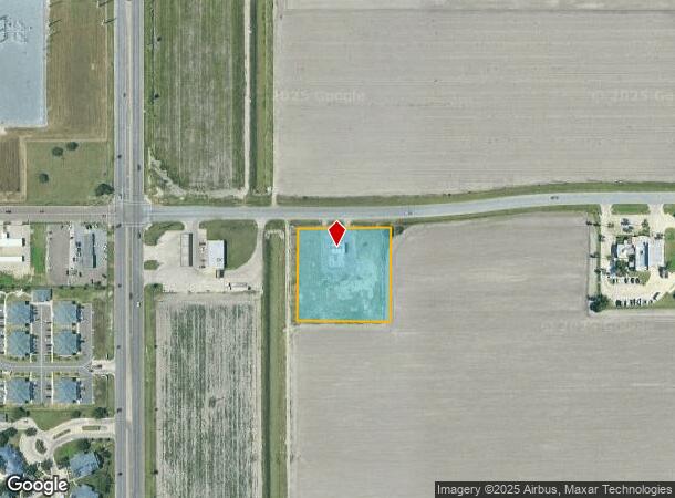
Property Record
3410 E Grimes St, Harlingen, TX 78550


Current Lease Availabilities
NEARBY LISTINGS FOR SALE OR LEASE
Property Detail
3410 E Grimes St
Brownsville-Harlingen, TX
Dollar Trhifty Subd
982083-0010-001000
LOT 1 BLK 1 DOLLAR THRIFTY SUBD ( C1-2668-B )
Commercialnec
Cameron
X
Texas
48061C0260F
1
2024
2 AC
2025
Greater Harlingen
010802
Brownsville/Harlingen
2,040 SF
DEMOGRAPHICS near 3410 E Grimes St
1 Mile
3 Mile
5 Mile
2024 Total Population
5,490
46,195
83,622
2029 Population
5,717
47,322
85,653
Pop Growth 2024-2029
+ 4.13%
+ 2.44%
+ 2.43%
Average Age
34
36
37
2024 Total Households
2,052
16,157
28,574
HH Growth 2024-2029
+ 3.80%
+ 2.36%
+ 2.36%
Median Household Inc
$47,222
$47,749
$46,859
Avg Household Size
2.50
2.70
2.80
2024 Avg HH Vehicles
2.00
2.00
2.00
Median Home Value
$117,847
$105,611
$90,122
Median Year Built
1991
1982
1985
Nearby Places
Map Layers
Map Styles
 Street
 Aerial
- Restaurants
- Banks
- Shops
- Fitness
- Groceries
PUBLIC TRANSPORTATION
AIRPORT
Valley International
DRIVE
WALK
Distance
Valley International
4 min
1.9 mi
Brownsville/South Padre Island International
DRIVE
WALK
Distance
Brownsville/South Padre Island International
39 min
28.8 mi
Freight Ports
Port of Brownsville
DRIVE
WALK
Distance
Port of Brownsville
32 min
26.4 mi
Nearby Properties
Address
Land Use
TOTAL SIZE
Lot Size
Zoning
Address
Land Use
TOTAL SIZE
Lot Size
Zoning
758,640 SF
11.31 AC
Address
Land Use
TOTAL SIZE
Lot Size
Zoning
427,448 SF
6.94 AC
Address
Land Use
TOTAL SIZE
Lot Size
Zoning
663,572 SF
60.74 AC
I
Address
Land Use
TOTAL SIZE
Lot Size
Zoning
293,886 SF
23.57 AC
Address
Land Use
TOTAL SIZE
Lot Size
Zoning
100,090 SF
15 AC
Address
Land Use
TOTAL SIZE
Lot Size
Zoning
148,596 SF
1 AC
Address
Land Use
TOTAL SIZE
Lot Size
Zoning
134,518 SF
10.01 AC
Address
Land Use
TOTAL SIZE
Lot Size
Zoning
118,561 SF
6.32 AC
C
Address
Land Use
TOTAL SIZE
Lot Size
Zoning
77,189 SF
3.28 AC
Address
Land Use
TOTAL SIZE
Lot Size
Zoning
15,085 SF
51.10 AC
C
Address
Land Use
TOTAL SIZE
Lot Size
Zoning
62,764 SF
10 AC
Address
Land Use
TOTAL SIZE
Lot Size
Zoning
16,508 SF
347.82 AC
Address
Land Use
TOTAL SIZE
Lot Size
Zoning
61,920 SF
5.60 AC
C
Address
Land Use
TOTAL SIZE
Lot Size
Zoning
76,756 SF
15.35 AC
Address
Land Use
TOTAL SIZE
Lot Size
Zoning
20,062 SF
47.54 AC
C
Address
Land Use
TOTAL SIZE
Lot Size
Zoning
230,267 SF
7.85 AC
C
Address
Land Use
TOTAL SIZE
Lot Size
Zoning
180,838 SF
12.56 AC
C
Address
Land Use
TOTAL SIZE
Lot Size
Zoning
47,558 SF
7 AC
Address
Land Use
TOTAL SIZE
Lot Size
Zoning
90,376 SF
1.93 AC
Address
Land Use
TOTAL SIZE
Lot Size
Zoning
176,627 SF
12.45 AC
A-C
Address
Land Use
TOTAL SIZE
Lot Size
Zoning
42,557 SF
1.74 AC
C
Address
Land Use
TOTAL SIZE
Lot Size
Zoning
145,232 SF
6.38 AC
Address
Land Use
TOTAL SIZE
Lot Size
Zoning
84,936 SF
12 AC
Address
Land Use
TOTAL SIZE
Lot Size
Zoning
188,102 SF
45.81 AC
C
Address
Land Use
TOTAL SIZE
Lot Size
Zoning
93,459 SF
20 AC
Address
Land Use
TOTAL SIZE
Lot Size
Zoning
7,600 SF
16.94 AC
Address
Land Use
TOTAL SIZE
Lot Size
Zoning
45,408 SF
12 AC
Address
Land Use
TOTAL SIZE
Lot Size
Zoning
130,347 SF
4.04 AC
Address
Land Use
TOTAL SIZE
Lot Size
Zoning
73,926 SF
4.39 AC
The World's #1 Commercial Real Estate Marketplace
Connect with us
© 2025 CoStar Group
The information above has been obtained from sources believed reliable. While we do not doubt its accuracy we have not verified it and make no guarantee, warranty or representation about it. It is your responsibility to independently confirm its accuracy and completeness. Any projections, opinions, assumptions, or estimates used are for example only and do not represent the current or future performance of the property. The value of this transaction to you depends on tax and other factors which should be evaluated by your tax, financial, and legal advisors. You and your advisors should conduct a careful, independent investigation of the property to determine to your satisfaction the suitability of the property for your needs.