Property Record
3410 Griswold Rd, Port Huron, MI 48060

Save to a Folder
{{folder.Name}}
{{folder.ListingIds.length}} Properties
{{folder.ListingIds.length}} Property
Create a New Folder
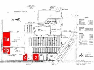
Property Detail
3410 Griswold Rd
Detroit-Warren-Dearborn, MI
PART OF LOTS 39 1/2 AND 41 BEG S 89D 17M E 695.96' & N 0D 13M 16S W 33' FROM S 1/4 COR SEC 8, TH N 0D 13M 16S W 350', TH N 89D 17M W 331.34', TH N 0D 12M 21S W 1038.66', TH N 61D 14M 56S E 619.49', TH S 54D 52M 22S E 1273.51', TH S 0D 13M 35S E 142.8
28-190-0105-000
ST. CLAIR
Commercialacreage
Michigan
I-H
1,39
B and X Area of moderate flood hazard, usually the area between the limits of the 100-year and 500-year floods.
35.76 AC
2025
St Clair & Lapeer Counties
2025
Detroit
636000
NEARBY LISTINGS FOR SALE OR LEASE
DEMOGRAPHICS near 3410 Griswold Rd
1 mile
3 mile
5 mile
2025 Total Population
2,214
36,731
64,417
2030 Population
2,167
36,608
64,161
Pop Growth 2025-2030
(2.12%)
(0.33%)
(0.40%)
Average Age
41
40
42
2025 Total Households
888
14,825
26,559
HH Growth 2025-2030
(2.36%)
(0.40%)
(0.48%)
Median Household Inc
$49,341
$48,853
$60,548
Avg Household Size
2.40
2.40
2.30
2025 Avg HH Vehicles
2.00
2.00
2.00
Median Home Value
$155,666
$158,670
$181,320
Median Year Built
1977
1963
1970
Nearby Places
Map Layers
Map Styles
 Street
 Aerial
Layers
 Traffic
 Biking
Places
Listings with unknown addresses are not visible on the map
- Restaurants
- Banks
- Shops
- Fitness
- Groceries
Nearby Properties
Address
Land Use
TOTAL SIZE
Lot Size
Zoning
Address
Land Use
TOTAL SIZE
Lot Size
Zoning
206,565 SF
22.08 AC
I
Address
Land Use
TOTAL SIZE
Lot Size
Zoning
241,664 SF
50.15 AC
B-3
Address
Land Use
TOTAL SIZE
Lot Size
Zoning
Address
Land Use
TOTAL SIZE
Lot Size
Zoning
88,524 SF
1.41 AC
CBD
Address
Land Use
TOTAL SIZE
Lot Size
Zoning
Address
Land Use
TOTAL SIZE
Lot Size
Zoning
134,379 SF
15 AC
RM-2
Address
Land Use
TOTAL SIZE
Lot Size
Zoning
115,172 SF
11.29 AC
A1
Address
Land Use
TOTAL SIZE
Lot Size
Zoning
83,563 SF
7.46 AC
CBD
Address
Land Use
TOTAL SIZE
Lot Size
Zoning
173,584 SF
9.50 AC
M1
Address
Land Use
TOTAL SIZE
Lot Size
Zoning
Address
Land Use
TOTAL SIZE
Lot Size
Zoning
149,732 SF
12.48 AC
M1
Address
Land Use
TOTAL SIZE
Lot Size
Zoning
109,097 SF
6.47 AC
A2
Address
Land Use
TOTAL SIZE
Lot Size
Zoning
40,690 SF
0.89 AC
CBD
Address
Land Use
TOTAL SIZE
Lot Size
Zoning
76,352 SF
4.88 AC
C1
Address
Land Use
TOTAL SIZE
Lot Size
Zoning
137,720 SF
12.04 AC
B-3
Address
Land Use
TOTAL SIZE
Lot Size
Zoning
94,537 SF
12.63 AC
B-3
Address
Land Use
TOTAL SIZE
Lot Size
Zoning
112,566 SF
7.20 AC
B-3
Address
Land Use
TOTAL SIZE
Lot Size
Zoning
77,868 SF
8.91 AC
RM-2
Address
Land Use
TOTAL SIZE
Lot Size
Zoning
73,882 SF
6.50 AC
B-3
Address
Land Use
TOTAL SIZE
Lot Size
Zoning
39,547 SF
A1
Address
Land Use
TOTAL SIZE
Lot Size
Zoning
33,810 SF
0.92 AC
CBD
Address
Land Use
TOTAL SIZE
Lot Size
Zoning
140,230 SF
7.90 AC
M1
Address
Land Use
TOTAL SIZE
Lot Size
Zoning
333,076 SF
23.19 AC
M2
Address
Land Use
TOTAL SIZE
Lot Size
Zoning
85,200 SF
4.23 AC
M1
Address
Land Use
TOTAL SIZE
Lot Size
Zoning
0.32 AC
CBD
Address
Land Use
TOTAL SIZE
Lot Size
Zoning
28,225 SF
3.74 AC
C1
Address
Land Use
TOTAL SIZE
Lot Size
Zoning
45,750 SF
M1
Address
Land Use
TOTAL SIZE
Lot Size
Zoning
26,962 SF
3.03 AC
C1
Address
Land Use
TOTAL SIZE
Lot Size
Zoning
198,647 SF
26.04 AC
B-3
Address
Land Use
TOTAL SIZE
Lot Size
Zoning
168,310 SF
8.90 AC
M1
The World's #1 Commercial Real Estate Marketplace
Connect with us
© 2026 CoStar Group
The information above has been obtained from sources believed reliable. While we do not doubt its accuracy we have not verified it and make no guarantee, warranty or representation about it. It is your responsibility to independently confirm its accuracy and completeness. Any projections, opinions, assumptions, or estimates used are for example only and do not represent the current or future performance of the property. The value of this transaction to you depends on tax and other factors which should be evaluated by your tax, financial, and legal advisors. You and your advisors should conduct a careful, independent investigation of the property to determine to your satisfaction the suitability of the property for your needs.