Property Record
3410 S 51St Ave, Phoenix, AZ 85043

Save to a Folder
{{folder.Name}}
{{folder.ListingIds.length}} Properties
{{folder.ListingIds.length}} Property
Create a New Folder
Property Detail
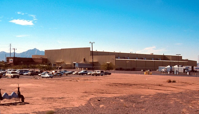
3410 S 51St Ave
104-45-004
SWIFT ADDITION MCR 386-31
Truckterminal
Maricopa
A-1
Arizona
C and X Area of minimal flood hazard, usually depicted on FIRMs as above the 500-year flood level.
2
2025
46.57 AC
2025
SW S of Buckeye Road
112514
Phoenix
258,720 SF
Phoenix-Mesa-Chandler, AZ
NEARBY LISTINGS FOR SALE OR LEASE
DEMOGRAPHICS near 3410 S 51St Ave
1 mile
3 mile
5 mile
2025 Total Population
2,948
57,357
264,125
2030 Population
3,161
59,504
274,433
Pop Growth 2025-2030
+ 7.23%
+ 3.74%
+ 3.90%
Average Age
31
33
33
2025 Total Households
823
15,238
72,550
HH Growth 2025-2030
+ 7.29%
+ 3.98%
+ 4.01%
Median Household Inc
$79,335
$77,888
$73,645
Avg Household Size
3.50
3.60
3.50
2025 Avg HH Vehicles
2.00
2.00
2.00
Median Home Value
$400,758
$398,048
$362,587
Median Year Built
2006
2003
1998
Nearby Places
Map Layers
Map Styles
 Street
 Aerial
Layers
 Traffic
 Biking
Places
Listings with unknown addresses are not visible on the map
- Restaurants
- Banks
- Shops
- Fitness
- Groceries
PUBLIC TRANSPORTATION
AIRPORT
Phoenix Sky Harbor International
Drive
Walk
Distance
Phoenix Sky Harbor International
24 min
11.9 mi
Phoenix-Mesa Gateway
Drive
Walk
Distance
Phoenix-Mesa Gateway
54 min
39.8 mi
Freight Ports
Port of San Diego
Drive
Walk
Distance
Port of San Diego
395 min
352.8 mi
Nearby Properties
Address
Land Use
TOTAL SIZE
Lot Size
Zoning
Address
Land Use
TOTAL SIZE
Lot Size
Zoning
569,517 SF
33.38 AC
PUD
Address
Land Use
TOTAL SIZE
Lot Size
Zoning
270,000 SF
12.90 AC
I-1
Address
Land Use
TOTAL SIZE
Lot Size
Zoning
68,452 SF
37.95 AC
R-35
Address
Land Use
TOTAL SIZE
Lot Size
Zoning
781,334 SF
59.96 AC
I-1
Address
Land Use
TOTAL SIZE
Lot Size
Zoning
1,378,775 SF
86.09 AC
M-H
Address
Land Use
TOTAL SIZE
Lot Size
Zoning
60.41 AC
CPGCP
Address
Land Use
TOTAL SIZE
Lot Size
Zoning
91,000 SF
7.57 AC
I-1
Address
Land Use
TOTAL SIZE
Lot Size
Zoning
86,350 SF
25.82 AC
I-1
Address
Land Use
TOTAL SIZE
Lot Size
Zoning
33.15 AC
Address
Land Use
TOTAL SIZE
Lot Size
Zoning
20,430 SF
24.57 AC
I-1
Address
Land Use
TOTAL SIZE
Lot Size
Zoning
440,160 SF
42.43 AC
A1
Address
Land Use
TOTAL SIZE
Lot Size
Zoning
61,508 SF
23.76 AC
I-1
Address
Land Use
TOTAL SIZE
Lot Size
Zoning
1,377,683 SF
72.08 AC
I-1
Address
Land Use
TOTAL SIZE
Lot Size
Zoning
1,205,743 SF
59.34 AC
I-1
Address
Land Use
TOTAL SIZE
Lot Size
Zoning
1,063,188 SF
59.94 AC
Address
Land Use
TOTAL SIZE
Lot Size
Zoning
270,483 SF
53.58 AC
R-43AG
Address
Land Use
TOTAL SIZE
Lot Size
Zoning
4,900 SF
12.05 AC
R1-6
Address
Land Use
TOTAL SIZE
Lot Size
Zoning
554,581 SF
37.82 AC
A1
Address
Land Use
TOTAL SIZE
Lot Size
Zoning
375,848 SF
117.15 AC
A1
Address
Land Use
TOTAL SIZE
Lot Size
Zoning
1,009,390 SF
44.22 AC
A1
Address
Land Use
TOTAL SIZE
Lot Size
Zoning
659,834 SF
42.04 AC
R-6
Address
Land Use
TOTAL SIZE
Lot Size
Zoning
14.16 AC
Address
Land Use
TOTAL SIZE
Lot Size
Zoning
682,727 SF
37.38 AC
I-1
Address
Land Use
TOTAL SIZE
Lot Size
Zoning
592,330 SF
36.89 AC
I-2
Address
Land Use
TOTAL SIZE
Lot Size
Zoning
554,011 SF
26.10 AC
I-P
Address
Land Use
TOTAL SIZE
Lot Size
Zoning
489,284 SF
28.64 AC
I-1
Address
Land Use
TOTAL SIZE
Lot Size
Zoning
662,796 SF
42.11 AC
I-1
Address
Land Use
TOTAL SIZE
Lot Size
Zoning
169,155 SF
32.84 AC
R-35
Address
Land Use
TOTAL SIZE
Lot Size
Zoning
532,713 SF
27.31 AC
Address
Land Use
TOTAL SIZE
Lot Size
Zoning
474,532 SF
26.17 AC
I-1
The World's #1 Commercial Real Estate Marketplace
Connect with us
© 2026 CoStar Group
The information above has been obtained from sources believed reliable. While we do not doubt its accuracy we have not verified it and make no guarantee, warranty or representation about it. It is your responsibility to independently confirm its accuracy and completeness. Any projections, opinions, assumptions, or estimates used are for example only and do not represent the current or future performance of the property. The value of this transaction to you depends on tax and other factors which should be evaluated by your tax, financial, and legal advisors. You and your advisors should conduct a careful, independent investigation of the property to determine to your satisfaction the suitability of the property for your needs.