Property Record
34105 Chagrin Blvd, Chagrin Falls, OH 44022
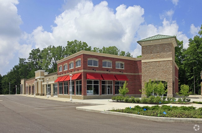


Property Detail
34105 Chagrin Blvd
912-02-011
PCL 1 VOL 361 PG 71 FF 686.97 D 449.83 3.4277AC OL 2-3 TR 3 ADDITIONAL PARCEL 91202014 2011 S/R
Stripcommercialcenter
CUYAHOGA
U-2
Ohio
B and X Area of moderate flood hazard, usually the area between the limits of the 100-year and 500-year floods.
1
2025
2.69 AC
2025
Chagrin Corridor
196300
Cleveland
21,241 SF
Cleveland-Elyria, OH
NEARBY LISTINGS FOR SALE OR LEASE
DEMOGRAPHICS near 34105 Chagrin Blvd
1 mile
3 mile
5 mile
2025 Total Population
2,086
18,762
101,895
2030 Population
2,078
18,706
101,424
Pop Growth 2025-2030
(0.38%)
(0.30%)
(0.46%)
Average Age
45
44
43
2025 Total Households
768
7,198
43,331
HH Growth 2025-2030
(0.52%)
(0.43%)
(0.56%)
Median Household Inc
$239,540
$180,852
$88,524
Avg Household Size
2.70
2.60
2.30
2025 Avg HH Vehicles
2.00
2.00
2.00
Median Home Value
$658,354
$560,765
$339,057
Median Year Built
1965
1970
1965
Nearby Places
Map Layers
Map Styles
 Street
 Aerial
Layers
 Traffic
 Biking
Places
Listings with unknown addresses are not visible on the map
- Restaurants
- Banks
- Shops
- Fitness
- Groceries
PUBLIC TRANSPORTATION
AIRPORT
Cleveland-Hopkins International
Drive
Walk
Distance
Cleveland-Hopkins International
37 min
24.1 mi
Freight Ports
Port of Toledo
Drive
Walk
Distance
Port of Toledo
151 min
125.0 mi
Nearby Properties
Address
Land Use
TOTAL SIZE
Lot Size
Zoning
Address
Land Use
TOTAL SIZE
Lot Size
Zoning
975,742 SF
42.03 AC
U-10
Address
Land Use
TOTAL SIZE
Lot Size
Zoning
341,556 SF
17.70 AC
U-4
Address
Land Use
TOTAL SIZE
Lot Size
Zoning
255.11 AC
U-1
Address
Land Use
TOTAL SIZE
Lot Size
Zoning
729,492 SF
17.67 AC
Address
Land Use
TOTAL SIZE
Lot Size
Zoning
257,564 SF
2.70 AC
U-4A
Address
Land Use
TOTAL SIZE
Lot Size
Zoning
485,482 SF
9.60 AC
U-8A
Address
Land Use
TOTAL SIZE
Lot Size
Zoning
78,838 SF
4.90 AC
U-7A
Address
Land Use
TOTAL SIZE
Lot Size
Zoning
232,078 SF
24.89 AC
U-7
Address
Land Use
TOTAL SIZE
Lot Size
Zoning
274,614 SF
44.25 AC
U-1
Address
Land Use
TOTAL SIZE
Lot Size
Zoning
119,418 SF
42.99 AC
U-5
Address
Land Use
TOTAL SIZE
Lot Size
Zoning
357,252 SF
10.80 AC
U-8A
Address
Land Use
TOTAL SIZE
Lot Size
Zoning
6,754 SF
275.01 AC
U-1
Address
Land Use
TOTAL SIZE
Lot Size
Zoning
75,275 SF
86.23 AC
U-2
Address
Land Use
TOTAL SIZE
Lot Size
Zoning
96,262 SF
10 AC
U-5
Address
Land Use
TOTAL SIZE
Lot Size
Zoning
60,001 SF
8.29 AC
Address
Land Use
TOTAL SIZE
Lot Size
Zoning
196,429 SF
10.31 AC
U-7
Address
Land Use
TOTAL SIZE
Lot Size
Zoning
240,046 SF
28.85 AC
U-1
Address
Land Use
TOTAL SIZE
Lot Size
Zoning
70,046 SF
14.62 AC
U-1
Address
Land Use
TOTAL SIZE
Lot Size
Zoning
114,367 SF
8.34 AC
U-4
Address
Land Use
TOTAL SIZE
Lot Size
Zoning
209,977 SF
30.40 AC
U-2
Address
Land Use
TOTAL SIZE
Lot Size
Zoning
139,800 SF
3.62 AC
U-7A
Address
Land Use
TOTAL SIZE
Lot Size
Zoning
115,932 SF
14.15 AC
U-10
Address
Land Use
TOTAL SIZE
Lot Size
Zoning
126,578 SF
5.20 AC
U-9
Address
Land Use
TOTAL SIZE
Lot Size
Zoning
117,285 SF
6.94 AC
U-10
Address
Land Use
TOTAL SIZE
Lot Size
Zoning
158,138 SF
6.99 AC
U-3
Address
Land Use
TOTAL SIZE
Lot Size
Zoning
100,268 SF
9.19 AC
PM-UD
Address
Land Use
TOTAL SIZE
Lot Size
Zoning
116,714 SF
9.15 AC
U-10
Address
Land Use
TOTAL SIZE
Lot Size
Zoning
61,099 SF
5.88 AC
U-9
Address
Land Use
TOTAL SIZE
Lot Size
Zoning
169,214 SF
5.77 AC
U-9
Address
Land Use
TOTAL SIZE
Lot Size
Zoning
441.72 AC
1F-2
The World's #1 Commercial Real Estate Marketplace
Connect with us
© 2026 CoStar Group
The information above has been obtained from sources believed reliable. While we do not doubt its accuracy we have not verified it and make no guarantee, warranty or representation about it. It is your responsibility to independently confirm its accuracy and completeness. Any projections, opinions, assumptions, or estimates used are for example only and do not represent the current or future performance of the property. The value of this transaction to you depends on tax and other factors which should be evaluated by your tax, financial, and legal advisors. You and your advisors should conduct a careful, independent investigation of the property to determine to your satisfaction the suitability of the property for your needs.