Property Record
3411 Austell Rd Sw, Marietta, GA 30008

NEARBY LISTINGS FOR SALE OR LEASE
Property Detail
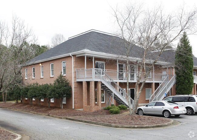
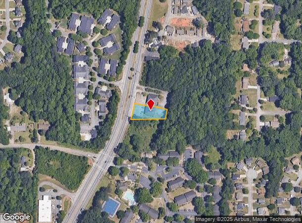
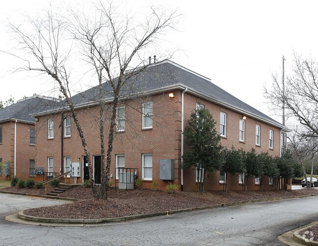
3411 Austell Rd Sw
Atlanta-Sandy Springs-Roswell, GA
Mae Materne
19-0775-0-012-0
ALL THAT TRACT OR PARCEL OF LAND LYING AND BEING IN THE 19TH DISTRICT, 2ND SECTION, COBB COUNTY, GEORGIA, LYING WITHIN LAND LOT 0775, IDENTIFIED AS TAX PARCEL 012 ON THE FIELD
Officebuilding
Cobb
X
Georgia
13067C0202J
775
2025
0.44 AC
2025
Kennesaw/Town Center
031119
Atlanta
6,160 SF
DEMOGRAPHICS near 3411 Austell Rd Sw
1 Mile
3 Mile
5 Mile
2024 Total Population
9,637
77,409
191,581
2029 Population
9,811
78,542
194,828
Pop Growth 2024-2029
+ 1.81%
+ 1.46%
+ 1.69%
Average Age
40
38
38
2024 Total Households
3,521
28,313
70,165
HH Growth 2024-2029
+ 1.73%
+ 1.42%
+ 1.65%
Median Household Inc
$68,641
$71,845
$74,890
Avg Household Size
2.60
2.60
2.60
2024 Avg HH Vehicles
2.00
2.00
2.00
Median Home Value
$249,893
$267,795
$290,483
Median Year Built
1990
1984
1984
Nearby Places
- Restaurants
- Banks
- Shops
- Fitness
- Groceries
PUBLIC TRANSPORTATION
AIRPORT
Hartsfield - Jackson Atlanta International
DRIVE
WALK
Distance
Hartsfield - Jackson Atlanta International
44 min
27.9 mi
SALE & LEASE HISTORY
LISTING DATE
SALE/LEASE

Sep 24, 2016
For Lease
Sep 24, 2016
For Sale
Nearby Properties
Address
Land Use
TOTAL SIZE
Lot Size
Zoning
Address
Land Use
TOTAL SIZE
Lot Size
Zoning
494,972 SF
25.60 AC
CF
Address
Land Use
TOTAL SIZE
Lot Size
Zoning
403,898 SF
37.53 AC
RM-12
Address
Land Use
TOTAL SIZE
Lot Size
Zoning
370,201 SF
28.35 AC
RM-12
Address
Land Use
TOTAL SIZE
Lot Size
Zoning
25,956 SF
12.78 AC
PVC
Address
Land Use
TOTAL SIZE
Lot Size
Zoning
272,170 SF
26.40 AC
RM-12
Address
Land Use
TOTAL SIZE
Lot Size
Zoning
488,748 SF
32.28 AC
RM-12
Address
Land Use
TOTAL SIZE
Lot Size
Zoning
285,190 SF
25.16 AC
RM-12
Address
Land Use
TOTAL SIZE
Lot Size
Zoning
238,984 SF
17.51 AC
RM-12
Address
Land Use
TOTAL SIZE
Lot Size
Zoning
148,612 SF
12.65 AC
RM-12
Address
Land Use
TOTAL SIZE
Lot Size
Zoning
209,649 SF
13.51 AC
RM-12
Address
Land Use
TOTAL SIZE
Lot Size
Zoning
345,192 SF
22.67 AC
RM-12
Address
Land Use
TOTAL SIZE
Lot Size
Zoning
219,402 SF
10.33 AC
RM-12
Address
Land Use
TOTAL SIZE
Lot Size
Zoning
179,048 SF
25.97 AC
RM-12
Address
Land Use
TOTAL SIZE
Lot Size
Zoning
289,582 SF
21.01 AC
RM-12
Address
Land Use
TOTAL SIZE
Lot Size
Zoning
250,482 SF
16.74 AC
RM-12
Address
Land Use
TOTAL SIZE
Lot Size
Zoning
118,069 SF
0.38 AC
OI
Address
Land Use
TOTAL SIZE
Lot Size
Zoning
145,185 SF
13.52 AC
RM-12
Address
Land Use
TOTAL SIZE
Lot Size
Zoning
188,988 SF
15.30 AC
OI
Address
Land Use
TOTAL SIZE
Lot Size
Zoning
3.46 AC
RM-12
Address
Land Use
TOTAL SIZE
Lot Size
Zoning
161,927 SF
7.95 AC
OI
Address
Land Use
TOTAL SIZE
Lot Size
Zoning
113,652 SF
9.40 AC
RM-12
Address
Land Use
TOTAL SIZE
Lot Size
Zoning
198,052 SF
24.52 AC
NRC/CRC
Address
Land Use
TOTAL SIZE
Lot Size
Zoning
109,072 SF
15.23 AC
NRC
Address
Land Use
TOTAL SIZE
Lot Size
Zoning
105,892 SF
14.07 AC
NRC/WS
Address
Land Use
TOTAL SIZE
Lot Size
Zoning
92,468 SF
13.69 AC
RM-8
Address
Land Use
TOTAL SIZE
Lot Size
Zoning
83,314 SF
15.74 AC
NRC
Address
Land Use
TOTAL SIZE
Lot Size
Zoning
98,574 SF
10.27 AC
CRC
Address
Land Use
TOTAL SIZE
Lot Size
Zoning
170,892 SF
29.16 AC
CRC/LRO
Address
Land Use
TOTAL SIZE
Lot Size
Zoning
89,686 SF
10.60 AC
NRC
Address
Land Use
TOTAL SIZE
Lot Size
Zoning
2.76 AC
NRC
The World's #1 Commercial Real Estate Marketplace
Connect with us
© 2025 CoStar Group
The information above has been obtained from sources believed reliable. While we do not doubt its accuracy we have not verified it and make no guarantee, warranty or representation about it. It is your responsibility to independently confirm its accuracy and completeness. Any projections, opinions, assumptions, or estimates used are for example only and do not represent the current or future performance of the property. The value of this transaction to you depends on tax and other factors which should be evaluated by your tax, financial, and legal advisors. You and your advisors should conduct a careful, independent investigation of the property to determine to your satisfaction the suitability of the property for your needs.