Property Record
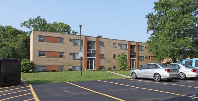
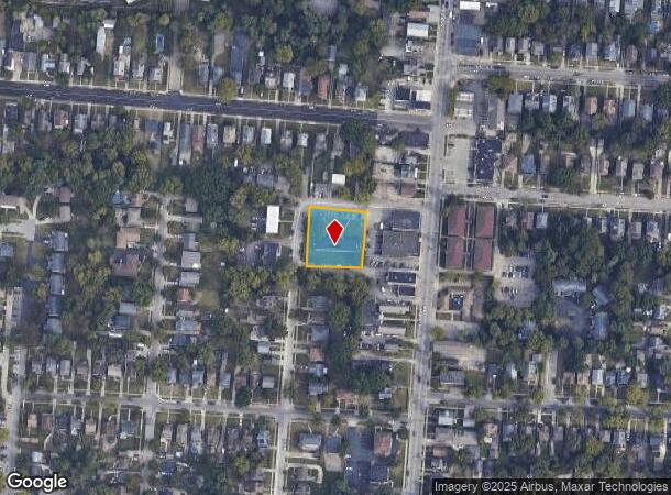
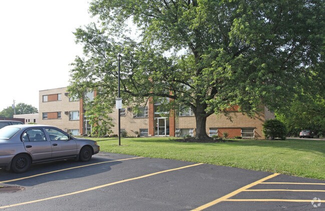
3411 Broadwell Ave, Cincinnati, OH 45211
NEARBY LISTINGS FOR SALE OR LEASE
Property Detail
3411 Broadwell Ave
Cincinnati, OH-KY-IN
Schwartzes Est 1St Sub
212-0064-0051
BROADWELL & STANHOPE 167.49 X 155 IRR LOT 14 PT 13 F W SCHWARTZES EST 1ST SUB PAR51-52 CON
Apartment
Hamilton
X
Ohio
39061C0213E
14
2025
0.57 AC
2025
Westwood
010201
Cincinnati/Dayton
10,894 SF
DEMOGRAPHICS near 3411 Broadwell Ave
1 Mile
3 Mile
5 Mile
2024 Total Population
18,219
102,484
228,398
2029 Population
17,811
101,315
226,720
Pop Growth 2024-2029
(2.24%)
(1.14%)
(0.73%)
Average Age
39
38
39
2024 Total Households
8,063
42,345
94,495
HH Growth 2024-2029
(2.39%)
(1.21%)
(0.81%)
Median Household Inc
$46,634
$51,942
$52,874
Avg Household Size
2.20
2.30
2.30
2024 Avg HH Vehicles
2.00
2.00
2.00
Median Home Value
$141,654
$159,412
$166,704
Median Year Built
1951
1961
1962
Nearby Places
Map Layers
Map Styles
 Street
 Aerial
- Restaurants
- Banks
- Shops
- Fitness
- Groceries
PUBLIC TRANSPORTATION
COMMUTER RAIL
Cincinnati Union Terminal (Cardinal - Amtrak)
DRIVE
WALK
Distance
Cincinnati Union Terminal (Cardinal - Amtrak)
15 min
7.0 mi
AIRPORT
Cincinnati/Northern Kentucky International
DRIVE
WALK
Distance
Cincinnati/Northern Kentucky International
39 min
21.1 mi
Freight Ports
Port of Toledo
DRIVE
WALK
Distance
Port of Toledo
245 min
207.0 mi
Nearby Properties
Address
Land Use
TOTAL SIZE
Lot Size
Zoning
Address
Land Use
TOTAL SIZE
Lot Size
Zoning
Address
Land Use
TOTAL SIZE
Lot Size
Zoning
9.52 AC
B
Address
Land Use
TOTAL SIZE
Lot Size
Zoning
17,857 SF
26.60 AC
CGA
Address
Land Use
TOTAL SIZE
Lot Size
Zoning
8.18 AC
SF4
Address
Land Use
TOTAL SIZE
Lot Size
Zoning
Address
Land Use
TOTAL SIZE
Lot Size
Zoning
2,678 SF
8.76 AC
Address
Land Use
TOTAL SIZE
Lot Size
Zoning
6,620 SF
16.91 AC
Address
Land Use
TOTAL SIZE
Lot Size
Zoning
14.43 AC
Address
Land Use
TOTAL SIZE
Lot Size
Zoning
Address
Land Use
TOTAL SIZE
Lot Size
Zoning
125,405 SF
16.69 AC
SF6
Address
Land Use
TOTAL SIZE
Lot Size
Zoning
360 SF
7.79 AC
F
Address
Land Use
TOTAL SIZE
Lot Size
Zoning
6.15 AC
SF2
Address
Land Use
TOTAL SIZE
Lot Size
Zoning
6,000 SF
11.92 AC
G
Address
Land Use
TOTAL SIZE
Lot Size
Zoning
8.57 AC
Address
Land Use
TOTAL SIZE
Lot Size
Zoning
62,160 SF
13.70 AC
RM20
Address
Land Use
TOTAL SIZE
Lot Size
Zoning
55,572 SF
6.12 AC
C
Address
Land Use
TOTAL SIZE
Lot Size
Zoning
14.01 AC
CGA
Address
Land Use
TOTAL SIZE
Lot Size
Zoning
10,036 SF
22.06 AC
RM20
Address
Land Use
TOTAL SIZE
Lot Size
Zoning
40,080 SF
4.14 AC
SF6
Address
Land Use
TOTAL SIZE
Lot Size
Zoning
76,739 SF
11.44 AC
SF6
Address
Land Use
TOTAL SIZE
Lot Size
Zoning
4.28 AC
OO
Address
Land Use
TOTAL SIZE
Lot Size
Zoning
24,222 SF
3.91 AC
CGA
Address
Land Use
TOTAL SIZE
Lot Size
Zoning
47,504 SF
14.37 AC
RM20
Address
Land Use
TOTAL SIZE
Lot Size
Zoning
60,751 SF
9.57 AC
C
Address
Land Use
TOTAL SIZE
Lot Size
Zoning
4.33 AC
Address
Land Use
TOTAL SIZE
Lot Size
Zoning
6.91 AC
B
Address
Land Use
TOTAL SIZE
Lot Size
Zoning
3.04 AC
OO
Address
Land Use
TOTAL SIZE
Lot Size
Zoning
11.81 AC
RM20
Address
Land Use
TOTAL SIZE
Lot Size
Zoning
15,998 SF
13.71 AC
SF10
Address
Land Use
TOTAL SIZE
Lot Size
Zoning
9.43 AC
CGA
The World's #1 Commercial Real Estate Marketplace
Connect with us
© 2026 CoStar Group
The information above has been obtained from sources believed reliable. While we do not doubt its accuracy we have not verified it and make no guarantee, warranty or representation about it. It is your responsibility to independently confirm its accuracy and completeness. Any projections, opinions, assumptions, or estimates used are for example only and do not represent the current or future performance of the property. The value of this transaction to you depends on tax and other factors which should be evaluated by your tax, financial, and legal advisors. You and your advisors should conduct a careful, independent investigation of the property to determine to your satisfaction the suitability of the property for your needs.