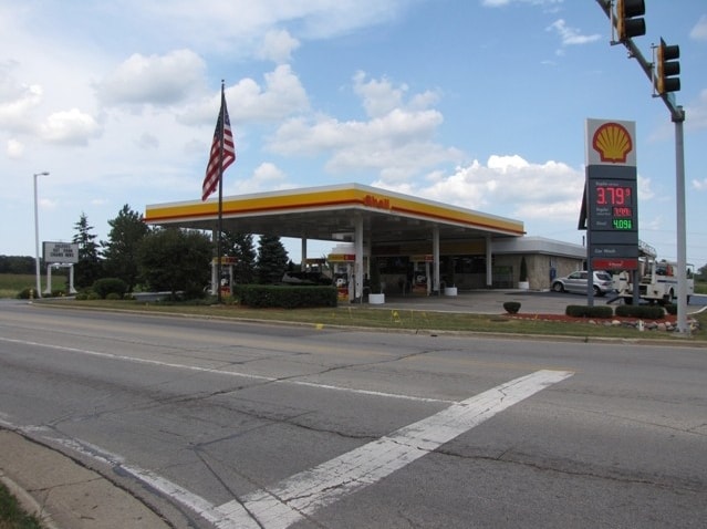
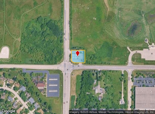
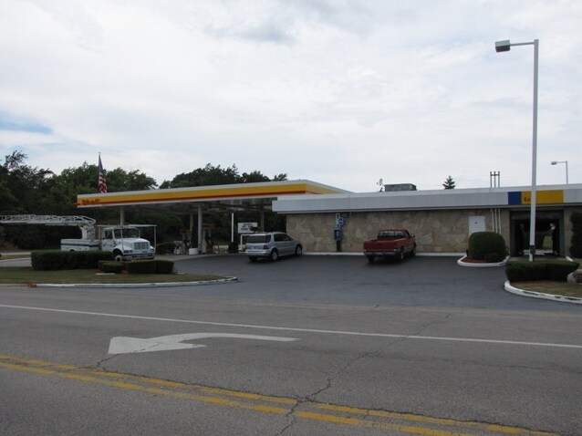
Property Record
3411 N Delany Rd, Waukegan, IL 60087

NEARBY LISTINGS FOR SALE OR LEASE
Property Detail
3411 N Delany Rd
03-36-300-008
W 205FT OF S 192FT SW1/4 SW1/4 36-46-11 SECTION 36 TOWNSHIP 46 RANGE 11
Commercialbuilding
Lake
X
Illinois
17097C0067K
0.90 AC
2023
Far North
2024
Chicago
861803
Chicago-Naperville-Elgin, IL-IN-WI
3,654 SF
DEMOGRAPHICS near 3411 N Delany Rd
1 Mile
3 Mile
5 Mile
2024 Total Population
2,641
39,127
142,129
2029 Population
2,578
38,556
139,740
Pop Growth 2024-2029
(2.39%)
(1.46%)
(1.68%)
Average Age
42
39
38
2024 Total Households
1,017
14,140
49,761
HH Growth 2024-2029
(2.56%)
(1.58%)
(1.78%)
Median Household Inc
$107,228
$79,376
$69,439
Avg Household Size
2.60
2.70
2.80
2024 Avg HH Vehicles
2.00
2.00
2.00
Median Home Value
$243,161
$214,707
$187,749
Median Year Built
1994
1985
1976
Nearby Places
Map Layers
Map Styles
 Street
 Aerial
- Restaurants
- Banks
- Shops
- Fitness
- Groceries
PUBLIC TRANSPORTATION
COMMUTER RAIL
Zion Station (Union Pacific North Line - Northeast Illinois Regional Commuter Railroad (Metra))
DRIVE
WALK
Distance
Zion Station (Union Pacific North Line - Northeast Illinois Regional Commuter Railroad (Metra))
14 min
7.0 mi
Waukegan Station (Union Pacific North Line - Northeast Illinois Regional Commuter Railroad (Metra))
DRIVE
WALK
Distance
Waukegan Station (Union Pacific North Line - Northeast Illinois Regional Commuter Railroad (Metra))
14 min
7.5 mi
Freight Ports
Port Milwaukee
DRIVE
WALK
Distance
Port Milwaukee
53 min
44.4 mi
Nearby Properties
Address
Land Use
TOTAL SIZE
Lot Size
Zoning
Address
Land Use
TOTAL SIZE
Lot Size
Zoning
7,061,069 SF
67.64 AC
Address
Land Use
TOTAL SIZE
Lot Size
Zoning
7,005,025 SF
22.61 AC
Address
Land Use
TOTAL SIZE
Lot Size
Zoning
1,881,360 SF
19.04 AC
Address
Land Use
TOTAL SIZE
Lot Size
Zoning
18.23 AC
Address
Land Use
TOTAL SIZE
Lot Size
Zoning
340,249 SF
15.10 AC
Address
Land Use
TOTAL SIZE
Lot Size
Zoning
3,278,145 SF
10.77 AC
Address
Land Use
TOTAL SIZE
Lot Size
Zoning
409,010 SF
2.01 AC
Address
Land Use
TOTAL SIZE
Lot Size
Zoning
914,522 SF
7.81 AC
Address
Land Use
TOTAL SIZE
Lot Size
Zoning
684,656 SF
20.62 AC
Address
Land Use
TOTAL SIZE
Lot Size
Zoning
223,479 SF
12.82 AC
Address
Land Use
TOTAL SIZE
Lot Size
Zoning
19.03 AC
Address
Land Use
TOTAL SIZE
Lot Size
Zoning
218,500 SF
9.86 AC
Address
Land Use
TOTAL SIZE
Lot Size
Zoning
1,252,125 SF
3.89 AC
Address
Land Use
TOTAL SIZE
Lot Size
Zoning
208,800 SF
9.34 AC
Address
Land Use
TOTAL SIZE
Lot Size
Zoning
122,314 SF
5.95 AC
Address
Land Use
TOTAL SIZE
Lot Size
Zoning
1,148,346 SF
7.90 AC
Address
Land Use
TOTAL SIZE
Lot Size
Zoning
218,500 SF
10.46 AC
Address
Land Use
TOTAL SIZE
Lot Size
Zoning
143,510 SF
4.33 AC
Address
Land Use
TOTAL SIZE
Lot Size
Zoning
456,332 SF
5.12 AC
Address
Land Use
TOTAL SIZE
Lot Size
Zoning
130,382 SF
6.19 AC
Address
Land Use
TOTAL SIZE
Lot Size
Zoning
194,520 SF
10.21 AC
Address
Land Use
TOTAL SIZE
Lot Size
Zoning
70,268 SF
8.66 AC
Address
Land Use
TOTAL SIZE
Lot Size
Zoning
470,010 SF
12.80 AC
Address
Land Use
TOTAL SIZE
Lot Size
Zoning
188,706 SF
6.05 AC
Address
Land Use
TOTAL SIZE
Lot Size
Zoning
95,368 SF
7.07 AC
Address
Land Use
TOTAL SIZE
Lot Size
Zoning
90,000 SF
2.79 AC
Address
Land Use
TOTAL SIZE
Lot Size
Zoning
130,770 SF
6.08 AC
Address
Land Use
TOTAL SIZE
Lot Size
Zoning
69,723 SF
6.51 AC
Address
Land Use
TOTAL SIZE
Lot Size
Zoning
83,996 SF
4.80 AC
Address
Land Use
TOTAL SIZE
Lot Size
Zoning
100,752 SF
3.30 AC
The World's #1 Commercial Real Estate Marketplace
Connect with us
© 2025 CoStar Group
The information above has been obtained from sources believed reliable. While we do not doubt its accuracy we have not verified it and make no guarantee, warranty or representation about it. It is your responsibility to independently confirm its accuracy and completeness. Any projections, opinions, assumptions, or estimates used are for example only and do not represent the current or future performance of the property. The value of this transaction to you depends on tax and other factors which should be evaluated by your tax, financial, and legal advisors. You and your advisors should conduct a careful, independent investigation of the property to determine to your satisfaction the suitability of the property for your needs.