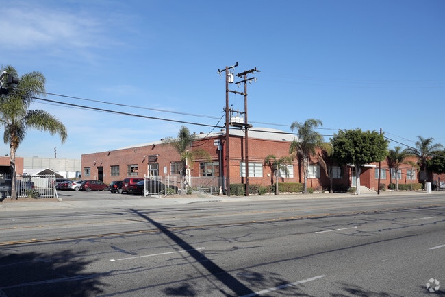
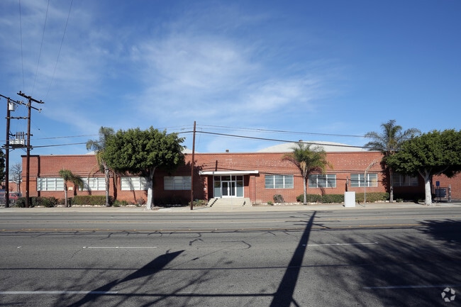
Property Record
3411 W El Segundo Blvd, Hawthorne, CA 90250

NEARBY LISTINGS FOR SALE OR LEASE
Property Detail
3411 W El Segundo Blvd
Los Angeles-Long Beach-Glendale, CA
Parcel Map 15784
4049-006-060
PARCEL MAP AS PER BK 170 P 28-29 OF PM LOT 2
Heavyindustrial
Los Angeles
X
California
06037C1790F
2
2024
1.22 AC
2025
Gardena/Hawthorne
602513
Los Angeles
65,568 SF
DEMOGRAPHICS near 3411 W El Segundo Blvd
1 Mile
3 Mile
5 Mile
2024 Total Population
48,189
315,004
759,312
2029 Population
47,014
304,687
735,607
Pop Growth 2024-2029
(2.44%)
(3.28%)
(3.12%)
Average Age
37
38
38
2024 Total Households
16,503
102,962
250,315
HH Growth 2024-2029
(2.58%)
(3.51%)
(3.29%)
Median Household Inc
$59,301
$68,623
$73,216
Avg Household Size
2.80
3.00
2.90
2024 Avg HH Vehicles
2.00
2.00
2.00
Median Home Value
$710,606
$717,560
$773,026
Median Year Built
1970
1959
1959
Nearby Places
Map Layers
Map Styles
 Street
 Aerial
- Restaurants
- Banks
- Shops
- Fitness
- Groceries
PUBLIC TRANSPORTATION
TRANSIT/SUBWAY
Crenshaw Station (Green Line - Los Angeles County Metropolitan Transportation Authority (Metro))
DRIVE
WALK
Distance
Crenshaw Station (Green Line - Los Angeles County Metropolitan Transportation Authority (Metro))
2 min
20 min
1.0 mi
AIRPORT
Los Angeles International
DRIVE
WALK
Distance
Los Angeles International
12 min
6.7 mi
Long Beach (Daugherty Field)
DRIVE
WALK
Distance
Long Beach (Daugherty Field)
22 min
15.3 mi
Bob Hope
DRIVE
WALK
Distance
Bob Hope
40 min
29.9 mi
Freight Ports
Port of Los Angeles
DRIVE
WALK
Distance
Port of Los Angeles
29 min
18.7 mi
SALE & LEASE HISTORY
LISTING DATE
SALE/LEASE

Sep 25, 2016
For Lease
Nearby Properties
Address
Land Use
TOTAL SIZE
Lot Size
Zoning
Address
Land Use
TOTAL SIZE
Lot Size
Zoning
2,531,696 SF
79.60 AC
INCR*
Address
Land Use
TOTAL SIZE
Lot Size
Zoning
Address
Land Use
TOTAL SIZE
Lot Size
Zoning
Address
Land Use
TOTAL SIZE
Lot Size
Zoning
Address
Land Use
TOTAL SIZE
Lot Size
Zoning
Address
Land Use
TOTAL SIZE
Lot Size
Zoning
337,106 SF
9.56 AC
ESCM*
Address
Land Use
TOTAL SIZE
Lot Size
Zoning
724,715 SF
5.76 AC
INCR*
Address
Land Use
TOTAL SIZE
Lot Size
Zoning
944,791 SF
22.53 AC
ESCM*
Address
Land Use
TOTAL SIZE
Lot Size
Zoning
421,934 SF
8.24 AC
ESCM
Address
Land Use
TOTAL SIZE
Lot Size
Zoning
718,086 SF
41.24 AC
RBI-1A
Address
Land Use
TOTAL SIZE
Lot Size
Zoning
418,131 SF
3.03 AC
LCC1
Address
Land Use
TOTAL SIZE
Lot Size
Zoning
848,217 SF
36.09 AC
RBI-1A
Address
Land Use
TOTAL SIZE
Lot Size
Zoning
227,596 SF
14.38 AC
HAM1YY
Address
Land Use
TOTAL SIZE
Lot Size
Zoning
1,359,630 SF
29 AC
INCR*
Address
Land Use
TOTAL SIZE
Lot Size
Zoning
279,694 SF
3.19 AC
LCR1*
Address
Land Use
TOTAL SIZE
Lot Size
Zoning
216,354 SF
3.52 AC
HAC3
Address
Land Use
TOTAL SIZE
Lot Size
Zoning
112,014 SF
5.11 AC
ESM2YY
Address
Land Use
TOTAL SIZE
Lot Size
Zoning
214,782 SF
3.66 AC
GAR3
Address
Land Use
TOTAL SIZE
Lot Size
Zoning
833,484 SF
6.62 AC
ESM2YY
Address
Land Use
TOTAL SIZE
Lot Size
Zoning
662,081 SF
2.50 AC
LAC2
Address
Land Use
TOTAL SIZE
Lot Size
Zoning
239,992 SF
4.72 AC
RBI-1B
Address
Land Use
TOTAL SIZE
Lot Size
Zoning
654,405 SF
14.82 AC
LAM2
Address
Land Use
TOTAL SIZE
Lot Size
Zoning
181,213 SF
3.96 AC
INCR*
Address
Land Use
TOTAL SIZE
Lot Size
Zoning
273,825 SF
7.73 AC
INRM*
Address
Land Use
TOTAL SIZE
Lot Size
Zoning
411,131 SF
11.41 AC
ESM2
Address
Land Use
TOTAL SIZE
Lot Size
Zoning
186,683 SF
1.74 AC
LCR1*
Address
Land Use
TOTAL SIZE
Lot Size
Zoning
145,120 SF
4.57 AC
ESM1YY*
Address
Land Use
TOTAL SIZE
Lot Size
Zoning
986,604 SF
42.66 AC
HAM2YY
Address
Land Use
TOTAL SIZE
Lot Size
Zoning
59,422 SF
2.89 AC
HAM2YY
The World's #1 Commercial Real Estate Marketplace
Connect with us
© 2026 CoStar Group
The information above has been obtained from sources believed reliable. While we do not doubt its accuracy we have not verified it and make no guarantee, warranty or representation about it. It is your responsibility to independently confirm its accuracy and completeness. Any projections, opinions, assumptions, or estimates used are for example only and do not represent the current or future performance of the property. The value of this transaction to you depends on tax and other factors which should be evaluated by your tax, financial, and legal advisors. You and your advisors should conduct a careful, independent investigation of the property to determine to your satisfaction the suitability of the property for your needs.