Property Record
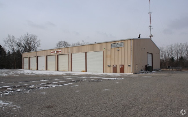
3414 Aurelius Rd, Lansing, MI 48910

Current Lease Availabilities
Property Detail
3414 Aurelius Rd
01-01-34-227-261
LOTS 78 & 79 SUPERVISORS PLAT OF CHERRY HILL, ALSO COM 461.74 FT S & 500 FT W OF NE COR SEC 34, TH W 159.69 FT TO E LINE
Autorepair
Ingham
MIXED Z
Michigan
B and X Area of moderate flood hazard, usually the area between the limits of the 100-year and 500-year floods.
78-79
2024
2.92 AC
2025
Southern Lansing
002901
West Michigan
19,467 SF
Lansing-East Lansing, MI
NEARBY LISTINGS FOR SALE OR LEASE
DEMOGRAPHICS near 3414 Aurelius Rd
1 mile
3 mile
5 mile
2025 Total Population
5,639
72,951
202,019
2030 Population
5,716
74,488
207,200
Pop Growth 2025-2030
+ 1.37%
+ 2.11%
+ 2.56%
Average Age
38
36
36
2025 Total Households
2,683
30,156
84,200
HH Growth 2025-2030
+ 1.49%
+ 2.19%
+ 2.69%
Median Household Inc
$60,027
$52,862
$55,789
Avg Household Size
2.10
2.10
2.20
2025 Avg HH Vehicles
1.00
1.00
2.00
Median Home Value
$137,294
$139,626
$167,743
Median Year Built
1970
1961
1968
Nearby Places
Map Layers
Map Styles
 Street
 Aerial
Transit
 Traffic
 Biking
Places
Listings with unknown addresses are not visible on the map
- Restaurants
- Banks
- Shops
- Fitness
- Groceries
PUBLIC TRANSPORTATION
COMMUTER RAIL
Drive
Walk
Distance
8 min
3.3 mi
AIRPORT
Capital Region International
Drive
Walk
Distance
Capital Region International
18 min
7.9 mi
Nearby Properties
Address
Land Use
TOTAL SIZE
Lot Size
Zoning
Address
Land Use
TOTAL SIZE
Lot Size
Zoning
312,651 SF
37.50 AC
D-1 PRO
Address
Land Use
TOTAL SIZE
Lot Size
Zoning
111,180 SF
3.63 AC
G-1 BUS
Address
Land Use
TOTAL SIZE
Lot Size
Zoning
14,304 SF
3.37 AC
MIXED Z
Address
Land Use
TOTAL SIZE
Lot Size
Zoning
274,720 SF
10.55 AC
Address
Land Use
TOTAL SIZE
Lot Size
Zoning
177,300 SF
8.72 AC
Address
Land Use
TOTAL SIZE
Lot Size
Zoning
69,851 SF
134.23 AC
I HVY
Address
Land Use
TOTAL SIZE
Lot Size
Zoning
13.13 AC
Address
Land Use
TOTAL SIZE
Lot Size
Zoning
49,336 SF
9.60 AC
F COMM
Address
Land Use
TOTAL SIZE
Lot Size
Zoning
21,447 SF
56.20 AC
RM
Address
Land Use
TOTAL SIZE
Lot Size
Zoning
3,246 SF
13.54 AC
DM-1 RE
Address
Land Use
TOTAL SIZE
Lot Size
Zoning
195,094 SF
1.89 AC
Address
Land Use
TOTAL SIZE
Lot Size
Zoning
185,190 SF
0.41 AC
G-1 BUS
Address
Land Use
TOTAL SIZE
Lot Size
Zoning
150,589 SF
3.06 AC
D-1 PRO
Address
Land Use
TOTAL SIZE
Lot Size
Zoning
2,920 SF
36.77 AC
CUP
Address
Land Use
TOTAL SIZE
Lot Size
Zoning
131,234 SF
2.49 AC
Address
Land Use
TOTAL SIZE
Lot Size
Zoning
9,628 SF
1.86 AC
B2
Address
Land Use
TOTAL SIZE
Lot Size
Zoning
410 AC
Address
Land Use
TOTAL SIZE
Lot Size
Zoning
8,857 SF
21.22 AC
A RESID
Address
Land Use
TOTAL SIZE
Lot Size
Zoning
169,704 SF
0.67 AC
G-1 BUS
Address
Land Use
TOTAL SIZE
Lot Size
Zoning
165,684 SF
1.20 AC
G-1 BUS
Address
Land Use
TOTAL SIZE
Lot Size
Zoning
112,248 SF
3.70 AC
B2
Address
Land Use
TOTAL SIZE
Lot Size
Zoning
157,548 SF
0.72 AC
Address
Land Use
TOTAL SIZE
Lot Size
Zoning
114,681 SF
1.08 AC
G-1 BUS
Address
Land Use
TOTAL SIZE
Lot Size
Zoning
31,215 SF
19.19 AC
CUP
Address
Land Use
TOTAL SIZE
Lot Size
Zoning
131,040 SF
2.36 AC
Address
Land Use
TOTAL SIZE
Lot Size
Zoning
67,365 SF
4.19 AC
H LT IN
Address
Land Use
TOTAL SIZE
Lot Size
Zoning
23,940 SF
13.44 AC
CUP
Address
Land Use
TOTAL SIZE
Lot Size
Zoning
121,536 SF
2 AC
Address
Land Use
TOTAL SIZE
Lot Size
Zoning
17,920 SF
208 AC
Address
Land Use
TOTAL SIZE
Lot Size
Zoning
1.25 AC
B2
The World's #1 Commercial Real Estate Marketplace
Connect with us
© 2026 CoStar Group
The information above has been obtained from sources believed reliable. While we do not doubt its accuracy we have not verified it and make no guarantee, warranty or representation about it. It is your responsibility to independently confirm its accuracy and completeness. Any projections, opinions, assumptions, or estimates used are for example only and do not represent the current or future performance of the property. The value of this transaction to you depends on tax and other factors which should be evaluated by your tax, financial, and legal advisors. You and your advisors should conduct a careful, independent investigation of the property to determine to your satisfaction the suitability of the property for your needs.