Property Record
3415 Colonnade Pky, Birmingham, AL 35243
NEARBY LISTINGS FOR SALE OR LEASE
Property Detail
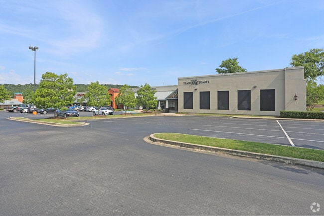
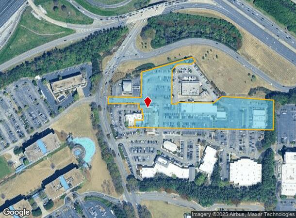
3415 Colonnade Pky
Birmingham, AL
Colonnade Re #4 28-27-1&4
28-00-27-1-000-006.501
BLDGS & LAND DESC AS THAT PT OF LOT 2-I COLONNADE RESUR #4 162/67 WHICH LIES IN NE 1/4 SEC 27 TP 18 R2W
Regionalshoppingcenterormallwithanchorstore
Jefferson
X
Alabama
01117C0080F
2-i
2023
6.20 AC
2024
Hwy 280/Jefferson County
012910
Birmingham
29,964 SF
DEMOGRAPHICS near 3415 Colonnade Pky
1 Mile
3 Mile
5 Mile
2024 Total Population
5,556
43,995
121,750
2029 Population
5,422
44,557
122,645
Pop Growth 2024-2029
(2.41%)
+ 1.28%
+ 0.74%
Average Age
37
40
40
2024 Total Households
3,004
19,638
49,156
HH Growth 2024-2029
(2.56%)
+ 1.54%
+ 0.74%
Median Household Inc
$85,356
$94,505
$99,785
Avg Household Size
1.80
2.20
2.40
2024 Avg HH Vehicles
2.00
2.00
2.00
Median Home Value
$359,243
$417,737
$425,072
Median Year Built
1999
1989
1984
Nearby Places
Map Layers
Map Styles
 Street
 Aerial
- Restaurants
- Banks
- Shops
- Fitness
- Groceries
PUBLIC TRANSPORTATION
COMMUTER RAIL
Birmingham (Crescent - Amtrak)
DRIVE
WALK
Distance
Birmingham (Crescent - Amtrak)
13 min
8.6 mi
AIRPORT
Birmingham-Shuttlesworth International
DRIVE
WALK
Distance
Birmingham-Shuttlesworth International
19 min
12.4 mi
Freight Ports
Port of Mobile
DRIVE
WALK
Distance
Port of Mobile
275 min
251.2 mi
SALE & LEASE HISTORY
LISTING DATE
SALE/LEASE

Sep 24, 2016
For Lease
Nearby Properties
Address
Land Use
TOTAL SIZE
Lot Size
Zoning
Address
Land Use
TOTAL SIZE
Lot Size
Zoning
200,418 SF
6.50 AC
C1
Address
Land Use
TOTAL SIZE
Lot Size
Zoning
15,013 SF
79.12 AC
Address
Land Use
TOTAL SIZE
Lot Size
Zoning
212,615 SF
19.66 AC
B-2
Address
Land Use
TOTAL SIZE
Lot Size
Zoning
45,868 SF
6.80 AC
CP Y
Address
Land Use
TOTAL SIZE
Lot Size
Zoning
500,279 SF
52.57 AC
B2
Address
Land Use
TOTAL SIZE
Lot Size
Zoning
140,853 SF
27 AC
B-2
Address
Land Use
TOTAL SIZE
Lot Size
Zoning
7,280 SF
35 AC
Address
Land Use
TOTAL SIZE
Lot Size
Zoning
153,413 SF
6.35 AC
C1
Address
Land Use
TOTAL SIZE
Lot Size
Zoning
6 AC
C-1
Address
Land Use
TOTAL SIZE
Lot Size
Zoning
169,501 SF
18 AC
E-2
Address
Land Use
TOTAL SIZE
Lot Size
Zoning
4,674 SF
28.10 AC
Address
Land Use
TOTAL SIZE
Lot Size
Zoning
136,498 SF
11 AC
C1
Address
Land Use
TOTAL SIZE
Lot Size
Zoning
30,967 SF
17.39 AC
Address
Land Use
TOTAL SIZE
Lot Size
Zoning
132,501 SF
50.39 AC
Address
Land Use
TOTAL SIZE
Lot Size
Zoning
235,082 SF
26.10 AC
C1
Address
Land Use
TOTAL SIZE
Lot Size
Zoning
102,373 SF
12.33 AC
R1-E
Address
Land Use
TOTAL SIZE
Lot Size
Zoning
344,434 SF
15.52 AC
R4
Address
Land Use
TOTAL SIZE
Lot Size
Zoning
239,213 SF
17 AC
C1
Address
Land Use
TOTAL SIZE
Lot Size
Zoning
259,316 SF
30 AC
PUD
Address
Land Use
TOTAL SIZE
Lot Size
Zoning
321,157 SF
33 AC
C
Address
Land Use
TOTAL SIZE
Lot Size
Zoning
59,454 SF
4.21 AC
C1
Address
Land Use
TOTAL SIZE
Lot Size
Zoning
11,492 SF
21.30 AC
Address
Land Use
TOTAL SIZE
Lot Size
Zoning
361,937 SF
22 AC
R4
Address
Land Use
TOTAL SIZE
Lot Size
Zoning
125,165 SF
8.07 AC
CP
Address
Land Use
TOTAL SIZE
Lot Size
Zoning
89,134 SF
6.50 AC
C-1
Address
Land Use
TOTAL SIZE
Lot Size
Zoning
2,404 SF
17.42 AC
Address
Land Use
TOTAL SIZE
Lot Size
Zoning
58,463 SF
11 AC
C1
Address
Land Use
TOTAL SIZE
Lot Size
Zoning
5,506 SF
17.36 AC
Address
Land Use
TOTAL SIZE
Lot Size
Zoning
1,400 SF
21.35 AC
Address
Land Use
TOTAL SIZE
Lot Size
Zoning
16,187 SF
33.04 AC
The World's #1 Commercial Real Estate Marketplace
Connect with us
© 2026 CoStar Group
The information above has been obtained from sources believed reliable. While we do not doubt its accuracy we have not verified it and make no guarantee, warranty or representation about it. It is your responsibility to independently confirm its accuracy and completeness. Any projections, opinions, assumptions, or estimates used are for example only and do not represent the current or future performance of the property. The value of this transaction to you depends on tax and other factors which should be evaluated by your tax, financial, and legal advisors. You and your advisors should conduct a careful, independent investigation of the property to determine to your satisfaction the suitability of the property for your needs.