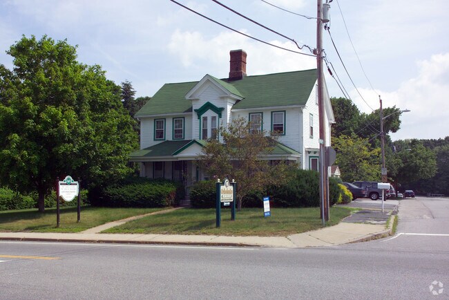
Property Record
3415 Mendon Rd, Cumberland, RI 02864

NEARBY LISTINGS FOR SALE OR LEASE
Property Detail
3415 Mendon Rd
Commercialofficeresidentialmixeduse
Providence
X
Rhode Island
25005C0100F
0.48 AC
2025
Woonsocket
2025
Providence
011402
Providence-Warwick, RI-MA
10,063 SF
CUMB-000045-000009-000000
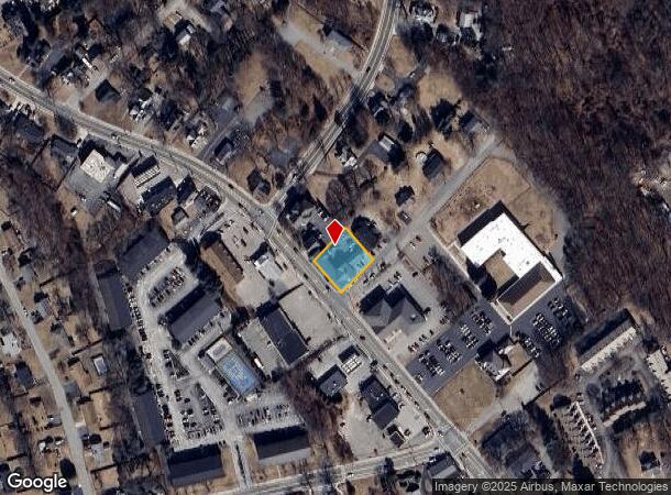
DEMOGRAPHICS near 3415 Mendon Rd
1 Mile
3 Mile
5 Mile
2024 Total Population
9,245
43,891
103,620
2029 Population
9,298
43,703
103,074
Pop Growth 2024-2029
+ 0.57%
(0.43%)
(0.53%)
Average Age
41
41
41
2024 Total Households
3,779
17,887
41,741
HH Growth 2024-2029
+ 0.40%
(0.57%)
(0.65%)
Median Household Inc
$80,823
$73,180
$77,612
Avg Household Size
2.40
2.40
2.40
2024 Avg HH Vehicles
2.00
2.00
2.00
Median Home Value
$346,916
$345,101
$360,220
Median Year Built
1972
1965
1964
Nearby Places
Map Layers
Map Styles
 Street
 Aerial
- Restaurants
- Banks
- Shops
- Fitness
- Groceries
PUBLIC TRANSPORTATION
COMMUTER RAIL
DRIVE
WALK
Distance
13 min
8.3 mi
South Attleboro (Providence/Stoughton Line - Massachusetts Bay Transportation Authority Commuter Rail (Purple Line))
DRIVE
WALK
Distance
South Attleboro (Providence/Stoughton Line - Massachusetts Bay Transportation Authority Commuter Rail (Purple Line))
16 min
9.6 mi
AIRPORT
Rhode Island Tf Green International
DRIVE
WALK
Distance
Rhode Island Tf Green International
34 min
21.9 mi
Worcester Regional
DRIVE
WALK
Distance
Worcester Regional
49 min
35.9 mi
Nearby Properties
Address
Land Use
TOTAL SIZE
Lot Size
Zoning
Address
Land Use
TOTAL SIZE
Lot Size
Zoning
16.88 AC
I1
Address
Land Use
TOTAL SIZE
Lot Size
Zoning
210,008 SF
13.95 AC
C1
Address
Land Use
TOTAL SIZE
Lot Size
Zoning
227,000 SF
6.72 AC
R3
Address
Land Use
TOTAL SIZE
Lot Size
Zoning
41.01 AC
30
Address
Land Use
TOTAL SIZE
Lot Size
Zoning
16.10 AC
60
Address
Land Use
TOTAL SIZE
Lot Size
Zoning
26.54 AC
90
Address
Land Use
TOTAL SIZE
Lot Size
Zoning
55.86 AC
BL05
Address
Land Use
TOTAL SIZE
Lot Size
Zoning
7,580 SF
32.61 AC
R4
Address
Land Use
TOTAL SIZE
Lot Size
Zoning
247,708 SF
12.14 AC
ML05
Address
Land Use
TOTAL SIZE
Lot Size
Zoning
54.49 AC
RS20
Address
Land Use
TOTAL SIZE
Lot Size
Zoning
17.10 AC
I1
Address
Land Use
TOTAL SIZE
Lot Size
Zoning
11.61 AC
60
Address
Land Use
TOTAL SIZE
Lot Size
Zoning
16.49 AC
PR1
Address
Land Use
TOTAL SIZE
Lot Size
Zoning
1 AC
R4
Address
Land Use
TOTAL SIZE
Lot Size
Zoning
18.49 AC
60
Address
Land Use
TOTAL SIZE
Lot Size
Zoning
175,122 SF
22.44 AC
ML05
Address
Land Use
TOTAL SIZE
Lot Size
Zoning
5,520 SF
9.81 AC
R1
Address
Land Use
TOTAL SIZE
Lot Size
Zoning
10.27 AC
ML05
Address
Land Use
TOTAL SIZE
Lot Size
Zoning
119,776 SF
17.33 AC
ML05
Address
Land Use
TOTAL SIZE
Lot Size
Zoning
19,774 SF
23.53 AC
R1
Address
Land Use
TOTAL SIZE
Lot Size
Zoning
147,146 SF
28.05 AC
BH
Address
Land Use
TOTAL SIZE
Lot Size
Zoning
8.33 AC
R2
Address
Land Use
TOTAL SIZE
Lot Size
Zoning
123,800 SF
8.31 AC
Address
Land Use
TOTAL SIZE
Lot Size
Zoning
103,520 SF
3.44 AC
BH
Address
Land Use
TOTAL SIZE
Lot Size
Zoning
105,384 SF
17.07 AC
120
Address
Land Use
TOTAL SIZE
Lot Size
Zoning
10.09 AC
RG7
Address
Land Use
TOTAL SIZE
Lot Size
Zoning
72,880 SF
4.30 AC
BH
Address
Land Use
TOTAL SIZE
Lot Size
Zoning
149,422 SF
14.45 AC
60
Address
Land Use
TOTAL SIZE
Lot Size
Zoning
48,216 SF
9.01 AC
ML05
Address
Land Use
TOTAL SIZE
Lot Size
Zoning
403,844 SF
10.78 AC
I2
The World's #1 Commercial Real Estate Marketplace
Connect with us
© 2026 CoStar Group
The information above has been obtained from sources believed reliable. While we do not doubt its accuracy we have not verified it and make no guarantee, warranty or representation about it. It is your responsibility to independently confirm its accuracy and completeness. Any projections, opinions, assumptions, or estimates used are for example only and do not represent the current or future performance of the property. The value of this transaction to you depends on tax and other factors which should be evaluated by your tax, financial, and legal advisors. You and your advisors should conduct a careful, independent investigation of the property to determine to your satisfaction the suitability of the property for your needs.