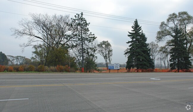
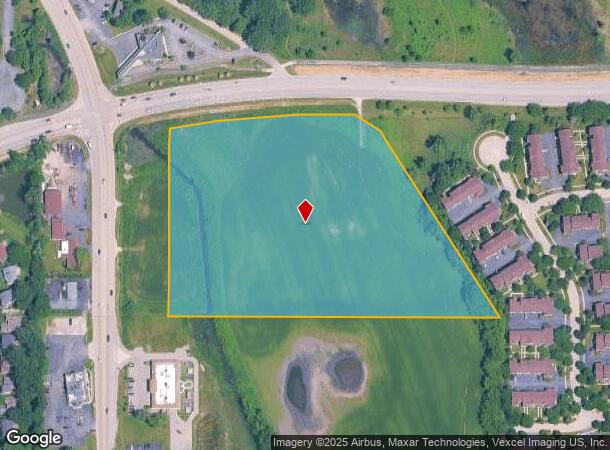
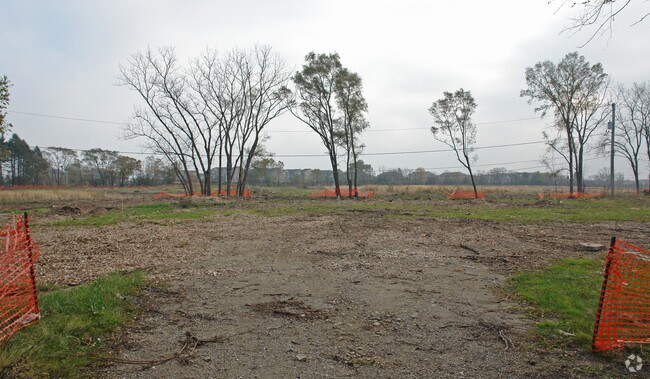
Property Record
20295 W Washington St, Grayslake, IL 60030
NEARBY LISTINGS FOR SALE OR LEASE
Property Detail
20295 W Washington St
Chicago-Naperville-Elgin, IL-IN-WI
Lake Sub
06-23-400-020
PT SW1/4 SE1/4; BEG ON E LN BARROW & VONACHENS GRAYSLAKE S UB & S ROW WASHINGTON ST, S 658.5 MOL, E 956.6 MOL, NWLY ALG VAC RD 638.3, NWLY 150.36 TO S ROW WASHINGTON ST SWLY
Farms
Lake
AE
Illinois
17097C0132L
110
2023
10.21 AC
2024
Far North
861106
Chicago
DEMOGRAPHICS near 20295 W Washington St
1 Mile
3 Mile
5 Mile
2024 Total Population
6,971
59,504
137,882
2029 Population
6,843
58,601
135,755
Pop Growth 2024-2029
(1.84%)
(1.52%)
(1.54%)
Average Age
39
39
39
2024 Total Households
2,697
20,848
48,495
HH Growth 2024-2029
(1.93%)
(1.62%)
(1.64%)
Median Household Inc
$106,118
$100,281
$99,021
Avg Household Size
2.60
2.80
2.80
2024 Avg HH Vehicles
2.00
2.00
2.00
Median Home Value
$235,608
$245,415
$245,758
Median Year Built
1992
1990
1990
Nearby Places
Map Layers
Map Styles
 Street
 Aerial
- Restaurants
- Banks
- Shops
- Fitness
- Groceries
PUBLIC TRANSPORTATION
COMMUTER RAIL
Washington St (Grayslake) Station (Ncs) (North Central Service - Northeast Illinois Regional Commuter Railroad (Metra))
DRIVE
WALK
Distance
Washington St (Grayslake) Station (Ncs) (North Central Service - Northeast Illinois Regional Commuter Railroad (Metra))
3 min
1.2 mi
Grayslake Station (Md-N) (Milwaukee District North Line - Northeast Illinois Regional Commuter Railroad (Metra))
DRIVE
WALK
Distance
Grayslake Station (Md-N) (Milwaukee District North Line - Northeast Illinois Regional Commuter Railroad (Metra))
5 min
2.7 mi
AIRPORT
Chicago O'Hare International
DRIVE
WALK
Distance
Chicago O'Hare International
47 min
35.9 mi
Freight Ports
Port Milwaukee
DRIVE
WALK
Distance
Port Milwaukee
64 min
51.8 mi
Nearby Properties
Address
Land Use
TOTAL SIZE
Lot Size
Zoning
Address
Land Use
TOTAL SIZE
Lot Size
Zoning
286,618 SF
11.81 AC
Address
Land Use
TOTAL SIZE
Lot Size
Zoning
2,993,760 SF
20.63 AC
Address
Land Use
TOTAL SIZE
Lot Size
Zoning
298,181 SF
20.41 AC
Address
Land Use
TOTAL SIZE
Lot Size
Zoning
194,075 SF
14.84 AC
Address
Land Use
TOTAL SIZE
Lot Size
Zoning
308,160 SF
7.43 AC
Address
Land Use
TOTAL SIZE
Lot Size
Zoning
282,999 SF
23.06 AC
Address
Land Use
TOTAL SIZE
Lot Size
Zoning
100,123 SF
12.63 AC
Address
Land Use
TOTAL SIZE
Lot Size
Zoning
89,754 SF
8.64 AC
Address
Land Use
TOTAL SIZE
Lot Size
Zoning
132,256 SF
18.59 AC
Address
Land Use
TOTAL SIZE
Lot Size
Zoning
92,245 SF
5.89 AC
Address
Land Use
TOTAL SIZE
Lot Size
Zoning
200,944 SF
5.84 AC
Address
Land Use
TOTAL SIZE
Lot Size
Zoning
209,803 SF
3.88 AC
Address
Land Use
TOTAL SIZE
Lot Size
Zoning
421,146 SF
4.79 AC
Address
Land Use
TOTAL SIZE
Lot Size
Zoning
115,805 SF
4.38 AC
Address
Land Use
TOTAL SIZE
Lot Size
Zoning
17,484 SF
3.52 AC
Address
Land Use
TOTAL SIZE
Lot Size
Zoning
97,798 SF
6.98 AC
Address
Land Use
TOTAL SIZE
Lot Size
Zoning
86,920 SF
6.89 AC
Address
Land Use
TOTAL SIZE
Lot Size
Zoning
77,864 SF
5.28 AC
Address
Land Use
TOTAL SIZE
Lot Size
Zoning
62,821 SF
6.79 AC
Address
Land Use
TOTAL SIZE
Lot Size
Zoning
104,143 SF
11.96 AC
Address
Land Use
TOTAL SIZE
Lot Size
Zoning
41,925 SF
5.15 AC
Address
Land Use
TOTAL SIZE
Lot Size
Zoning
39,253 SF
2.26 AC
Address
Land Use
TOTAL SIZE
Lot Size
Zoning
224,750 SF
4.79 AC
Address
Land Use
TOTAL SIZE
Lot Size
Zoning
66,554 SF
1.62 AC
Address
Land Use
TOTAL SIZE
Lot Size
Zoning
87,233 SF
7.72 AC
Address
Land Use
TOTAL SIZE
Lot Size
Zoning
35.61 AC
Address
Land Use
TOTAL SIZE
Lot Size
Zoning
285,750 SF
4.27 AC
Address
Land Use
TOTAL SIZE
Lot Size
Zoning
10,998 SF
2.50 AC
Address
Land Use
TOTAL SIZE
Lot Size
Zoning
13,500 SF
7.97 AC
Address
Land Use
TOTAL SIZE
Lot Size
Zoning
188,183 SF
17.16 AC
The World's #1 Commercial Real Estate Marketplace
Connect with us
© 2026 CoStar Group
The information above has been obtained from sources believed reliable. While we do not doubt its accuracy we have not verified it and make no guarantee, warranty or representation about it. It is your responsibility to independently confirm its accuracy and completeness. Any projections, opinions, assumptions, or estimates used are for example only and do not represent the current or future performance of the property. The value of this transaction to you depends on tax and other factors which should be evaluated by your tax, financial, and legal advisors. You and your advisors should conduct a careful, independent investigation of the property to determine to your satisfaction the suitability of the property for your needs.