Property Record
3418 Highway 81 N, Anderson, SC 29621

Save to a Folder
{{folder.Name}}
{{folder.ListingIds.length}} Properties
{{folder.ListingIds.length}} Property
Create a New Folder
Property Detail
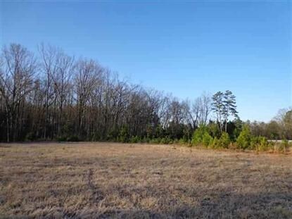
3418 Highway 81 N
Greenville-Anderson-Greer, SC
CP S 1907/1A PP S 1513/3A F220 D396 PP S 755/1B LT 11 HWY 81N 2.13 AC
145-07-01-011
ANDERSON
Dentalbldg
South Carolina
B and X Area of moderate flood hazard, usually the area between the limits of the 100-year and 500-year floods.
11
2025
2.13 AC
2025
Anderson County
011204
Greenville/Spartanburg
2,565 SF
NEARBY LISTINGS FOR SALE OR LEASE
-
-
View all Anderson listings for sale on LoopNet.com
DEMOGRAPHICS near 3418 Highway 81 N
1 mile
3 mile
5 mile
2025 Total Population
2,556
14,609
43,616
2030 Population
2,684
15,336
45,783
Pop Growth 2025-2030
+ 5.01%
+ 4.98%
+ 4.97%
Average Age
42
42
41
2025 Total Households
921
5,357
16,956
HH Growth 2025-2030
+ 5.43%
+ 5.21%
+ 5.06%
Median Household Inc
$107,314
$97,829
$74,180
Avg Household Size
2.70
2.70
2.40
2025 Avg HH Vehicles
2.00
2.00
2.00
Median Home Value
$427,586
$373,065
$313,089
Median Year Built
2002
1999
1991
Nearby Places
Map Layers
Map Styles
 Street
 Aerial
Layers
 Traffic
 Biking
Places
Listings with unknown addresses are not visible on the map
- Restaurants
- Banks
- Shops
- Fitness
- Groceries
PUBLIC TRANSPORTATION
AIRPORT
Greenville Spartanburg International
Drive
Walk
Distance
Greenville Spartanburg International
46 min
34.7 mi
Nearby Properties
Address
Land Use
TOTAL SIZE
Lot Size
Zoning
Address
Land Use
TOTAL SIZE
Lot Size
Zoning
41.61 AC
Address
Land Use
TOTAL SIZE
Lot Size
Zoning
2,420 SF
48.50 AC
Address
Land Use
TOTAL SIZE
Lot Size
Zoning
29.70 AC
Address
Land Use
TOTAL SIZE
Lot Size
Zoning
66,400 SF
12 AC
Address
Land Use
TOTAL SIZE
Lot Size
Zoning
91,455 SF
12 AC
Address
Land Use
TOTAL SIZE
Lot Size
Zoning
42,416 SF
6.45 AC
Address
Land Use
TOTAL SIZE
Lot Size
Zoning
49,123 SF
5.14 AC
Address
Land Use
TOTAL SIZE
Lot Size
Zoning
67,563 SF
17.23 AC
Address
Land Use
TOTAL SIZE
Lot Size
Zoning
31,616 SF
4.99 AC
Address
Land Use
TOTAL SIZE
Lot Size
Zoning
1,446 SF
5.15 AC
Address
Land Use
TOTAL SIZE
Lot Size
Zoning
2,408 SF
3.89 AC
Address
Land Use
TOTAL SIZE
Lot Size
Zoning
45,085 SF
6.96 AC
Address
Land Use
TOTAL SIZE
Lot Size
Zoning
6,590 SF
1.83 AC
Address
Land Use
TOTAL SIZE
Lot Size
Zoning
1,768 SF
7.33 AC
Address
Land Use
TOTAL SIZE
Lot Size
Zoning
86.27 AC
Address
Land Use
TOTAL SIZE
Lot Size
Zoning
30,736 SF
3.05 AC
Address
Land Use
TOTAL SIZE
Lot Size
Zoning
12,500 SF
1.70 AC
Address
Land Use
TOTAL SIZE
Lot Size
Zoning
Address
Land Use
TOTAL SIZE
Lot Size
Zoning
3,835 SF
2.98 AC
Address
Land Use
TOTAL SIZE
Lot Size
Zoning
41.95 AC
Address
Land Use
TOTAL SIZE
Lot Size
Zoning
12,661 SF
1.61 AC
Address
Land Use
TOTAL SIZE
Lot Size
Zoning
15,435 SF
2.94 AC
Address
Land Use
TOTAL SIZE
Lot Size
Zoning
7,507 SF
7.73 AC
Address
Land Use
TOTAL SIZE
Lot Size
Zoning
60.83 AC
Address
Land Use
TOTAL SIZE
Lot Size
Zoning
13,205 SF
1.33 AC
Address
Land Use
TOTAL SIZE
Lot Size
Zoning
8,242 SF
1.22 AC
Address
Land Use
TOTAL SIZE
Lot Size
Zoning
4,030 SF
0.72 AC
Address
Land Use
TOTAL SIZE
Lot Size
Zoning
1.91 AC
The World's #1 Commercial Real Estate Marketplace
Connect with us
© 2026 CoStar Group
The information above has been obtained from sources believed reliable. While we do not doubt its accuracy we have not verified it and make no guarantee, warranty or representation about it. It is your responsibility to independently confirm its accuracy and completeness. Any projections, opinions, assumptions, or estimates used are for example only and do not represent the current or future performance of the property. The value of this transaction to you depends on tax and other factors which should be evaluated by your tax, financial, and legal advisors. You and your advisors should conduct a careful, independent investigation of the property to determine to your satisfaction the suitability of the property for your needs.