Property Record
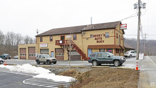
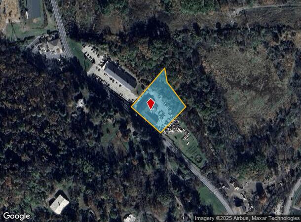
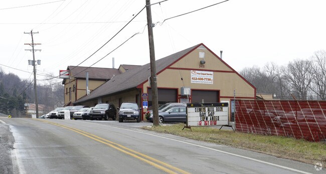
3419 Harts Run Rd, Glenshaw, PA 15116
NEARBY LISTINGS FOR SALE OR LEASE
Property Detail
3419 Harts Run Rd
Pittsburgh, PA
Spittler Plan
0619-J-00322-0000-00
SPITTLER PLAN OF LOTS LOT 1 = 228.28X234.41X187.73X85X326,57
Warehouse
Allegheny
A
Pennsylvania
42003C0216H
322
2024
1.42 AC
2025
Northeast Pittsburgh
415001
Pittsburgh
DEMOGRAPHICS near 3419 Harts Run Rd
1 Mile
3 Mile
5 Mile
2024 Total Population
1,330
23,588
97,954
2029 Population
1,303
22,922
95,105
Pop Growth 2024-2029
(2.03%)
(2.82%)
(2.91%)
Average Age
43
45
44
2024 Total Households
498
9,266
40,948
HH Growth 2024-2029
(2.01%)
(2.86%)
(3.00%)
Median Household Inc
$119,886
$108,065
$95,623
Avg Household Size
2.60
2.50
2.30
2024 Avg HH Vehicles
2.00
2.00
2.00
Median Home Value
$344,000
$301,130
$272,114
Median Year Built
1965
1966
1963
Nearby Places
Map Layers
Map Styles
 Street
 Aerial
- Restaurants
- Banks
- Shops
- Fitness
- Groceries
PUBLIC TRANSPORTATION
AIRPORT
Pittsburgh International
DRIVE
WALK
Distance
Pittsburgh International
46 min
27.2 mi
Arnold Palmer Regional
DRIVE
WALK
Distance
Arnold Palmer Regional
68 min
44.3 mi
Nearby Properties
Address
Land Use
TOTAL SIZE
Lot Size
Zoning
Address
Land Use
TOTAL SIZE
Lot Size
Zoning
115.10 AC
Address
Land Use
TOTAL SIZE
Lot Size
Zoning
4,242 SF
115.01 AC
Address
Land Use
TOTAL SIZE
Lot Size
Zoning
3,711 SF
11.07 AC
Address
Land Use
TOTAL SIZE
Lot Size
Zoning
Address
Land Use
TOTAL SIZE
Lot Size
Zoning
Address
Land Use
TOTAL SIZE
Lot Size
Zoning
4,836 SF
30.63 AC
Address
Land Use
TOTAL SIZE
Lot Size
Zoning
43.18 AC
Address
Land Use
TOTAL SIZE
Lot Size
Zoning
121.54 AC
Address
Land Use
TOTAL SIZE
Lot Size
Zoning
54.90 AC
Address
Land Use
TOTAL SIZE
Lot Size
Zoning
37.84 AC
Address
Land Use
TOTAL SIZE
Lot Size
Zoning
1,422 SF
162.05 AC
Address
Land Use
TOTAL SIZE
Lot Size
Zoning
72.14 AC
Address
Land Use
TOTAL SIZE
Lot Size
Zoning
28.23 AC
Address
Land Use
TOTAL SIZE
Lot Size
Zoning
11.03 AC
Address
Land Use
TOTAL SIZE
Lot Size
Zoning
Address
Land Use
TOTAL SIZE
Lot Size
Zoning
80.97 AC
Address
Land Use
TOTAL SIZE
Lot Size
Zoning
Address
Land Use
TOTAL SIZE
Lot Size
Zoning
Address
Land Use
TOTAL SIZE
Lot Size
Zoning
Address
Land Use
TOTAL SIZE
Lot Size
Zoning
11.97 AC
Address
Land Use
TOTAL SIZE
Lot Size
Zoning
Address
Land Use
TOTAL SIZE
Lot Size
Zoning
18.41 AC
Address
Land Use
TOTAL SIZE
Lot Size
Zoning
Address
Land Use
TOTAL SIZE
Lot Size
Zoning
19.45 AC
Address
Land Use
TOTAL SIZE
Lot Size
Zoning
900 SF
86.45 AC
Address
Land Use
TOTAL SIZE
Lot Size
Zoning
1,972 SF
365.87 AC
Address
Land Use
TOTAL SIZE
Lot Size
Zoning
Address
Land Use
TOTAL SIZE
Lot Size
Zoning
6.22 AC
Address
Land Use
TOTAL SIZE
Lot Size
Zoning
1,568 SF
1.48 AC
Address
Land Use
TOTAL SIZE
Lot Size
Zoning
The World's #1 Commercial Real Estate Marketplace
Connect with us
© 2025 CoStar Group
The information above has been obtained from sources believed reliable. While we do not doubt its accuracy we have not verified it and make no guarantee, warranty or representation about it. It is your responsibility to independently confirm its accuracy and completeness. Any projections, opinions, assumptions, or estimates used are for example only and do not represent the current or future performance of the property. The value of this transaction to you depends on tax and other factors which should be evaluated by your tax, financial, and legal advisors. You and your advisors should conduct a careful, independent investigation of the property to determine to your satisfaction the suitability of the property for your needs.