Property Record
3419 W State Road 46, Bloomington, IN 47404

NEARBY LISTINGS FOR SALE OR LEASE
Property Detail
3419 W State Road 46
53-04-24-101-026.000-011
King And Stangers Baby Farm Subdivision
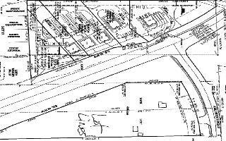
Financialbuilding
KING&STANGER BABY FARMS PT L10 1.39A
X
Monroe
18105C0129D
Indiana
2024
1.39 AC
2024
Bloomington/Terre Haute
001305
Other Market Areas
2,862 SF
Bloomington, IN
DEMOGRAPHICS near 3419 W State Road 46
1 Mile
3 Mile
5 Mile
2024 Total Population
3,627
21,096
72,917
2029 Population
3,635
21,207
73,067
Pop Growth 2024-2029
+ 0.22%
+ 0.53%
+ 0.21%
Average Age
42
39
34
2024 Total Households
1,391
8,743
29,214
HH Growth 2024-2029
+ 0.07%
+ 0.45%
+ 0.28%
Median Household Inc
$88,173
$66,322
$43,050
Avg Household Size
2.50
2.30
2.10
2024 Avg HH Vehicles
2.00
2.00
2.00
Median Home Value
$276,585
$205,012
$206,779
Median Year Built
1995
1989
1986
Nearby Places
Map Layers
Map Styles
 Street
 Aerial
- Restaurants
- Banks
- Shops
- Fitness
- Groceries
Nearby Properties
Address
Land Use
TOTAL SIZE
Lot Size
Zoning
Address
Land Use
TOTAL SIZE
Lot Size
Zoning
318,600 SF
43.80 AC
IL
Address
Land Use
TOTAL SIZE
Lot Size
Zoning
14,964 SF
12.34 AC
Address
Land Use
TOTAL SIZE
Lot Size
Zoning
53,005 SF
10.03 AC
PUD
Address
Land Use
TOTAL SIZE
Lot Size
Zoning
1,509 SF
3 AC
Address
Land Use
TOTAL SIZE
Lot Size
Zoning
269,822 SF
27.95 AC
Address
Land Use
TOTAL SIZE
Lot Size
Zoning
126,046 SF
19.03 AC
IL
Address
Land Use
TOTAL SIZE
Lot Size
Zoning
45,676 SF
4.18 AC
Address
Land Use
TOTAL SIZE
Lot Size
Zoning
7,444 SF
70.20 AC
IG
Address
Land Use
TOTAL SIZE
Lot Size
Zoning
60,184 SF
1.95 AC
Address
Land Use
TOTAL SIZE
Lot Size
Zoning
59,601 SF
2.42 AC
GB
Address
Land Use
TOTAL SIZE
Lot Size
Zoning
25,749 SF
10.77 AC
Address
Land Use
TOTAL SIZE
Lot Size
Zoning
14,600 SF
28.09 AC
AGRR
Address
Land Use
TOTAL SIZE
Lot Size
Zoning
30,013 SF
7.86 AC
Address
Land Use
TOTAL SIZE
Lot Size
Zoning
68,903 SF
1.50 AC
Address
Land Use
TOTAL SIZE
Lot Size
Zoning
134,791 SF
12.81 AC
Address
Land Use
TOTAL SIZE
Lot Size
Zoning
147,420 SF
20.33 AC
IL
Address
Land Use
TOTAL SIZE
Lot Size
Zoning
11,529 SF
18.49 AC
Address
Land Use
TOTAL SIZE
Lot Size
Zoning
26,632 SF
21.62 AC
AGRR
Address
Land Use
TOTAL SIZE
Lot Size
Zoning
9,380 SF
34.28 AC
IG
Address
Land Use
TOTAL SIZE
Lot Size
Zoning
65,533 SF
2.25 AC
Address
Land Use
TOTAL SIZE
Lot Size
Zoning
1,120 SF
30.37 AC
RM15
Address
Land Use
TOTAL SIZE
Lot Size
Zoning
48,698 SF
1.50 AC
Address
Land Use
TOTAL SIZE
Lot Size
Zoning
12,288 SF
3.24 AC
Address
Land Use
TOTAL SIZE
Lot Size
Zoning
46,203 SF
2.60 AC
Address
Land Use
TOTAL SIZE
Lot Size
Zoning
46,050 SF
50.17 AC
LI
Address
Land Use
TOTAL SIZE
Lot Size
Zoning
68,575 SF
9.67 AC
PUD
Address
Land Use
TOTAL SIZE
Lot Size
Zoning
168,000 SF
9.62 AC
IG
Address
Land Use
TOTAL SIZE
Lot Size
Zoning
38,720 SF
10.02 AC
Address
Land Use
TOTAL SIZE
Lot Size
Zoning
5,580 SF
2.98 AC
PUD
Address
Land Use
TOTAL SIZE
Lot Size
Zoning
73,768 SF
8.77 AC
GB
The World's #1 Commercial Real Estate Marketplace
Connect with us
© 2026 CoStar Group
The information above has been obtained from sources believed reliable. While we do not doubt its accuracy we have not verified it and make no guarantee, warranty or representation about it. It is your responsibility to independently confirm its accuracy and completeness. Any projections, opinions, assumptions, or estimates used are for example only and do not represent the current or future performance of the property. The value of this transaction to you depends on tax and other factors which should be evaluated by your tax, financial, and legal advisors. You and your advisors should conduct a careful, independent investigation of the property to determine to your satisfaction the suitability of the property for your needs.