Property Record
3420 Acworth Due West Rd Nw, Kennesaw, GA 30144
NEARBY LISTINGS FOR SALE OR LEASE
Property Detail
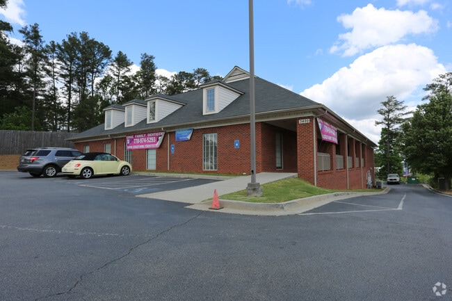
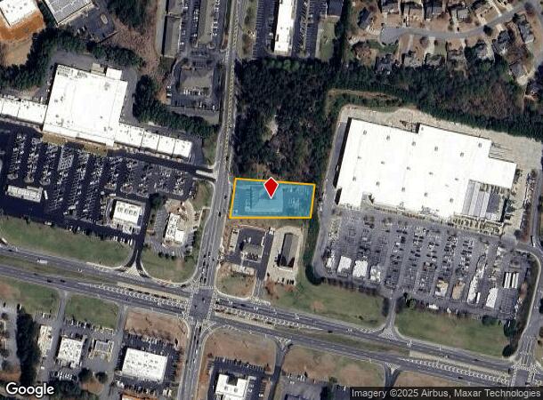
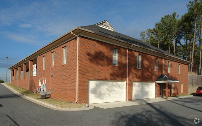
3420 Acworth Due West Rd Nw
Medicalbuilding
Cobb
X
Georgia
13057C0325E
0.81 AC
2025
Kennesaw/Town Center
2025
Atlanta
030110
Atlanta-Sandy Springs-Roswell, GA
12,836 SF
20-0107-0-089-0
DEMOGRAPHICS near 3420 Acworth Due West Rd Nw
1 Mile
3 Mile
5 Mile
2024 Total Population
6,218
53,461
138,767
2029 Population
6,369
54,269
143,427
Pop Growth 2024-2029
+ 2.43%
+ 1.51%
+ 3.36%
Average Age
42
40
39
2024 Total Households
2,302
19,279
48,990
HH Growth 2024-2029
+ 2.52%
+ 1.57%
+ 3.31%
Median Household Inc
$90,441
$96,131
$97,279
Avg Household Size
2.70
2.70
2.80
2024 Avg HH Vehicles
2.00
2.00
2.00
Median Home Value
$287,534
$301,909
$317,145
Median Year Built
1995
1995
1996
Nearby Places
Map Layers
Map Styles
 Street
 Aerial
- Restaurants
- Banks
- Shops
- Fitness
- Groceries
PUBLIC TRANSPORTATION
AIRPORT
Hartsfield - Jackson Atlanta International
DRIVE
WALK
Distance
Hartsfield - Jackson Atlanta International
54 min
38.0 mi
SALE & LEASE HISTORY
LISTING DATE
SALE/LEASE

Sep 25, 2016
For Lease
Nearby Properties
Address
Land Use
TOTAL SIZE
Lot Size
Zoning
Address
Land Use
TOTAL SIZE
Lot Size
Zoning
1,120 SF
42.20 AC
HI
Address
Land Use
TOTAL SIZE
Lot Size
Zoning
174,960 SF
3.99 AC
MU
Address
Land Use
TOTAL SIZE
Lot Size
Zoning
225,382 SF
18.67 AC
RM-8
Address
Land Use
TOTAL SIZE
Lot Size
Zoning
218,433 SF
26.38 AC
C2/R-8
Address
Land Use
TOTAL SIZE
Lot Size
Zoning
200,596 SF
16.04 AC
RM-8
Address
Land Use
TOTAL SIZE
Lot Size
Zoning
147,079 SF
16.90 AC
C2/R-7
Address
Land Use
TOTAL SIZE
Lot Size
Zoning
204,948 SF
15 AC
RM-8
Address
Land Use
TOTAL SIZE
Lot Size
Zoning
156,945 SF
18.03 AC
RM-8
Address
Land Use
TOTAL SIZE
Lot Size
Zoning
120,715 SF
14.60 AC
SLC
Address
Land Use
TOTAL SIZE
Lot Size
Zoning
113,376 SF
0.86 AC
SLC
Address
Land Use
TOTAL SIZE
Lot Size
Zoning
111,673 SF
36.39 AC
Address
Land Use
TOTAL SIZE
Lot Size
Zoning
97,525 SF
10.96 AC
GC
Address
Land Use
TOTAL SIZE
Lot Size
Zoning
2,584 SF
6.20 AC
RSL
Address
Land Use
TOTAL SIZE
Lot Size
Zoning
204,292 SF
26.42 AC
C2
Address
Land Use
TOTAL SIZE
Lot Size
Zoning
192,215 SF
20.60 AC
C2
Address
Land Use
TOTAL SIZE
Lot Size
Zoning
118,665 SF
15.42 AC
C2
Address
Land Use
TOTAL SIZE
Lot Size
Zoning
69,249 SF
2.96 AC
MU
Address
Land Use
TOTAL SIZE
Lot Size
Zoning
172,170 SF
14.67 AC
C2/R-7
Address
Land Use
TOTAL SIZE
Lot Size
Zoning
1,186 SF
3.74 AC
Address
Land Use
TOTAL SIZE
Lot Size
Zoning
2,016 SF
12.29 AC
HI
Address
Land Use
TOTAL SIZE
Lot Size
Zoning
33,504 SF
4.79 AC
SLC
Address
Land Use
TOTAL SIZE
Lot Size
Zoning
124,101 SF
4.78 AC
Address
Land Use
TOTAL SIZE
Lot Size
Zoning
85,172 SF
21.79 AC
C2
Address
Land Use
TOTAL SIZE
Lot Size
Zoning
137,454 SF
19.61 AC
GC/WS
Address
Land Use
TOTAL SIZE
Lot Size
Zoning
132,440 SF
6.88 AC
C2
Address
Land Use
TOTAL SIZE
Lot Size
Zoning
98,812 SF
4 AC
C1
Address
Land Use
TOTAL SIZE
Lot Size
Zoning
109,626 SF
15.58 AC
C2
Address
Land Use
TOTAL SIZE
Lot Size
Zoning
71.64 AC
Address
Land Use
TOTAL SIZE
Lot Size
Zoning
109,347 SF
4.69 AC
C2
Address
Land Use
TOTAL SIZE
Lot Size
Zoning
8.61 AC
C-2
The World's #1 Commercial Real Estate Marketplace
Connect with us
© 2025 CoStar Group
The information above has been obtained from sources believed reliable. While we do not doubt its accuracy we have not verified it and make no guarantee, warranty or representation about it. It is your responsibility to independently confirm its accuracy and completeness. Any projections, opinions, assumptions, or estimates used are for example only and do not represent the current or future performance of the property. The value of this transaction to you depends on tax and other factors which should be evaluated by your tax, financial, and legal advisors. You and your advisors should conduct a careful, independent investigation of the property to determine to your satisfaction the suitability of the property for your needs.