Property Record
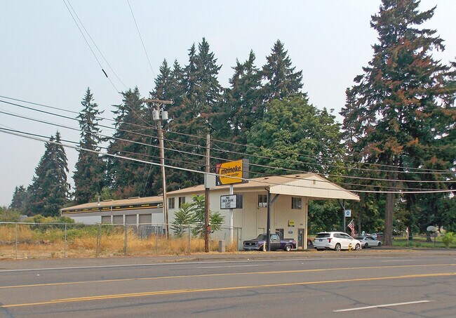
2411 Neals Ln, Vancouver, WA 98661


Property Detail
2411 Neals Ln
030559-000
HIDDEN HD LOTS #4 LOT 17 .51 A FOR ASSESSOR USE ONLY THT PTN LOT 17 HIDDEN HD LOTS BK A PG 68 DAF: BAAP ON W LI OF TT CVYD TO MDC III LLC PER AFN 3288684 SD PT BG S 00DG 28 MIN 50SEC E 459.48 FT & S 87DG 24MIN 06SEC E 205.5 FT OF NW COR OF SD LOT 17
Multifamilydwelling
Clark
R-18
Washington
B and X Area of moderate flood hazard, usually the area between the limits of the 100-year and 500-year floods.
17
2025
0.51 AC
2025
St Johns/Cntrl Vancouver
041700
Portland
4,608 SF
Portland-Vancouver-Hillsboro, OR-WA
NEARBY LISTINGS FOR SALE OR LEASE
DEMOGRAPHICS near 2411 Neals Ln
1 mile
3 mile
5 mile
2025 Total Population
21,967
111,828
247,299
2030 Population
22,656
115,438
254,213
Pop Growth 2025-2030
+ 3.14%
+ 3.23%
+ 2.80%
Average Age
38
40
40
2025 Total Households
9,185
47,666
99,955
HH Growth 2025-2030
+ 3.24%
+ 3.49%
+ 2.97%
Median Household Inc
$61,122
$78,615
$84,274
Avg Household Size
2.30
2.30
2.40
2025 Avg HH Vehicles
2.00
2.00
2.00
Median Home Value
$439,329
$462,472
$475,879
Median Year Built
1973
1979
1983
Nearby Places
Map Layers
Map Styles
 Street
 Aerial
Layers
 Traffic
 Biking
Places
Listings with unknown addresses are not visible on the map
- Restaurants
- Banks
- Shops
- Fitness
- Groceries
PUBLIC TRANSPORTATION
COMMUTER RAIL
Vancouver (Amtrak Cascades - Amtrak, Coast Starlight - Amtrak, Empire Builder - Amtrak)
Drive
Walk
Distance
Vancouver (Amtrak Cascades - Amtrak, Coast Starlight - Amtrak, Empire Builder - Amtrak)
9 min
3.0 mi
AIRPORT
Portland International
Drive
Walk
Distance
Portland International
21 min
12.4 mi
Freight Ports
Port of Vancouver
Drive
Walk
Distance
Port of Vancouver
10 min
3.7 mi
SALE & LEASE HISTORY
LISTING DATE
SALE/LEASE

Sep 16, 2021
For Sale
Oct 08, 2021
For Sale
Nearby Properties
Address
Land Use
TOTAL SIZE
Lot Size
Zoning
Address
Land Use
TOTAL SIZE
Lot Size
Zoning
780,691 SF
17.66 AC
OCI
Address
Land Use
TOTAL SIZE
Lot Size
Zoning
15,473 SF
192.67 AC
IG2
Address
Land Use
TOTAL SIZE
Lot Size
Zoning
590,457 SF
53.12 AC
CPX
Address
Land Use
TOTAL SIZE
Lot Size
Zoning
522,778 SF
193.16 AC
CPX
Address
Land Use
TOTAL SIZE
Lot Size
Zoning
465,188 SF
1.29 AC
CX
Address
Land Use
TOTAL SIZE
Lot Size
Zoning
769,347 SF
8.52 AC
CX
Address
Land Use
TOTAL SIZE
Lot Size
Zoning
319,958 SF
53.08 AC
CPX
Address
Land Use
TOTAL SIZE
Lot Size
Zoning
281,852 SF
13.14 AC
OR-22
Address
Land Use
TOTAL SIZE
Lot Size
Zoning
284,788 SF
13.72 AC
R-30
Address
Land Use
TOTAL SIZE
Lot Size
Zoning
352,865 SF
10.10 AC
R-30
Address
Land Use
TOTAL SIZE
Lot Size
Zoning
699,292 SF
30.16 AC
CG
Address
Land Use
TOTAL SIZE
Lot Size
Zoning
229,962 SF
30.18 AC
R-6
Address
Land Use
TOTAL SIZE
Lot Size
Zoning
463,000 SF
67.68 AC
CPX
Address
Land Use
TOTAL SIZE
Lot Size
Zoning
520,384 SF
9.51 AC
R-30
Address
Land Use
TOTAL SIZE
Lot Size
Zoning
589,596 SF
9.63 AC
R-22
Address
Land Use
TOTAL SIZE
Lot Size
Zoning
278,788 SF
0.92 AC
CX
Address
Land Use
TOTAL SIZE
Lot Size
Zoning
307,468 SF
8.27 AC
CPX
Address
Land Use
TOTAL SIZE
Lot Size
Zoning
294,114 SF
2.03 AC
CX
Address
Land Use
TOTAL SIZE
Lot Size
Zoning
280,541 SF
63.94 AC
IL
Address
Land Use
TOTAL SIZE
Lot Size
Zoning
222,177 SF
4.96 AC
CX
Address
Land Use
TOTAL SIZE
Lot Size
Zoning
203,193 SF
4.90 AC
R-30
Address
Land Use
TOTAL SIZE
Lot Size
Zoning
177,297 SF
11.10 AC
R-18
Address
Land Use
TOTAL SIZE
Lot Size
Zoning
18,135 SF
0.45 AC
CX
Address
Land Use
TOTAL SIZE
Lot Size
Zoning
202,980 SF
8.72 AC
R-18
Address
Land Use
TOTAL SIZE
Lot Size
Zoning
144,267 SF
5.83 AC
R-22
Address
Land Use
TOTAL SIZE
Lot Size
Zoning
134,442 SF
6.35 AC
OCI
Address
Land Use
TOTAL SIZE
Lot Size
Zoning
369,864 SF
74.42 AC
R-9
Address
Land Use
TOTAL SIZE
Lot Size
Zoning
5.19 AC
IH
Address
Land Use
TOTAL SIZE
Lot Size
Zoning
169,980 SF
15.98 AC
R-18
Address
Land Use
TOTAL SIZE
Lot Size
Zoning
253,011 SF
0.98 AC
CX
The World's #1 Commercial Real Estate Marketplace
Connect with us
© 2026 CoStar Group
The information above has been obtained from sources believed reliable. While we do not doubt its accuracy we have not verified it and make no guarantee, warranty or representation about it. It is your responsibility to independently confirm its accuracy and completeness. Any projections, opinions, assumptions, or estimates used are for example only and do not represent the current or future performance of the property. The value of this transaction to you depends on tax and other factors which should be evaluated by your tax, financial, and legal advisors. You and your advisors should conduct a careful, independent investigation of the property to determine to your satisfaction the suitability of the property for your needs.