Property Record
3420 Highway 412, , OK


Property Detail
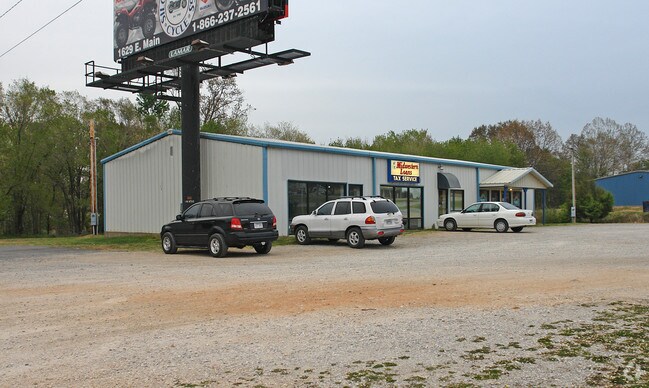
3420 Highway 412
0058994
30-20-26 E 130' OF SW SW SE SW AND A TRACT DESCRIBED AS BEG AT THE NW CORNER OF THE ABOVE TRACT, SE1 DEG 261.87' TO HWY, NW 8
Stripcommercialcenter
DELAWARE
2025
Oklahoma
2025
1.11 AC
9762003111
Oklahoma East Area
3,200 SF
Other Market Areas
NEARBY LISTINGS FOR SALE OR LEASE
DEMOGRAPHICS near 3420 Highway 412
1 mile
3 mile
5 mile
2025 Total Population
1,375
17,248
26,414
2030 Population
1,440
18,928
29,091
Pop Growth 2025-2030
+ 4.73%
+ 9.74%
+ 10.13%
Average Age
37
36
37
2025 Total Households
458
5,934
9,215
HH Growth 2025-2030
+ 4.37%
+ 9.98%
+ 10.34%
Median Household Inc
$55,588
$68,010
$68,739
Avg Household Size
2.50
2.70
2.70
2025 Avg HH Vehicles
2.00
2.00
2.00
Median Home Value
$200,847
$252,110
$252,820
Median Year Built
1984
1992
1994
Nearby Places
Map Layers
Map Styles
 Street
 Aerial
Layers
 Traffic
 Biking
Places
Listings with unknown addresses are not visible on the map
- Restaurants
- Banks
- Shops
- Fitness
- Groceries
PUBLIC TRANSPORTATION
AIRPORT
Northwest Arkansas Ntl
Drive
Walk
Distance
Northwest Arkansas Ntl
34 min
24.6 mi
Nearby Properties
Address
Land Use
TOTAL SIZE
Lot Size
Zoning
Address
Land Use
TOTAL SIZE
Lot Size
Zoning
85,903 SF
10 AC
Address
Land Use
TOTAL SIZE
Lot Size
Zoning
190,712 SF
15.73 AC
Address
Land Use
TOTAL SIZE
Lot Size
Zoning
119,258 SF
16.25 AC
Address
Land Use
TOTAL SIZE
Lot Size
Zoning
53,071 SF
2.07 AC
Address
Land Use
TOTAL SIZE
Lot Size
Zoning
264,685 SF
14.13 AC
Address
Land Use
TOTAL SIZE
Lot Size
Zoning
98,492 SF
6.33 AC
Address
Land Use
TOTAL SIZE
Lot Size
Zoning
20,475 SF
19.62 AC
Address
Land Use
TOTAL SIZE
Lot Size
Zoning
92,300 SF
6.35 AC
Address
Land Use
TOTAL SIZE
Lot Size
Zoning
144,166 SF
12.49 AC
Address
Land Use
TOTAL SIZE
Lot Size
Zoning
36,185 SF
0.78 AC
Address
Land Use
TOTAL SIZE
Lot Size
Zoning
41,748 SF
5.44 AC
Address
Land Use
TOTAL SIZE
Lot Size
Zoning
20,714 SF
0.57 AC
Address
Land Use
TOTAL SIZE
Lot Size
Zoning
40,709 SF
4.24 AC
Address
Land Use
TOTAL SIZE
Lot Size
Zoning
21,908 SF
6.44 AC
Address
Land Use
TOTAL SIZE
Lot Size
Zoning
244,674 SF
18.51 AC
Address
Land Use
TOTAL SIZE
Lot Size
Zoning
64,710 SF
2.32 AC
Address
Land Use
TOTAL SIZE
Lot Size
Zoning
59,140 SF
4.38 AC
Address
Land Use
TOTAL SIZE
Lot Size
Zoning
69,878 SF
3.69 AC
Address
Land Use
TOTAL SIZE
Lot Size
Zoning
20,484 SF
0.93 AC
Address
Land Use
TOTAL SIZE
Lot Size
Zoning
23,918 SF
1.95 AC
Address
Land Use
TOTAL SIZE
Lot Size
Zoning
16,250 SF
4.57 AC
Address
Land Use
TOTAL SIZE
Lot Size
Zoning
36,126 SF
1.97 AC
Address
Land Use
TOTAL SIZE
Lot Size
Zoning
117,300 SF
7.27 AC
Address
Land Use
TOTAL SIZE
Lot Size
Zoning
7,160 SF
2.05 AC
Address
Land Use
TOTAL SIZE
Lot Size
Zoning
88,576 SF
4.45 AC
Address
Land Use
TOTAL SIZE
Lot Size
Zoning
46,882 SF
7.62 AC
Address
Land Use
TOTAL SIZE
Lot Size
Zoning
6,547 SF
2.19 AC
Address
Land Use
TOTAL SIZE
Lot Size
Zoning
19,395 SF
2.21 AC
Address
Land Use
TOTAL SIZE
Lot Size
Zoning
5,650 SF
0.18 AC
Address
Land Use
TOTAL SIZE
Lot Size
Zoning
2,548 SF
4 AC
The World's #1 Commercial Real Estate Marketplace
Connect with us
© 2026 CoStar Group
The information above has been obtained from sources believed reliable. While we do not doubt its accuracy we have not verified it and make no guarantee, warranty or representation about it. It is your responsibility to independently confirm its accuracy and completeness. Any projections, opinions, assumptions, or estimates used are for example only and do not represent the current or future performance of the property. The value of this transaction to you depends on tax and other factors which should be evaluated by your tax, financial, and legal advisors. You and your advisors should conduct a careful, independent investigation of the property to determine to your satisfaction the suitability of the property for your needs.