Property Record
3420 Main St, Stamping Ground, KY 40379


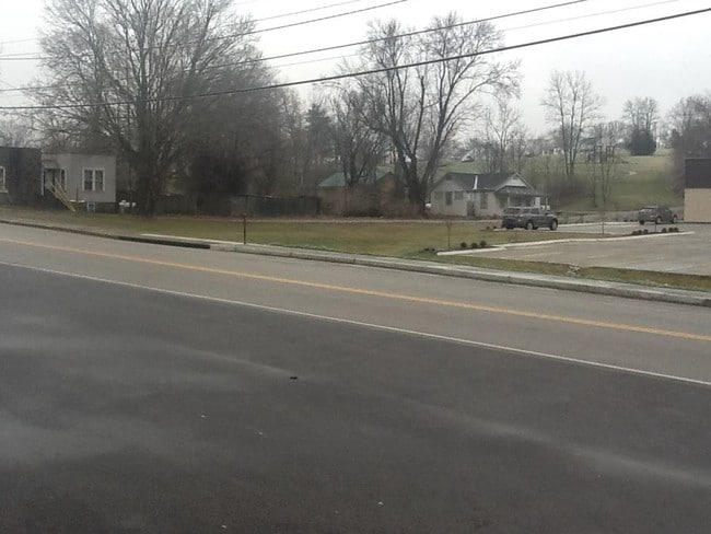
This Property Is For Sale
NEARBY LISTINGS FOR SALE OR LEASE
-
-
View all Stamping Ground listings for sale on LoopNet.com
Property Detail
3420 Main St
Lexington-Fayette, KY
Final Subdivision Plat John J Herlihy
038-00-052.000
COMM RETAIL
Storebuilding
Scott
X
Kentucky
21209C0089C
1-a
2024
1.40 AC
2024
Scott County
040501
Lexington/Fayette
9,100 SF
DEMOGRAPHICS near 3420 Main St
1 Mile
3 Mile
5 Mile
2024 Total Population
1,099
2,468
6,137
2029 Population
1,218
2,732
6,745
Pop Growth 2024-2029
+ 10.83%
+ 10.70%
+ 9.91%
Average Age
39
40
40
2024 Total Households
405
908
2,228
HH Growth 2024-2029
+ 11.11%
+ 11.01%
+ 10.19%
Median Household Inc
$62,445
$68,749
$79,294
Avg Household Size
2.70
2.70
2.70
2024 Avg HH Vehicles
2.00
3.00
3.00
Median Home Value
$204,464
$239,436
$255,545
Median Year Built
1984
1989
1993
Nearby Places
Map Layers
Map Styles
 Street
 Aerial
- Restaurants
- Banks
- Shops
- Fitness
- Groceries
PUBLIC TRANSPORTATION
AIRPORT
Blue Grass
DRIVE
WALK
Distance
Blue Grass
42 min
26.4 mi
Nearby Properties
Address
Land Use
TOTAL SIZE
Lot Size
Zoning
Address
Land Use
TOTAL SIZE
Lot Size
Zoning
55,234 SF
13.90 AC
Address
Land Use
TOTAL SIZE
Lot Size
Zoning
980 SF
457.05 AC
Address
Land Use
TOTAL SIZE
Lot Size
Zoning
12,544 SF
14.85 AC
Address
Land Use
TOTAL SIZE
Lot Size
Zoning
27,580 SF
3.51 AC
Address
Land Use
TOTAL SIZE
Lot Size
Zoning
3,408 SF
2.49 AC
Address
Land Use
TOTAL SIZE
Lot Size
Zoning
13,632 SF
2.32 AC
Address
Land Use
TOTAL SIZE
Lot Size
Zoning
8,161 SF
6.38 AC
Address
Land Use
TOTAL SIZE
Lot Size
Zoning
1,944 SF
0.34 AC
Address
Land Use
TOTAL SIZE
Lot Size
Zoning
2,547 SF
7.65 AC
Address
Land Use
TOTAL SIZE
Lot Size
Zoning
788 SF
86 AC
Address
Land Use
TOTAL SIZE
Lot Size
Zoning
110.50 AC
Address
Land Use
TOTAL SIZE
Lot Size
Zoning
1,280 SF
105.51 AC
Address
Land Use
TOTAL SIZE
Lot Size
Zoning
1,600 SF
7.57 AC
Address
Land Use
TOTAL SIZE
Lot Size
Zoning
2,508 SF
49 AC
Address
Land Use
TOTAL SIZE
Lot Size
Zoning
64.07 AC
Address
Land Use
TOTAL SIZE
Lot Size
Zoning
2,789 SF
7.01 AC
Address
Land Use
TOTAL SIZE
Lot Size
Zoning
1,036 SF
50 AC
Address
Land Use
TOTAL SIZE
Lot Size
Zoning
8,208 SF
1.05 AC
Address
Land Use
TOTAL SIZE
Lot Size
Zoning
8,912 SF
0.72 AC
Address
Land Use
TOTAL SIZE
Lot Size
Zoning
Address
Land Use
TOTAL SIZE
Lot Size
Zoning
2,356 SF
5 AC
Address
Land Use
TOTAL SIZE
Lot Size
Zoning
26.38 AC
Address
Land Use
TOTAL SIZE
Lot Size
Zoning
10,488 SF
1.52 AC
Address
Land Use
TOTAL SIZE
Lot Size
Zoning
Address
Land Use
TOTAL SIZE
Lot Size
Zoning
5,386 SF
0.88 AC
Address
Land Use
TOTAL SIZE
Lot Size
Zoning
2,494 SF
5.23 AC
Address
Land Use
TOTAL SIZE
Lot Size
Zoning
Address
Land Use
TOTAL SIZE
Lot Size
Zoning
Address
Land Use
TOTAL SIZE
Lot Size
Zoning
2,100 SF
0.47 AC
The World's #1 Commercial Real Estate Marketplace
Connect with us
© 2025 CoStar Group
The information above has been obtained from sources believed reliable. While we do not doubt its accuracy we have not verified it and make no guarantee, warranty or representation about it. It is your responsibility to independently confirm its accuracy and completeness. Any projections, opinions, assumptions, or estimates used are for example only and do not represent the current or future performance of the property. The value of this transaction to you depends on tax and other factors which should be evaluated by your tax, financial, and legal advisors. You and your advisors should conduct a careful, independent investigation of the property to determine to your satisfaction the suitability of the property for your needs.