Property Record
3420 N Expressway, Griffin, GA 30223

NEARBY LISTINGS FOR SALE OR LEASE
-
-
View all Griffin listings for sale on LoopNet.com
Property Detail
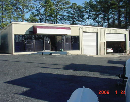
3420 N Expressway
242D-03-001-B
The Marion
Autorepair
2.0 AC PB 25/715
X
Spalding
13255C0060E
Georgia
2024
2 AC
2024
W Henry/Spalding
160102
Atlanta
5,376 SF
Atlanta-Sandy Springs-Roswell, GA
DEMOGRAPHICS near 3420 N Expressway
1 Mile
3 Mile
5 Mile
2024 Total Population
1,125
11,069
37,951
2029 Population
1,187
11,771
40,669
Pop Growth 2024-2029
+ 5.51%
+ 6.34%
+ 7.16%
Average Age
38
41
40
2024 Total Households
404
4,164
13,995
HH Growth 2024-2029
+ 5.45%
+ 6.24%
+ 7.06%
Median Household Inc
$57,158
$60,898
$58,423
Avg Household Size
2.70
2.60
2.70
2024 Avg HH Vehicles
2.00
2.00
2.00
Median Home Value
$133,478
$177,366
$184,154
Median Year Built
1988
1993
1992
Nearby Places
Map Layers
Map Styles
 Street
 Aerial
- Restaurants
- Banks
- Shops
- Fitness
- Groceries
PUBLIC TRANSPORTATION
AIRPORT
Hartsfield - Jackson Atlanta International
DRIVE
WALK
Distance
Hartsfield - Jackson Atlanta International
39 min
25.4 mi
Freight Ports
Georgia Ports - Savannah
DRIVE
WALK
Distance
Georgia Ports - Savannah
255 min
224.0 mi
Nearby Properties
Address
Land Use
TOTAL SIZE
Lot Size
Zoning
Address
Land Use
TOTAL SIZE
Lot Size
Zoning
115,608 SF
20.92 AC
R3
Address
Land Use
TOTAL SIZE
Lot Size
Zoning
72,870 SF
30 AC
Address
Land Use
TOTAL SIZE
Lot Size
Zoning
11,520 SF
8.77 AC
C-1B
Address
Land Use
TOTAL SIZE
Lot Size
Zoning
312 SF
258.57 AC
AAR
Address
Land Use
TOTAL SIZE
Lot Size
Zoning
50,382 SF
3.32 AC
C1
Address
Land Use
TOTAL SIZE
Lot Size
Zoning
20 AC
AR-1
Address
Land Use
TOTAL SIZE
Lot Size
Zoning
22,520 SF
1.01 AC
C1
Address
Land Use
TOTAL SIZE
Lot Size
Zoning
21,542 SF
7.53 AC
C-1B
Address
Land Use
TOTAL SIZE
Lot Size
Zoning
2,160 SF
6.90 AC
C-1B
Address
Land Use
TOTAL SIZE
Lot Size
Zoning
594 SF
4.08 AC
C-1B
Address
Land Use
TOTAL SIZE
Lot Size
Zoning
5,751 SF
16.49 AC
C1
Address
Land Use
TOTAL SIZE
Lot Size
Zoning
22,464 SF
1.55 AC
C1
Address
Land Use
TOTAL SIZE
Lot Size
Zoning
5,518 SF
11.39 AC
C-1
Address
Land Use
TOTAL SIZE
Lot Size
Zoning
25,925 SF
8.25 AC
Address
Land Use
TOTAL SIZE
Lot Size
Zoning
9,020 SF
3.30 AC
C1
Address
Land Use
TOTAL SIZE
Lot Size
Zoning
22,032 SF
1.52 AC
C1
Address
Land Use
TOTAL SIZE
Lot Size
Zoning
10,556 SF
0.99 AC
C1
Address
Land Use
TOTAL SIZE
Lot Size
Zoning
16,800 SF
2.01 AC
C-1B
Address
Land Use
TOTAL SIZE
Lot Size
Zoning
40,536 SF
6 AC
Address
Land Use
TOTAL SIZE
Lot Size
Zoning
10,200 SF
8.35 AC
Address
Land Use
TOTAL SIZE
Lot Size
Zoning
308.50 AC
Address
Land Use
TOTAL SIZE
Lot Size
Zoning
24,000 SF
2.07 AC
C1
Address
Land Use
TOTAL SIZE
Lot Size
Zoning
9,049 SF
0.62 AC
AAR
Address
Land Use
TOTAL SIZE
Lot Size
Zoning
73,390 SF
6.35 AC
M2
Address
Land Use
TOTAL SIZE
Lot Size
Zoning
31.38 AC
R1
Address
Land Use
TOTAL SIZE
Lot Size
Zoning
16,800 SF
2.66 AC
Address
Land Use
TOTAL SIZE
Lot Size
Zoning
3,476 SF
2 AC
C-1-B
Address
Land Use
TOTAL SIZE
Lot Size
Zoning
66 AC
C1/AR1
The World's #1 Commercial Real Estate Marketplace
Connect with us
© 2025 CoStar Group
The information above has been obtained from sources believed reliable. While we do not doubt its accuracy we have not verified it and make no guarantee, warranty or representation about it. It is your responsibility to independently confirm its accuracy and completeness. Any projections, opinions, assumptions, or estimates used are for example only and do not represent the current or future performance of the property. The value of this transaction to you depends on tax and other factors which should be evaluated by your tax, financial, and legal advisors. You and your advisors should conduct a careful, independent investigation of the property to determine to your satisfaction the suitability of the property for your needs.