Property Record
3420 Whitehurst Rd, Greensboro, NC 27410
NEARBY LISTINGS FOR SALE OR LEASE
-
-
View all Greensboro listings for sale on LoopNet.com
Property Detail
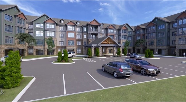
3420 Whitehurst Rd
Greensboro-High Point, NC
Westover
0227142
WESTOVER TERRACE II LLC LO:2C PL:204-50
Hospitalprivate
Guilford
X
North Carolina
3710784600J
2c
2024
6.65 AC
2025
British Woods-Guilford
012510
Greensboro/Winston-Salem
227,063 SF
DEMOGRAPHICS near 3420 Whitehurst Rd
1 Mile
3 Mile
5 Mile
2024 Total Population
6,105
62,167
171,285
2029 Population
6,070
61,637
170,698
Pop Growth 2024-2029
(0.57%)
(0.85%)
(0.34%)
Average Age
45
43
39
2024 Total Households
2,866
27,945
72,113
HH Growth 2024-2029
(0.80%)
(0.87%)
(0.28%)
Median Household Inc
$74,658
$82,539
$64,277
Avg Household Size
2.10
2.20
2.10
2024 Avg HH Vehicles
2.00
2.00
2.00
Median Home Value
$298,616
$274,116
$252,277
Median Year Built
1982
1984
1983
Nearby Places
Map Layers
Map Styles
 Street
 Aerial
- Restaurants
- Banks
- Shops
- Fitness
- Groceries
PUBLIC TRANSPORTATION
COMMUTER RAIL
Greensboro Station (Piedmont - North Carolina by Train (NC Train))
DRIVE
WALK
Distance
Greensboro Station (Piedmont - North Carolina by Train (NC Train))
12 min
6.2 mi
AIRPORT
Piedmont Triad International
DRIVE
WALK
Distance
Piedmont Triad International
18 min
8.4 mi
Freight Ports
Virginia Port Authority - Richmond
DRIVE
WALK
Distance
Virginia Port Authority - Richmond
238 min
203.0 mi
Nearby Properties
Address
Land Use
TOTAL SIZE
Lot Size
Zoning
Address
Land Use
TOTAL SIZE
Lot Size
Zoning
593,135 SF
26.07 AC
PI
Address
Land Use
TOTAL SIZE
Lot Size
Zoning
549,907 SF
43.02 AC
C-H
Address
Land Use
TOTAL SIZE
Lot Size
Zoning
440,925 SF
72.55 AC
O
Address
Land Use
TOTAL SIZE
Lot Size
Zoning
472,566 SF
46.77 AC
RM-12
Address
Land Use
TOTAL SIZE
Lot Size
Zoning
106,706 SF
343.57 AC
PI
Address
Land Use
TOTAL SIZE
Lot Size
Zoning
309,598 SF
28.10 AC
RM-18
Address
Land Use
TOTAL SIZE
Lot Size
Zoning
317,844 SF
17.10 AC
PUD
Address
Land Use
TOTAL SIZE
Lot Size
Zoning
400,821 SF
30.06 AC
PUD
Address
Land Use
TOTAL SIZE
Lot Size
Zoning
321,985 SF
4.80 AC
C-H
Address
Land Use
TOTAL SIZE
Lot Size
Zoning
358,324 SF
4.02 AC
PUD
Address
Land Use
TOTAL SIZE
Lot Size
Zoning
82,067 SF
9.41 AC
CU-SC
Address
Land Use
TOTAL SIZE
Lot Size
Zoning
223,891 SF
10.53 AC
PUD
Address
Land Use
TOTAL SIZE
Lot Size
Zoning
281,337 SF
20.64 AC
PUD
Address
Land Use
TOTAL SIZE
Lot Size
Zoning
316,205 SF
17.84 AC
CU-RM-18
Address
Land Use
TOTAL SIZE
Lot Size
Zoning
466,399 SF
22.07 AC
RM-18
Address
Land Use
TOTAL SIZE
Lot Size
Zoning
222,661 SF
51.39 AC
R-3
Address
Land Use
TOTAL SIZE
Lot Size
Zoning
249,702 SF
15.39 AC
PUD
Address
Land Use
TOTAL SIZE
Lot Size
Zoning
214,228 SF
21.46 AC
C-H
Address
Land Use
TOTAL SIZE
Lot Size
Zoning
263,148 SF
32.18 AC
RM-8
Address
Land Use
TOTAL SIZE
Lot Size
Zoning
204,438 SF
12.06 AC
RM-18
Address
Land Use
TOTAL SIZE
Lot Size
Zoning
157,596 SF
23.71 AC
C-M
Address
Land Use
TOTAL SIZE
Lot Size
Zoning
69,744 SF
100.01 AC
CD-O
Address
Land Use
TOTAL SIZE
Lot Size
Zoning
287,394 SF
7.47 AC
PUD
Address
Land Use
TOTAL SIZE
Lot Size
Zoning
171,358 SF
11.91 AC
PUD
Address
Land Use
TOTAL SIZE
Lot Size
Zoning
223,272 SF
9.91 AC
RM-26
Address
Land Use
TOTAL SIZE
Lot Size
Zoning
302,048 SF
24.45 AC
RM-12
Address
Land Use
TOTAL SIZE
Lot Size
Zoning
61,400 SF
4.11 AC
O
Address
Land Use
TOTAL SIZE
Lot Size
Zoning
138,773 SF
13.90 AC
C-H
Address
Land Use
TOTAL SIZE
Lot Size
Zoning
206,820 SF
14.59 AC
C-H
The World's #1 Commercial Real Estate Marketplace
Connect with us
© 2025 CoStar Group
The information above has been obtained from sources believed reliable. While we do not doubt its accuracy we have not verified it and make no guarantee, warranty or representation about it. It is your responsibility to independently confirm its accuracy and completeness. Any projections, opinions, assumptions, or estimates used are for example only and do not represent the current or future performance of the property. The value of this transaction to you depends on tax and other factors which should be evaluated by your tax, financial, and legal advisors. You and your advisors should conduct a careful, independent investigation of the property to determine to your satisfaction the suitability of the property for your needs.