Property Record
34205 Asternal Pl, Myakka City, FL 34251

NEARBY LISTINGS FOR SALE OR LEASE
-
-
View all Myakka City listings for sale on LoopNet.com
Property Detail
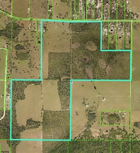
34205 Asternal Pl
2121-0000-2
Acreage
Vacantlandnec
THAT PART OF SEC 27, LYING N OF THE MYAKKA RIVER, LESS THE E 2745 FT THEREOF; AND ALSO LESS THE FOLLOWING DESC PROPERTY: COM AT THE NE COR OF SEC 27, TH W ALG THE N LN OF SD SEC 27
A
Manatee
12081C0455E
Florida
2023
359.78 AC
2025
Manatee Outlying
002010
Tampa/St Petersburg
1,832 SF
North Port-Sarasota-Bradenton, FL
DEMOGRAPHICS near 34205 Asternal Pl
1 Mile
3 Mile
5 Mile
2024 Total Population
33
894
2,705
2029 Population
38
1,024
3,079
Pop Growth 2024-2029
+ 15.15%
+ 14.54%
+ 13.83%
Average Age
41
41
41
2024 Total Households
11
306
938
HH Growth 2024-2029
+ 18.18%
+ 13.40%
+ 12.90%
Median Household Inc
$99,999
$92,272
$96,163
Avg Household Size
2.90
2.80
2.70
2024 Avg HH Vehicles
3.00
3.00
3.00
Median Home Value
$450,000
$427,659
$448,000
Median Year Built
1995
1996
1994
Nearby Places
Map Layers
Map Styles
 Street
 Aerial
- Restaurants
- Banks
- Shops
- Fitness
- Groceries
PUBLIC TRANSPORTATION
AIRPORT
Sarasota/Bradenton International
DRIVE
WALK
Distance
Sarasota/Bradenton International
52 min
33.4 mi
Freight Ports
Port Manatee
DRIVE
WALK
Distance
Port Manatee
57 min
39.3 mi
SALE & LEASE HISTORY
LISTING DATE
SALE/LEASE

Jan 20, 2021
For Sale
Nearby Properties
Address
Land Use
TOTAL SIZE
Lot Size
Zoning
Address
Land Use
TOTAL SIZE
Lot Size
Zoning
191 AC
A GENERAL
Address
Land Use
TOTAL SIZE
Lot Size
Zoning
440.80 AC
A GENERAL
Address
Land Use
TOTAL SIZE
Lot Size
Zoning
72,127 SF
10.60 AC
VIL VILLAG
Address
Land Use
TOTAL SIZE
Lot Size
Zoning
326,820 SF
242.72 AC
A GENERAL
Address
Land Use
TOTAL SIZE
Lot Size
Zoning
4,756 SF
36.32 AC
A GENERAL
Address
Land Use
TOTAL SIZE
Lot Size
Zoning
9,100 SF
1.20 AC
PD-C
Address
Land Use
TOTAL SIZE
Lot Size
Zoning
12,000 SF
2,213.80 AC
A GENERAL
Address
Land Use
TOTAL SIZE
Lot Size
Zoning
8,062 SF
4.11 AC
A-1 SUBURB
Address
Land Use
TOTAL SIZE
Lot Size
Zoning
130 AC
A GENERAL
Address
Land Use
TOTAL SIZE
Lot Size
Zoning
6,900 SF
30.40 AC
A GENERAL
Address
Land Use
TOTAL SIZE
Lot Size
Zoning
8,397 SF
17.81 AC
PD-R
Address
Land Use
TOTAL SIZE
Lot Size
Zoning
2,377 SF
39.80 AC
A GENERAL
Address
Land Use
TOTAL SIZE
Lot Size
Zoning
297 SF
1,508.20 AC
A GENERAL
Address
Land Use
TOTAL SIZE
Lot Size
Zoning
14,524 SF
46.16 AC
A GENERAL
Address
Land Use
TOTAL SIZE
Lot Size
Zoning
4,963 SF
5.31 AC
A GENERAL
Address
Land Use
TOTAL SIZE
Lot Size
Zoning
3,830 SF
26.58 AC
A-1 SUBURB
Address
Land Use
TOTAL SIZE
Lot Size
Zoning
46.09 AC
A GENERAL
Address
Land Use
TOTAL SIZE
Lot Size
Zoning
6,554 SF
5 AC
A GENERAL
Address
Land Use
TOTAL SIZE
Lot Size
Zoning
8,000 SF
38.12 AC
A GENERAL
Address
Land Use
TOTAL SIZE
Lot Size
Zoning
40.59 AC
A GENERAL
Address
Land Use
TOTAL SIZE
Lot Size
Zoning
1,372 SF
25.20 AC
A GENERAL
Address
Land Use
TOTAL SIZE
Lot Size
Zoning
4,389 SF
5.01 AC
A GENERAL
Address
Land Use
TOTAL SIZE
Lot Size
Zoning
3,756 SF
5.59 AC
A-1 SUBURB
Address
Land Use
TOTAL SIZE
Lot Size
Zoning
7,092 SF
78 AC
A GENERAL
Address
Land Use
TOTAL SIZE
Lot Size
Zoning
4,392 SF
100.35 AC
A GENERAL
Address
Land Use
TOTAL SIZE
Lot Size
Zoning
4,856 SF
30.03 AC
A GENERAL
Address
Land Use
TOTAL SIZE
Lot Size
Zoning
22.83 AC
A GENERAL
Address
Land Use
TOTAL SIZE
Lot Size
Zoning
3,807 SF
131.02 AC
A GENERAL
Address
Land Use
TOTAL SIZE
Lot Size
Zoning
214.60 AC
A GENERAL
The World's #1 Commercial Real Estate Marketplace
Connect with us
© 2026 CoStar Group
The information above has been obtained from sources believed reliable. While we do not doubt its accuracy we have not verified it and make no guarantee, warranty or representation about it. It is your responsibility to independently confirm its accuracy and completeness. Any projections, opinions, assumptions, or estimates used are for example only and do not represent the current or future performance of the property. The value of this transaction to you depends on tax and other factors which should be evaluated by your tax, financial, and legal advisors. You and your advisors should conduct a careful, independent investigation of the property to determine to your satisfaction the suitability of the property for your needs.