Property Record
3421 Old Vineyard Rd, Winston Salem, NC 27103
NEARBY LISTINGS FOR SALE OR LEASE
-
-
View all Winston Salem listings for sale on LoopNet.com
Property Detail
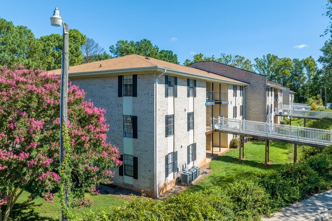
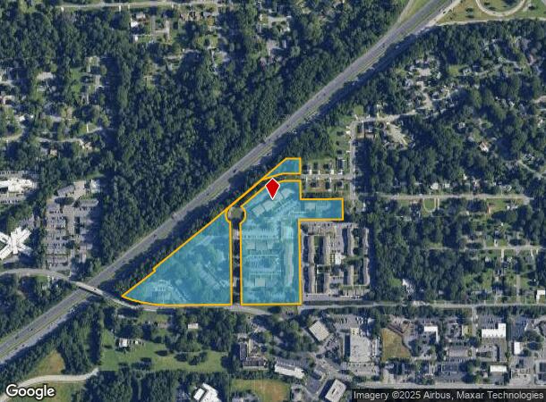
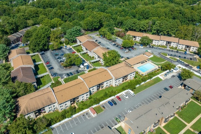
3421 Old Vineyard Rd
Winston-Salem, NC
The Arlington Apartments
6814-19-8913
THE ARLINGTON APARTMENTS LO:012A BL:3827 BU:1
Apartment
Forsyth
X
North Carolina
3710681400J
12a
2023
15.87 AC
2025
Old Vineyard
003805
Greensboro/Winston-Salem
98,061 SF
DEMOGRAPHICS near 3421 Old Vineyard Rd
1 Mile
3 Mile
5 Mile
2024 Total Population
6,571
65,544
159,385
2029 Population
6,834
67,978
165,972
Pop Growth 2024-2029
+ 4.00%
+ 3.71%
+ 4.13%
Average Age
39
41
39
2024 Total Households
3,214
30,294
67,841
HH Growth 2024-2029
+ 4.04%
+ 3.77%
+ 4.28%
Median Household Inc
$38,892
$66,583
$61,118
Avg Household Size
2.00
2.10
2.20
2024 Avg HH Vehicles
1.00
2.00
2.00
Median Home Value
$160,232
$251,727
$234,937
Median Year Built
1974
1977
1980
Nearby Places
Map Layers
Map Styles
 Street
 Aerial
- Restaurants
- Banks
- Shops
- Fitness
- Groceries
PUBLIC TRANSPORTATION
AIRPORT
Piedmont Triad International
DRIVE
WALK
Distance
Piedmont Triad International
39 min
26.1 mi
Freight Ports
Virginia Port Authority - Richmond
DRIVE
WALK
Distance
Virginia Port Authority - Richmond
266 min
229.8 mi
Nearby Properties
Address
Land Use
TOTAL SIZE
Lot Size
Zoning
Address
Land Use
TOTAL SIZE
Lot Size
Zoning
133,360 SF
60.44 AC
C,RMU-S
Address
Land Use
TOTAL SIZE
Lot Size
Zoning
822,684 SF
33.33 AC
GB
Address
Land Use
TOTAL SIZE
Lot Size
Zoning
100 SF
2.59 AC
C
Address
Land Use
TOTAL SIZE
Lot Size
Zoning
123,109 SF
65.07 AC
C,HB,LO-S
Address
Land Use
TOTAL SIZE
Lot Size
Zoning
127,530 SF
2.52 AC
C
Address
Land Use
TOTAL SIZE
Lot Size
Zoning
100 SF
1.53 AC
C
Address
Land Use
TOTAL SIZE
Lot Size
Zoning
316,648 SF
30.46 AC
GB
Address
Land Use
TOTAL SIZE
Lot Size
Zoning
100 SF
2.71 AC
C
Address
Land Use
TOTAL SIZE
Lot Size
Zoning
125,328 SF
19.14 AC
RM18-S
Address
Land Use
TOTAL SIZE
Lot Size
Zoning
117,188 SF
12.22 AC
RM18
Address
Land Use
TOTAL SIZE
Lot Size
Zoning
205,778 SF
4.75 AC
GB
Address
Land Use
TOTAL SIZE
Lot Size
Zoning
138,636 SF
6.34 AC
RMU-S
Address
Land Use
TOTAL SIZE
Lot Size
Zoning
181,748 SF
7.58 AC
GO,GO-S
Address
Land Use
TOTAL SIZE
Lot Size
Zoning
120,259 SF
13.68 AC
MU-S
Address
Land Use
TOTAL SIZE
Lot Size
Zoning
30,360 SF
17.09 AC
CPO-S
Address
Land Use
TOTAL SIZE
Lot Size
Zoning
297,487 SF
40.24 AC
RM12,RM18
Address
Land Use
TOTAL SIZE
Lot Size
Zoning
143,081 SF
4.88 AC
GB-S
Address
Land Use
TOTAL SIZE
Lot Size
Zoning
166,757 SF
5.89 AC
HB
Address
Land Use
TOTAL SIZE
Lot Size
Zoning
125,015 SF
33.69 AC
LO-S,RM8-S
Address
Land Use
TOTAL SIZE
Lot Size
Zoning
275,051 SF
32.47 AC
PB-S,RM18
Address
Land Use
TOTAL SIZE
Lot Size
Zoning
153,436 SF
17.46 AC
GB-S
Address
Land Use
TOTAL SIZE
Lot Size
Zoning
68,656 SF
6.25 AC
MU-S
Address
Land Use
TOTAL SIZE
Lot Size
Zoning
257,080 SF
23.47 AC
HB-S
Address
Land Use
TOTAL SIZE
Lot Size
Zoning
160,690 SF
17.81 AC
GB-S
Address
Land Use
TOTAL SIZE
Lot Size
Zoning
139,775 SF
11.57 AC
HB,RS9
Address
Land Use
TOTAL SIZE
Lot Size
Zoning
129,977 SF
7.51 AC
RM12-S
Address
Land Use
TOTAL SIZE
Lot Size
Zoning
75,095 SF
4.84 AC
HB,LO
Address
Land Use
TOTAL SIZE
Lot Size
Zoning
147,000 SF
5.77 AC
GB-S,LB
Address
Land Use
TOTAL SIZE
Lot Size
Zoning
88,466 SF
9.94 AC
GO-S
Address
Land Use
TOTAL SIZE
Lot Size
Zoning
81,858 SF
5.50 AC
C
The World's #1 Commercial Real Estate Marketplace
Connect with us
© 2026 CoStar Group
The information above has been obtained from sources believed reliable. While we do not doubt its accuracy we have not verified it and make no guarantee, warranty or representation about it. It is your responsibility to independently confirm its accuracy and completeness. Any projections, opinions, assumptions, or estimates used are for example only and do not represent the current or future performance of the property. The value of this transaction to you depends on tax and other factors which should be evaluated by your tax, financial, and legal advisors. You and your advisors should conduct a careful, independent investigation of the property to determine to your satisfaction the suitability of the property for your needs.