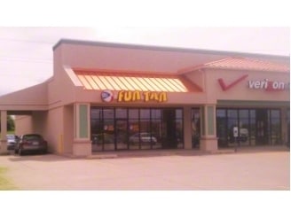
Property Record
3422-3432 Freedom Dr, Springfield, IL 62704


NEARBY LISTINGS FOR SALE OR LEASE
Property Detail
3422-3432 Freedom Dr
Springfield, IL
Parkway Pointe Second Plat
21-13.0-227-008
LOT 78 PARKWAY POINTE 2ND PLAT 29507.78 SQ FT
Commercialnec
Sangamon
X
Illinois
17167C0239F
78
2024
0.68 AC
2024
Springfield/Decatur
002100
Other Market Areas
DEMOGRAPHICS near 3422-3432 Freedom Dr
1 Mile
3 Mile
5 Mile
2024 Total Population
3,629
36,047
101,454
2029 Population
3,545
35,548
100,821
Pop Growth 2024-2029
(2.31%)
(1.38%)
(0.62%)
Average Age
44
44
41
2024 Total Households
1,646
16,488
45,839
HH Growth 2024-2029
(2.43%)
(1.49%)
(0.70%)
Median Household Inc
$72,254
$81,077
$66,375
Avg Household Size
2.20
2.10
2.10
2024 Avg HH Vehicles
2.00
2.00
2.00
Median Home Value
$163,309
$195,568
$164,174
Median Year Built
1975
1978
1971
Nearby Places
Map Layers
Map Styles
 Street
 Aerial
- Restaurants
- Banks
- Shops
- Fitness
- Groceries
PUBLIC TRANSPORTATION
COMMUTER RAIL
DRIVE
WALK
Distance
14 min
6.2 mi
AIRPORT
Abraham Lincoln Capital
DRIVE
WALK
Distance
Abraham Lincoln Capital
14 min
8.2 mi
SALE & LEASE HISTORY
LISTING DATE
SALE/LEASE

Sep 19, 2022
For Sale
May 14, 2021
For Sale
May 08, 2020
For Lease
Nearby Properties
Address
Land Use
TOTAL SIZE
Lot Size
Zoning
Address
Land Use
TOTAL SIZE
Lot Size
Zoning
24.91 AC
Address
Land Use
TOTAL SIZE
Lot Size
Zoning
14.67 AC
Address
Land Use
TOTAL SIZE
Lot Size
Zoning
19.94 AC
Address
Land Use
TOTAL SIZE
Lot Size
Zoning
21.61 AC
Address
Land Use
TOTAL SIZE
Lot Size
Zoning
13.91 AC
Address
Land Use
TOTAL SIZE
Lot Size
Zoning
17.31 AC
Address
Land Use
TOTAL SIZE
Lot Size
Zoning
21.53 AC
Address
Land Use
TOTAL SIZE
Lot Size
Zoning
Address
Land Use
TOTAL SIZE
Lot Size
Zoning
Address
Land Use
TOTAL SIZE
Lot Size
Zoning
Address
Land Use
TOTAL SIZE
Lot Size
Zoning
Address
Land Use
TOTAL SIZE
Lot Size
Zoning
Address
Land Use
TOTAL SIZE
Lot Size
Zoning
7.51 AC
Address
Land Use
TOTAL SIZE
Lot Size
Zoning
11.02 AC
Address
Land Use
TOTAL SIZE
Lot Size
Zoning
15.99 AC
Address
Land Use
TOTAL SIZE
Lot Size
Zoning
Address
Land Use
TOTAL SIZE
Lot Size
Zoning
10.08 AC
Address
Land Use
TOTAL SIZE
Lot Size
Zoning
0.88 AC
Address
Land Use
TOTAL SIZE
Lot Size
Zoning
10.52 AC
Address
Land Use
TOTAL SIZE
Lot Size
Zoning
12.74 AC
Address
Land Use
TOTAL SIZE
Lot Size
Zoning
13.99 AC
Address
Land Use
TOTAL SIZE
Lot Size
Zoning
10.13 AC
Address
Land Use
TOTAL SIZE
Lot Size
Zoning
Address
Land Use
TOTAL SIZE
Lot Size
Zoning
6.44 AC
Address
Land Use
TOTAL SIZE
Lot Size
Zoning
Address
Land Use
TOTAL SIZE
Lot Size
Zoning
Address
Land Use
TOTAL SIZE
Lot Size
Zoning
7.80 AC
Address
Land Use
TOTAL SIZE
Lot Size
Zoning
Address
Land Use
TOTAL SIZE
Lot Size
Zoning
Address
Land Use
TOTAL SIZE
Lot Size
Zoning
9.17 AC
The World's #1 Commercial Real Estate Marketplace
Connect with us
© 2025 CoStar Group
The information above has been obtained from sources believed reliable. While we do not doubt its accuracy we have not verified it and make no guarantee, warranty or representation about it. It is your responsibility to independently confirm its accuracy and completeness. Any projections, opinions, assumptions, or estimates used are for example only and do not represent the current or future performance of the property. The value of this transaction to you depends on tax and other factors which should be evaluated by your tax, financial, and legal advisors. You and your advisors should conduct a careful, independent investigation of the property to determine to your satisfaction the suitability of the property for your needs.