Property Record
3422 State Route 13, Pulaski, NY 13142
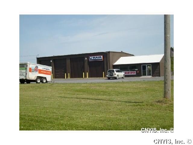


Property Detail
3422 State Route 13
355089-071-000-0002-014-001-0000
OSWEGO
Gasolinefuelbulkstorage
New York
02 - SINGL
14.010
B and X Area of moderate flood hazard, usually the area between the limits of the 100-year and 500-year floods.
4.04 AC
2025
Oswego County
2025
Syracuse
020304
Syracuse, NY
4,464 SF
NEARBY LISTINGS FOR SALE OR LEASE
-
-
View all Pulaski listings for sale on LoopNet.com
DEMOGRAPHICS near 3422 State Route 13
1 mile
3 mile
5 mile
2025 Total Population
213
3,887
6,392
2030 Population
214
3,883
6,417
Pop Growth 2025-2030
+ 0.47%
(0.10%)
+ 0.39%
Average Age
41
42
42
2025 Total Households
79
1,628
2,578
HH Growth 2025-2030
+ 1.27%
(0.12%)
+ 0.35%
Median Household Inc
$83,928
$70,657
$73,345
Avg Household Size
2.60
2.40
2.40
2025 Avg HH Vehicles
2.00
2.00
2.00
Median Home Value
$148,484
$160,199
$163,170
Median Year Built
1973
1971
1973
Nearby Places
Map Layers
Map Styles
 Street
 Aerial
Layers
 Traffic
 Biking
Places
Listings with unknown addresses are not visible on the map
- Restaurants
- Banks
- Shops
- Fitness
- Groceries
PUBLIC TRANSPORTATION
AIRPORT
Syracuse Hancock International
Drive
Walk
Distance
Syracuse Hancock International
43 min
34.7 mi
Freight Ports
Albany, NY Port
Drive
Walk
Distance
Albany, NY Port
194 min
149.8 mi
Nearby Properties
Address
Land Use
TOTAL SIZE
Lot Size
Zoning
Address
Land Use
TOTAL SIZE
Lot Size
Zoning
5,600 SF
21.48 AC
Address
Land Use
TOTAL SIZE
Lot Size
Zoning
166,960 SF
152.14 AC
06 - INDUS
Address
Land Use
TOTAL SIZE
Lot Size
Zoning
27,944 SF
34.51 AC
01 - NOT Z
Address
Land Use
TOTAL SIZE
Lot Size
Zoning
91,883 SF
16.10 AC
02 - SINGL
Address
Land Use
TOTAL SIZE
Lot Size
Zoning
86,840 SF
4.84 AC
02 - SINGL
Address
Land Use
TOTAL SIZE
Lot Size
Zoning
73,362 SF
22.66 AC
03 - MULTI
Address
Land Use
TOTAL SIZE
Lot Size
Zoning
54,602 SF
7.29 AC
Address
Land Use
TOTAL SIZE
Lot Size
Zoning
21,994 SF
8 AC
02 - SINGL
Address
Land Use
TOTAL SIZE
Lot Size
Zoning
30.67 AC
Address
Land Use
TOTAL SIZE
Lot Size
Zoning
Address
Land Use
TOTAL SIZE
Lot Size
Zoning
1,440 SF
28.01 AC
06 - INDUS
Address
Land Use
TOTAL SIZE
Lot Size
Zoning
67.48 AC
Address
Land Use
TOTAL SIZE
Lot Size
Zoning
49.53 AC
02 - SINGL
Address
Land Use
TOTAL SIZE
Lot Size
Zoning
14,914 SF
1.88 AC
Address
Land Use
TOTAL SIZE
Lot Size
Zoning
23,483 SF
0.71 AC
05 - COMME
Address
Land Use
TOTAL SIZE
Lot Size
Zoning
17,330 SF
2.64 AC
Address
Land Use
TOTAL SIZE
Lot Size
Zoning
28,896 SF
45.86 AC
02 - SINGL
Address
Land Use
TOTAL SIZE
Lot Size
Zoning
11,282 SF
0.47 AC
05 - COMME
Address
Land Use
TOTAL SIZE
Lot Size
Zoning
13,262 SF
0.56 AC
05 - COMME
Address
Land Use
TOTAL SIZE
Lot Size
Zoning
18,868 SF
17.42 AC
02 - SINGL
Address
Land Use
TOTAL SIZE
Lot Size
Zoning
13,772 SF
2.59 AC
02 - SINGL
Address
Land Use
TOTAL SIZE
Lot Size
Zoning
4,488 SF
3.91 AC
01 - NOT Z
Address
Land Use
TOTAL SIZE
Lot Size
Zoning
14,700 SF
2.81 AC
01 - NOT Z
Address
Land Use
TOTAL SIZE
Lot Size
Zoning
11,550 SF
1.59 AC
05
Address
Land Use
TOTAL SIZE
Lot Size
Zoning
4.41 AC
02 - SINGL
Address
Land Use
TOTAL SIZE
Lot Size
Zoning
11,275 SF
7.21 AC
02 - SINGL
Address
Land Use
TOTAL SIZE
Lot Size
Zoning
14,396 SF
1.26 AC
05 - COMME
Address
Land Use
TOTAL SIZE
Lot Size
Zoning
28,700 SF
2.59 AC
05 - COMME
Address
Land Use
TOTAL SIZE
Lot Size
Zoning
10,080 SF
0.72 AC
01 - NOT Z
Address
Land Use
TOTAL SIZE
Lot Size
Zoning
4,368 SF
4.96 AC
The World's #1 Commercial Real Estate Marketplace
Connect with us
© 2026 CoStar Group
The information above has been obtained from sources believed reliable. While we do not doubt its accuracy we have not verified it and make no guarantee, warranty or representation about it. It is your responsibility to independently confirm its accuracy and completeness. Any projections, opinions, assumptions, or estimates used are for example only and do not represent the current or future performance of the property. The value of this transaction to you depends on tax and other factors which should be evaluated by your tax, financial, and legal advisors. You and your advisors should conduct a careful, independent investigation of the property to determine to your satisfaction the suitability of the property for your needs.