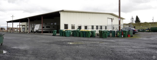
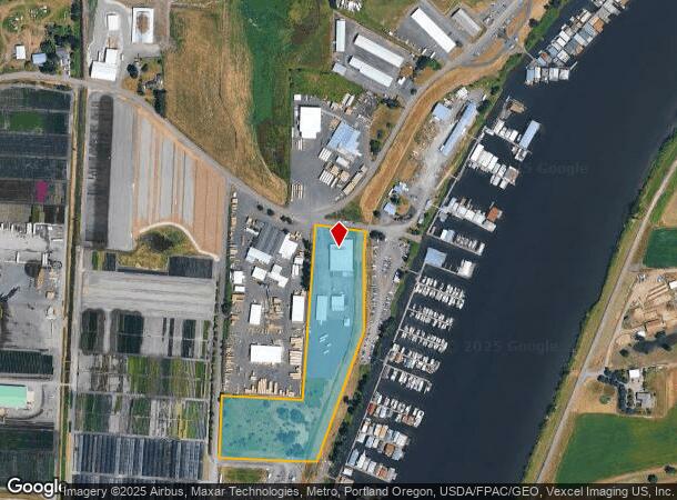
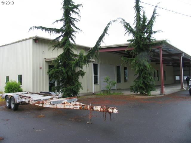
Property Record
34240 Johnsons Landing Rd, Scappoose, OR 97056
NEARBY LISTINGS FOR SALE OR LEASE
Property Detail
34240 Johnsons Landing Rd
Commercialnec
Columbia
AE
Oregon
53011C0330D
8.53 AC
2025
Columbia County
2025
Portland
970900
Portland-Vancouver-Hillsboro, OR-WA
17,670 SF
0108031190000100100
DEMOGRAPHICS near 34240 Johnsons Landing Rd
1 Mile
3 Mile
5 Mile
2024 Total Population
945
10,709
12,741
2029 Population
997
11,197
13,279
Pop Growth 2024-2029
+ 5.50%
+ 4.56%
+ 4.22%
Average Age
49
42
43
2024 Total Households
450
4,298
5,102
HH Growth 2024-2029
+ 5.78%
+ 4.58%
+ 4.17%
Median Household Inc
$100,098
$96,982
$96,965
Avg Household Size
2.10
2.40
2.50
2024 Avg HH Vehicles
2.00
2.00
2.00
Median Home Value
$369,629
$394,555
$408,435
Median Year Built
1993
1985
1984
Nearby Places
Map Layers
Map Styles
 Street
 Aerial
- Restaurants
- Banks
- Shops
- Fitness
- Groceries
PUBLIC TRANSPORTATION
AIRPORT
Portland International
DRIVE
WALK
Distance
Portland International
49 min
25.3 mi
Freight Ports
Port of Vancouver
DRIVE
WALK
Distance
Port of Vancouver
44 min
23.0 mi
SALE & LEASE HISTORY
LISTING DATE
SALE/LEASE

May 02, 2017
For Lease
Nearby Properties
Address
Land Use
TOTAL SIZE
Lot Size
Zoning
Address
Land Use
TOTAL SIZE
Lot Size
Zoning
49.56 AC
SC:PUA
Address
Land Use
TOTAL SIZE
Lot Size
Zoning
155,350 SF
10.86 AC
SC:EC
Address
Land Use
TOTAL SIZE
Lot Size
Zoning
17.25 AC
SC:PUA
Address
Land Use
TOTAL SIZE
Lot Size
Zoning
45,294 SF
1.92 AC
SC:EC
Address
Land Use
TOTAL SIZE
Lot Size
Zoning
49,852 SF
5.58 AC
SC:A-1
Address
Land Use
TOTAL SIZE
Lot Size
Zoning
2,336 SF
28.60 AC
SC:PUA
Address
Land Use
TOTAL SIZE
Lot Size
Zoning
874 SF
3.94 AC
SC:MH
Address
Land Use
TOTAL SIZE
Lot Size
Zoning
31,350 SF
2.89 AC
SC:EC
Address
Land Use
TOTAL SIZE
Lot Size
Zoning
19.20 AC
SC:C
Address
Land Use
TOTAL SIZE
Lot Size
Zoning
2,435 SF
3.32 AC
SC:EC
Address
Land Use
TOTAL SIZE
Lot Size
Zoning
28,986 SF
3.03 AC
SC:EC
Address
Land Use
TOTAL SIZE
Lot Size
Zoning
36,760 SF
4.12 AC
CO:RIPD
Address
Land Use
TOTAL SIZE
Lot Size
Zoning
19,986 SF
2.11 AC
SC:A-1
Address
Land Use
TOTAL SIZE
Lot Size
Zoning
43,950 SF
2.57 AC
SC:LI
Address
Land Use
TOTAL SIZE
Lot Size
Zoning
311.12 AC
CFU1
Address
Land Use
TOTAL SIZE
Lot Size
Zoning
14.14 AC
SC:PL-R
Address
Land Use
TOTAL SIZE
Lot Size
Zoning
16,206 SF
0.67 AC
SC:EC
Address
Land Use
TOTAL SIZE
Lot Size
Zoning
240 AC
CFU1
Address
Land Use
TOTAL SIZE
Lot Size
Zoning
14,000 SF
0.88 AC
CO:RIPD
Address
Land Use
TOTAL SIZE
Lot Size
Zoning
9,856 SF
1.27 AC
SC:EC
Address
Land Use
TOTAL SIZE
Lot Size
Zoning
13,352 SF
0.45 AC
SC:EC
Address
Land Use
TOTAL SIZE
Lot Size
Zoning
15,750 SF
1.86 AC
SC:MH
Address
Land Use
TOTAL SIZE
Lot Size
Zoning
17.36 AC
SC:PL-R
Address
Land Use
TOTAL SIZE
Lot Size
Zoning
4,986 SF
1.26 AC
SC:C
Address
Land Use
TOTAL SIZE
Lot Size
Zoning
5,320 SF
0.98 AC
SC:EC
Address
Land Use
TOTAL SIZE
Lot Size
Zoning
10 SF
1.33 AC
SC:EC
Address
Land Use
TOTAL SIZE
Lot Size
Zoning
8.36 AC
SC:R-4
Address
Land Use
TOTAL SIZE
Lot Size
Zoning
16,040 SF
0.63 AC
SC:C
Address
Land Use
TOTAL SIZE
Lot Size
Zoning
12,840 SF
1 AC
SC:EC
The World's #1 Commercial Real Estate Marketplace
Connect with us
© 2025 CoStar Group
The information above has been obtained from sources believed reliable. While we do not doubt its accuracy we have not verified it and make no guarantee, warranty or representation about it. It is your responsibility to independently confirm its accuracy and completeness. Any projections, opinions, assumptions, or estimates used are for example only and do not represent the current or future performance of the property. The value of this transaction to you depends on tax and other factors which should be evaluated by your tax, financial, and legal advisors. You and your advisors should conduct a careful, independent investigation of the property to determine to your satisfaction the suitability of the property for your needs.