Property Record
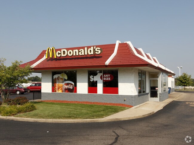
3425 Lansing Ave, Jackson, MI 49202


NEARBY LISTINGS FOR SALE OR LEASE
Property Detail
3425 Lansing Ave
000-08-15-451-003-09
SPLIT ON 12/06/1997 FROM 000 -08-15-451-003-00; THE N 180 FT OF S 420 FT OF W 333 FT OF SW 1/4 OF SE
Restaurantdrivein
Jackson
X
Michigan
26075C0195D
1.23 AC
2024
Jackson County
2025
West Michigan
005700
Jackson, MI
2,723 SF
DEMOGRAPHICS near 3425 Lansing Ave
1 mile
3 mile
5 mile
2024 Total Population
2,287
26,676
64,320
2029 Population
2,253
26,583
64,046
Pop Growth 2024-2029
(1.49%)
(0.35%)
(0.43%)
Average Age
42
40
39
2024 Total Households
953
11,665
27,058
HH Growth 2024-2029
(1.47%)
(0.29%)
(0.40%)
Median Household Inc
$63,944
$46,539
$47,285
Avg Household Size
2.30
2.20
2.30
2024 Avg HH Vehicles
2.00
2.00
2.00
Median Home Value
$144,989
$104,912
$119,477
Median Year Built
1962
1960
1957
Nearby Places
Map Layers
Map Styles
 Street
 Aerial
Transit
 Traffic
 Biking
Places
Listings with unknown addresses are not visible on the map
- Restaurants
- Banks
- Shops
- Fitness
- Groceries
PUBLIC TRANSPORTATION
COMMUTER RAIL
Drive
Walk
Distance
7 min
3.8 mi
AIRPORT
Capital Region International
Drive
Walk
Distance
Capital Region International
49 min
39.5 mi
Freight Ports
Drive
Walk
Distance
116 min
94.8 mi
Nearby Properties
Address
Land Use
TOTAL SIZE
Lot Size
Zoning
Address
Land Use
TOTAL SIZE
Lot Size
Zoning
44,148 SF
20 AC
RM-1
Address
Land Use
TOTAL SIZE
Lot Size
Zoning
121,532 SF
29.94 AC
PC-1
Address
Land Use
TOTAL SIZE
Lot Size
Zoning
398,449 SF
41.51 AC
PR-1
Address
Land Use
TOTAL SIZE
Lot Size
Zoning
240,148 SF
30.64 AC
PC-1
Address
Land Use
TOTAL SIZE
Lot Size
Zoning
415,004 SF
19.97 AC
PB
Address
Land Use
TOTAL SIZE
Lot Size
Zoning
224,803 SF
22.59 AC
RM-1
Address
Land Use
TOTAL SIZE
Lot Size
Zoning
64,257 SF
1.90 AC
R-4
Address
Land Use
TOTAL SIZE
Lot Size
Zoning
187,264 SF
7.10 AC
R-4
Address
Land Use
TOTAL SIZE
Lot Size
Zoning
251,350 SF
23.11 AC
I-1
Address
Land Use
TOTAL SIZE
Lot Size
Zoning
189,680 SF
6.90 AC
R-4
Address
Land Use
TOTAL SIZE
Lot Size
Zoning
84,489 SF
55.50 AC
RM-1
Address
Land Use
TOTAL SIZE
Lot Size
Zoning
125,393 SF
3.94 AC
C-2
Address
Land Use
TOTAL SIZE
Lot Size
Zoning
91,108 SF
5.42 AC
C-2
Address
Land Use
TOTAL SIZE
Lot Size
Zoning
145,152 SF
41.45 AC
RM-1
Address
Land Use
TOTAL SIZE
Lot Size
Zoning
84,084 SF
6.50 AC
PB
Address
Land Use
TOTAL SIZE
Lot Size
Zoning
242,708 SF
29.44 AC
PC-1
Address
Land Use
TOTAL SIZE
Lot Size
Zoning
57,057 SF
10.10 AC
C-3
Address
Land Use
TOTAL SIZE
Lot Size
Zoning
112,571 SF
9.35 AC
C-4
Address
Land Use
TOTAL SIZE
Lot Size
Zoning
159,432 SF
31.90 AC
RM-1
Address
Land Use
TOTAL SIZE
Lot Size
Zoning
67,146 SF
0.80 AC
C-3
Address
Land Use
TOTAL SIZE
Lot Size
Zoning
180,410 SF
12.60 AC
RM-1
Address
Land Use
TOTAL SIZE
Lot Size
Zoning
35,908 SF
6.60 AC
R-4
Address
Land Use
TOTAL SIZE
Lot Size
Zoning
154,448 SF
12.97 AC
PR-1
Address
Land Use
TOTAL SIZE
Lot Size
Zoning
98,560 SF
13.35 AC
RM-1
Address
Land Use
TOTAL SIZE
Lot Size
Zoning
110,894 SF
21.68 AC
PR-1
Address
Land Use
TOTAL SIZE
Lot Size
Zoning
79,923 SF
8.17 AC
C-2
Address
Land Use
TOTAL SIZE
Lot Size
Zoning
270,966 SF
67.93 AC
I-1
Address
Land Use
TOTAL SIZE
Lot Size
Zoning
130,497 SF
13.51 AC
C-2
Address
Land Use
TOTAL SIZE
Lot Size
Zoning
66,062 SF
3.38 AC
PC-1
Address
Land Use
TOTAL SIZE
Lot Size
Zoning
47,765 SF
2.30 AC
C-2
The World's #1 Commercial Real Estate Marketplace
Connect with us
© 2026 CoStar Group
The information above has been obtained from sources believed reliable. While we do not doubt its accuracy we have not verified it and make no guarantee, warranty or representation about it. It is your responsibility to independently confirm its accuracy and completeness. Any projections, opinions, assumptions, or estimates used are for example only and do not represent the current or future performance of the property. The value of this transaction to you depends on tax and other factors which should be evaluated by your tax, financial, and legal advisors. You and your advisors should conduct a careful, independent investigation of the property to determine to your satisfaction the suitability of the property for your needs.