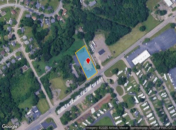
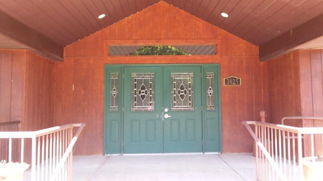
Property Record
3425 Valley St, Dayton, OH 45424

NEARBY LISTINGS FOR SALE OR LEASE
Property Detail
3425 Valley St
Dayton, OH
Mrs
I39-00202-0025
8-2-19 2-2-26
Storebuilding
Montgomery
X
Ohio
39057C0015D
25
2023
1.50 AC
2024
Northeast Central Dayton
090304
Cincinnati/Dayton
7,635 SF
DEMOGRAPHICS near 3425 Valley St
1 Mile
3 Mile
5 Mile
2024 Total Population
5,954
47,693
171,873
2029 Population
5,877
47,137
172,683
Pop Growth 2024-2029
(1.29%)
(1.17%)
+ 0.47%
Average Age
39
37
38
2024 Total Households
2,466
19,409
72,330
HH Growth 2024-2029
(1.34%)
(1.20%)
+ 0.50%
Median Household Inc
$62,882
$54,258
$50,872
Avg Household Size
2.40
2.40
2.30
2024 Avg HH Vehicles
2.00
2.00
2.00
Median Home Value
$150,618
$128,546
$121,022
Median Year Built
1978
1968
1962
Nearby Places
Map Layers
Map Styles
 Street
 Aerial
- Restaurants
- Banks
- Shops
- Fitness
- Groceries
PUBLIC TRANSPORTATION
AIRPORT
James M Cox Dayton International
DRIVE
WALK
Distance
James M Cox Dayton International
22 min
13.8 mi
Freight Ports
Port of Toledo
DRIVE
WALK
Distance
Port of Toledo
179 min
153.4 mi
SALE & LEASE HISTORY
LISTING DATE
SALE/LEASE

Sep 19, 2019
For Sale
Nearby Properties
Address
Land Use
TOTAL SIZE
Lot Size
Zoning
Address
Land Use
TOTAL SIZE
Lot Size
Zoning
14.22 AC
Address
Land Use
TOTAL SIZE
Lot Size
Zoning
316.77 AC
Address
Land Use
TOTAL SIZE
Lot Size
Zoning
22,133 SF
47.58 AC
Address
Land Use
TOTAL SIZE
Lot Size
Zoning
133.37 AC
Address
Land Use
TOTAL SIZE
Lot Size
Zoning
144,340 SF
91.38 AC
Address
Land Use
TOTAL SIZE
Lot Size
Zoning
54.85 AC
Address
Land Use
TOTAL SIZE
Lot Size
Zoning
46.32 AC
Address
Land Use
TOTAL SIZE
Lot Size
Zoning
32.30 AC
Address
Land Use
TOTAL SIZE
Lot Size
Zoning
2,376 SF
18.75 AC
PD1
Address
Land Use
TOTAL SIZE
Lot Size
Zoning
18,087 SF
19.69 AC
Address
Land Use
TOTAL SIZE
Lot Size
Zoning
96,732 SF
6.73 AC
CPUD002
Address
Land Use
TOTAL SIZE
Lot Size
Zoning
94,608 SF
7.44 AC
Address
Land Use
TOTAL SIZE
Lot Size
Zoning
634,508 SF
24.36 AC
Address
Land Use
TOTAL SIZE
Lot Size
Zoning
22.70 AC
Address
Land Use
TOTAL SIZE
Lot Size
Zoning
19,008 SF
19.96 AC
PD1
Address
Land Use
TOTAL SIZE
Lot Size
Zoning
93,360 SF
694.57 AC
Address
Land Use
TOTAL SIZE
Lot Size
Zoning
21.53 AC
Address
Land Use
TOTAL SIZE
Lot Size
Zoning
66,042 SF
9.47 AC
Address
Land Use
TOTAL SIZE
Lot Size
Zoning
2,034 SF
23.83 AC
Address
Land Use
TOTAL SIZE
Lot Size
Zoning
55,997 SF
4.20 AC
Address
Land Use
TOTAL SIZE
Lot Size
Zoning
401.86 AC
Address
Land Use
TOTAL SIZE
Lot Size
Zoning
139,400 SF
20.26 AC
Address
Land Use
TOTAL SIZE
Lot Size
Zoning
263,022 SF
19.33 AC
Address
Land Use
TOTAL SIZE
Lot Size
Zoning
11.30 AC
Address
Land Use
TOTAL SIZE
Lot Size
Zoning
230,764 SF
24.05 AC
Address
Land Use
TOTAL SIZE
Lot Size
Zoning
152,612 SF
93.77 AC
Address
Land Use
TOTAL SIZE
Lot Size
Zoning
59,200 SF
9.22 AC
PD1
Address
Land Use
TOTAL SIZE
Lot Size
Zoning
97,859 SF
7.67 AC
Address
Land Use
TOTAL SIZE
Lot Size
Zoning
62,022 SF
4.97 AC
CPUD061
Address
Land Use
TOTAL SIZE
Lot Size
Zoning
66,610 SF
3.90 AC
The World's #1 Commercial Real Estate Marketplace
Connect with us
© 2025 CoStar Group
The information above has been obtained from sources believed reliable. While we do not doubt its accuracy we have not verified it and make no guarantee, warranty or representation about it. It is your responsibility to independently confirm its accuracy and completeness. Any projections, opinions, assumptions, or estimates used are for example only and do not represent the current or future performance of the property. The value of this transaction to you depends on tax and other factors which should be evaluated by your tax, financial, and legal advisors. You and your advisors should conduct a careful, independent investigation of the property to determine to your satisfaction the suitability of the property for your needs.