Property Record
343 E 47Th St, Chicago, IL 60653


Property Detail
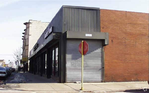
343 E 47Th St
20-10-105-001-0000
(MURPHYS) SUB OF LTS 1 & 2 OF BOGUES SUB OF PART OF L YING W OF E 315 FT THEREOF NE NE NW SEC 10-38-14
Commercialbuilding
Cook
B1-5
Illinois
B and X Area of moderate flood hazard, usually the area between the limits of the 100-year and 500-year floods.
1,2
2023
0.30 AC
2025
South Chicago
835800
Chicago
7,365 SF
Chicago-Naperville-Elgin, IL-IN
NEARBY LISTINGS FOR SALE OR LEASE
DEMOGRAPHICS near 343 E 47Th St
1 mile
3 mile
5 mile
2025 Total Population
40,096
247,701
653,821
2030 Population
40,624
246,566
646,702
Pop Growth 2025-2030
+ 1.32%
(0.46%)
(1.09%)
Average Age
39
38
38
2025 Total Households
18,420
105,451
266,853
HH Growth 2025-2030
+ 1.01%
(0.41%)
(0.84%)
Median Household Inc
$45,662
$50,404
$55,143
Avg Household Size
2.10
2.20
2.30
2025 Avg HH Vehicles
1.00
1.00
1.00
Median Home Value
$320,997
$310,698
$281,386
Median Year Built
1965
1954
1951
Nearby Places
Map Layers
Map Styles
 Street
 Aerial
Transit
 Traffic
 Biking
Places
Listings with unknown addresses are not visible on the map
- Restaurants
- Banks
- Shops
- Fitness
- Groceries
PUBLIC TRANSPORTATION
TRANSIT/SUBWAY
47th Street Station (Green Line) (Green Line - Chicago Transit Authority "L" Trains (The "L"))
Drive
Walk
Distance
47th Street Station (Green Line) (Green Line - Chicago Transit Authority "L" Trains (The "L"))
0 min
2 min
0.1 mi
51st Street Station (Green Line - Chicago Transit Authority "L" Trains (The "L"))
Drive
Walk
Distance
51st Street Station (Green Line - Chicago Transit Authority "L" Trains (The "L"))
2 min
10 min
0.5 mi
43rd Street Station (Green Line - Chicago Transit Authority "L" Trains (The "L"))
Drive
Walk
Distance
43rd Street Station (Green Line - Chicago Transit Authority "L" Trains (The "L"))
2 min
11 min
0.6 mi
47th Street Station (Red Line) (Red Line - Chicago Transit Authority "L" Trains (The "L"))
Drive
Walk
Distance
47th Street Station (Red Line) (Red Line - Chicago Transit Authority "L" Trains (The "L"))
13 min
14 min
0.7 mi
Indiana Station (Green Line - Chicago Transit Authority "L" Trains (The "L"))
Drive
Walk
Distance
Indiana Station (Green Line - Chicago Transit Authority "L" Trains (The "L"))
2 min
20 min
1.0 mi
COMMUTER RAIL
47th Street Station (Metra Electric Line - Northeast Illinois Regional Commuter Railroad (Metra))
Drive
Walk
Distance
47th Street Station (Metra Electric Line - Northeast Illinois Regional Commuter Railroad (Metra))
3 min
1.4 mi
Drive
Walk
Distance
4 min
2.1 mi
AIRPORT
Chicago Midway International
Drive
Walk
Distance
Chicago Midway International
15 min
7.6 mi
Chicago O'Hare International
Drive
Walk
Distance
Chicago O'Hare International
36 min
23.0 mi
SALE & LEASE HISTORY
LISTING DATE
SALE/LEASE

Mar 12, 2021
For Lease
Nearby Properties
Address
Land Use
TOTAL SIZE
Lot Size
Zoning
Address
Land Use
TOTAL SIZE
Lot Size
Zoning
590,844 SF
0.80 AC
PD 26
Address
Land Use
TOTAL SIZE
Lot Size
Zoning
Address
Land Use
TOTAL SIZE
Lot Size
Zoning
0.28 AC
PD 38
Address
Land Use
TOTAL SIZE
Lot Size
Zoning
460,333 SF
2.62 AC
C2-3
Address
Land Use
TOTAL SIZE
Lot Size
Zoning
136,720 SF
0.54 AC
PD 1
Address
Land Use
TOTAL SIZE
Lot Size
Zoning
3.14 AC
PD 1211
Address
Land Use
TOTAL SIZE
Lot Size
Zoning
1,302,463 SF
3.14 AC
PD 1211
Address
Land Use
TOTAL SIZE
Lot Size
Zoning
0.91 AC
PD 1177
Address
Land Use
TOTAL SIZE
Lot Size
Zoning
Address
Land Use
TOTAL SIZE
Lot Size
Zoning
250,040 SF
15.70 AC
PD 1169
Address
Land Use
TOTAL SIZE
Lot Size
Zoning
2.65 AC
PD 38
Address
Land Use
TOTAL SIZE
Lot Size
Zoning
10 AC
PD 1169
Address
Land Use
TOTAL SIZE
Lot Size
Zoning
8.54 AC
PD 1169
Address
Land Use
TOTAL SIZE
Lot Size
Zoning
1,687,020 SF
10.25 AC
PD 1169
Address
Land Use
TOTAL SIZE
Lot Size
Zoning
475,000 SF
14.01 AC
PMD 8
Address
Land Use
TOTAL SIZE
Lot Size
Zoning
304,685 SF
1.11 AC
PD 1218
Address
Land Use
TOTAL SIZE
Lot Size
Zoning
0.27 AC
PD 1
Address
Land Use
TOTAL SIZE
Lot Size
Zoning
283,180 SF
1.41 AC
M2-3
Address
Land Use
TOTAL SIZE
Lot Size
Zoning
7,200 SF
0.22 AC
B3-3
Address
Land Use
TOTAL SIZE
Lot Size
Zoning
38,214 SF
0.92 AC
C2-3
Address
Land Use
TOTAL SIZE
Lot Size
Zoning
156,800 SF
2.65 AC
PD 38
Address
Land Use
TOTAL SIZE
Lot Size
Zoning
1.09 AC
B2-2
Address
Land Use
TOTAL SIZE
Lot Size
Zoning
55,440 SF
1.16 AC
C2-3
Address
Land Use
TOTAL SIZE
Lot Size
Zoning
PD 43
Address
Land Use
TOTAL SIZE
Lot Size
Zoning
Address
Land Use
TOTAL SIZE
Lot Size
Zoning
451,349 SF
1.62 AC
PD 1062
Address
Land Use
TOTAL SIZE
Lot Size
Zoning
0.29 AC
PD 1548
Address
Land Use
TOTAL SIZE
Lot Size
Zoning
4,900 SF
0.29 AC
PD 1548
Address
Land Use
TOTAL SIZE
Lot Size
Zoning
794,288 SF
6.53 AC
PD 41
Address
Land Use
TOTAL SIZE
Lot Size
Zoning
0.73 AC
PD 1072
The World's #1 Commercial Real Estate Marketplace
Connect with us
© 2026 CoStar Group
The information above has been obtained from sources believed reliable. While we do not doubt its accuracy we have not verified it and make no guarantee, warranty or representation about it. It is your responsibility to independently confirm its accuracy and completeness. Any projections, opinions, assumptions, or estimates used are for example only and do not represent the current or future performance of the property. The value of this transaction to you depends on tax and other factors which should be evaluated by your tax, financial, and legal advisors. You and your advisors should conduct a careful, independent investigation of the property to determine to your satisfaction the suitability of the property for your needs.