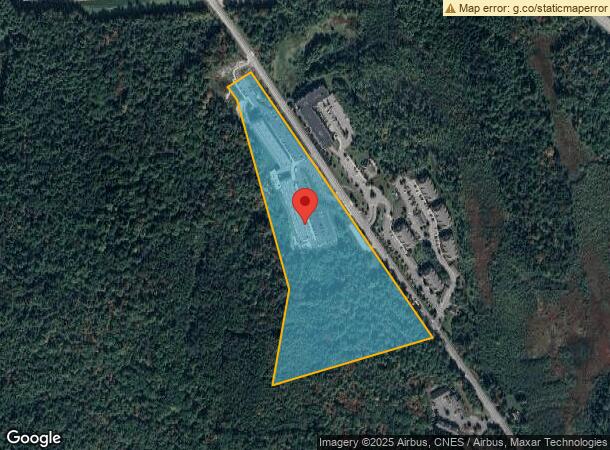
Property Record
343 Mount Support Rd, Lebanon, NH 03766


NEARBY LISTINGS FOR SALE OR LEASE
Property Detail
343 Mount Support Rd
Apartment
Grafton
X
New Hampshire
33009C0892E
17.70 AC
2024
Concord/New Hampshire North Area
2024
Other Market Areas
961701
Claremont-Lebanon, NH-VT
191,951 SF
LBAN-000024-000001
DEMOGRAPHICS near 343 Mount Support Rd
1 Mile
3 Mile
5 Mile
2024 Total Population
2,644
17,812
33,136
2029 Population
2,954
18,704
34,488
Pop Growth 2024-2029
+ 11.72%
+ 5.01%
+ 4.08%
Average Age
39
41
41
2024 Total Households
1,364
8,241
13,908
HH Growth 2024-2029
+ 11.58%
+ 4.99%
+ 4.26%
Median Household Inc
$89,927
$93,152
$92,321
Avg Household Size
1.90
2.00
2.10
2024 Avg HH Vehicles
2.00
2.00
2.00
Median Home Value
$319,886
$316,284
$331,557
Median Year Built
2010
1979
1979
Nearby Places
Map Layers
Map Styles
 Street
 Aerial
- Restaurants
- Banks
- Shops
- Fitness
- Groceries
PUBLIC TRANSPORTATION
COMMUTER RAIL
White River Junction Amtrak Station (Vermonter - Amtrak)
DRIVE
WALK
Distance
White River Junction Amtrak Station (Vermonter - Amtrak)
14 min
6.2 mi
Freight Ports
Portland, ME
DRIVE
WALK
Distance
Portland, ME
196 min
164.0 mi
Nearby Properties
Address
Land Use
TOTAL SIZE
Lot Size
Zoning
Address
Land Use
TOTAL SIZE
Lot Size
Zoning
163,845 SF
MC
Address
Land Use
TOTAL SIZE
Lot Size
Zoning
3,136 SF
53.32 AC
R1
Address
Land Use
TOTAL SIZE
Lot Size
Zoning
137,168 SF
11.39 AC
GC
Address
Land Use
TOTAL SIZE
Lot Size
Zoning
Address
Land Use
TOTAL SIZE
Lot Size
Zoning
3.76 AC
GC
Address
Land Use
TOTAL SIZE
Lot Size
Zoning
1,315 SF
16.35 AC
RL3
Address
Land Use
TOTAL SIZE
Lot Size
Zoning
194,496 SF
28.26 AC
I
Address
Land Use
TOTAL SIZE
Lot Size
Zoning
356.40 AC
RL3
Address
Land Use
TOTAL SIZE
Lot Size
Zoning
430,065 SF
23.35 AC
I
Address
Land Use
TOTAL SIZE
Lot Size
Zoning
86.78 AC
IC
Address
Land Use
TOTAL SIZE
Lot Size
Zoning
18.38 AC
R3
Address
Land Use
TOTAL SIZE
Lot Size
Zoning
202,868 SF
5.74 AC
LD
Address
Land Use
TOTAL SIZE
Lot Size
Zoning
10.20 AC
R3
Address
Land Use
TOTAL SIZE
Lot Size
Zoning
106,069 SF
19.42 AC
R3
Address
Land Use
TOTAL SIZE
Lot Size
Zoning
75,575 SF
0.78 AC
D1
Address
Land Use
TOTAL SIZE
Lot Size
Zoning
23.33 AC
R3
Address
Land Use
TOTAL SIZE
Lot Size
Zoning
9.80 AC
I
Address
Land Use
TOTAL SIZE
Lot Size
Zoning
1.03 AC
I
Address
Land Use
TOTAL SIZE
Lot Size
Zoning
37.58 AC
R3
Address
Land Use
TOTAL SIZE
Lot Size
Zoning
169.73 AC
MC
Address
Land Use
TOTAL SIZE
Lot Size
Zoning
41.18 AC
I
Address
Land Use
TOTAL SIZE
Lot Size
Zoning
128,514 SF
11.10 AC
R1
Address
Land Use
TOTAL SIZE
Lot Size
Zoning
146,472 SF
23.24 AC
INDL
Address
Land Use
TOTAL SIZE
Lot Size
Zoning
81,160 SF
2.61 AC
INDL
Address
Land Use
TOTAL SIZE
Lot Size
Zoning
116.22 AC
MC
Address
Land Use
TOTAL SIZE
Lot Size
Zoning
78,986 SF
3.71 AC
INDL
Address
Land Use
TOTAL SIZE
Lot Size
Zoning
75,077 SF
8.97 AC
INDL
Address
Land Use
TOTAL SIZE
Lot Size
Zoning
23.35 AC
1
Address
Land Use
TOTAL SIZE
Lot Size
Zoning
11.38 AC
MC
The World's #1 Commercial Real Estate Marketplace
Connect with us
© 2026 CoStar Group
The information above has been obtained from sources believed reliable. While we do not doubt its accuracy we have not verified it and make no guarantee, warranty or representation about it. It is your responsibility to independently confirm its accuracy and completeness. Any projections, opinions, assumptions, or estimates used are for example only and do not represent the current or future performance of the property. The value of this transaction to you depends on tax and other factors which should be evaluated by your tax, financial, and legal advisors. You and your advisors should conduct a careful, independent investigation of the property to determine to your satisfaction the suitability of the property for your needs.