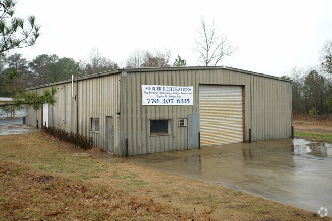
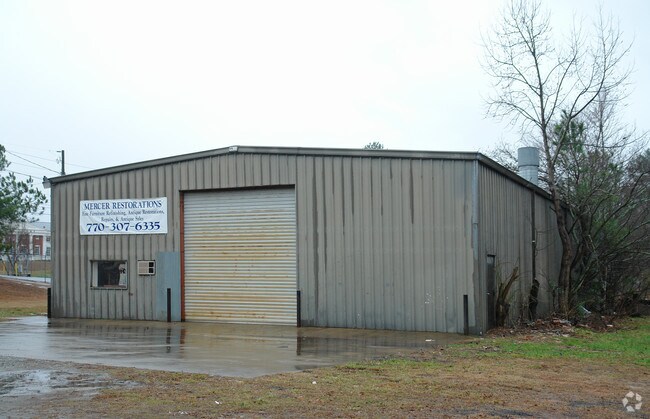
Property Record
3430 Davenport Rd, Duluth, GA 30096
NEARBY LISTINGS FOR SALE OR LEASE
Property Detail
3430 Davenport Rd
6-293-244
Peachtree
Municipalproperty
TR2 DAVENPORT RD PB165-179
X
Gwinnett
13135C0055G
Georgia
0
0.25 AC
2025
Duluth/Suwanee/Buford
050222
Atlanta
5,000 SF
Atlanta-Sandy Springs-Roswell, GA
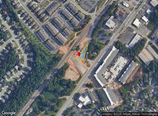
DEMOGRAPHICS near 3430 Davenport Rd
1 Mile
3 Mile
5 Mile
2024 Total Population
9,584
69,100
209,280
2029 Population
9,998
72,185
218,290
Pop Growth 2024-2029
+ 4.32%
+ 4.46%
+ 4.31%
Average Age
40
39
38
2024 Total Households
3,612
25,722
76,366
HH Growth 2024-2029
+ 4.37%
+ 4.48%
+ 4.36%
Median Household Inc
$82,163
$78,662
$73,793
Avg Household Size
2.60
2.70
2.70
2024 Avg HH Vehicles
2.00
2.00
2.00
Median Home Value
$284,621
$352,619
$387,582
Median Year Built
1991
1994
1994
Nearby Places
Map Layers
Map Styles
 Street
 Aerial
- Restaurants
- Banks
- Shops
- Fitness
- Groceries
PUBLIC TRANSPORTATION
AIRPORT
Hartsfield - Jackson Atlanta International
DRIVE
WALK
Distance
Hartsfield - Jackson Atlanta International
49 min
34.7 mi
Freight Ports
Georgia Ports - Savannah
DRIVE
WALK
Distance
Georgia Ports - Savannah
305 min
269.6 mi
Nearby Properties
Address
Land Use
TOTAL SIZE
Lot Size
Zoning
Address
Land Use
TOTAL SIZE
Lot Size
Zoning
794,057 SF
78.64 AC
PUD
Address
Land Use
TOTAL SIZE
Lot Size
Zoning
508,494 SF
38.74 AC
RM13
Address
Land Use
TOTAL SIZE
Lot Size
Zoning
356,984 SF
24.89 AC
PUD
Address
Land Use
TOTAL SIZE
Lot Size
Zoning
346,219 SF
21.95 AC
PUD
Address
Land Use
TOTAL SIZE
Lot Size
Zoning
393,913 SF
25.93 AC
RM13
Address
Land Use
TOTAL SIZE
Lot Size
Zoning
523,344 SF
40.47 AC
RM
Address
Land Use
TOTAL SIZE
Lot Size
Zoning
450,815 SF
45.79 AC
RM10
Address
Land Use
TOTAL SIZE
Lot Size
Zoning
423,004 SF
47.93 AC
RM
Address
Land Use
TOTAL SIZE
Lot Size
Zoning
503,097 SF
40 AC
RM13
Address
Land Use
TOTAL SIZE
Lot Size
Zoning
491,482 SF
41.72 AC
C1
Address
Land Use
TOTAL SIZE
Lot Size
Zoning
620,975 SF
8.10 AC
PUD
Address
Land Use
TOTAL SIZE
Lot Size
Zoning
341,506 SF
36.69 AC
C1
Address
Land Use
TOTAL SIZE
Lot Size
Zoning
372,904 SF
11.64 AC
PUD
Address
Land Use
TOTAL SIZE
Lot Size
Zoning
609,495 SF
6.28 AC
PUD
Address
Land Use
TOTAL SIZE
Lot Size
Zoning
418,495 SF
22.06 AC
PUD
Address
Land Use
TOTAL SIZE
Lot Size
Zoning
88.90 AC
AG1
Address
Land Use
TOTAL SIZE
Lot Size
Zoning
287,824 SF
31.59 AC
RM
Address
Land Use
TOTAL SIZE
Lot Size
Zoning
217,080 SF
49.32 AC
M1
Address
Land Use
TOTAL SIZE
Lot Size
Zoning
263,285 SF
22.50 AC
RM
Address
Land Use
TOTAL SIZE
Lot Size
Zoning
252,043 SF
22.03 AC
RM
Address
Land Use
TOTAL SIZE
Lot Size
Zoning
256,640 SF
28.59 AC
RM
Address
Land Use
TOTAL SIZE
Lot Size
Zoning
230,830 SF
20.14 AC
RM10
Address
Land Use
TOTAL SIZE
Lot Size
Zoning
1,052,800 SF
51.40 AC
M2
Address
Land Use
TOTAL SIZE
Lot Size
Zoning
326,904 SF
46.73 AC
OI
Address
Land Use
TOTAL SIZE
Lot Size
Zoning
304,001 SF
32 AC
PUD
Address
Land Use
TOTAL SIZE
Lot Size
Zoning
235,586 SF
16.21 AC
PUD
Address
Land Use
TOTAL SIZE
Lot Size
Zoning
308,804 SF
31.10 AC
C2
Address
Land Use
TOTAL SIZE
Lot Size
Zoning
197,115 SF
16.93 AC
PUD
Address
Land Use
TOTAL SIZE
Lot Size
Zoning
326,946 SF
15.33 AC
M2
Address
Land Use
TOTAL SIZE
Lot Size
Zoning
212,250 SF
150 AC
AG1
The World's #1 Commercial Real Estate Marketplace
Connect with us
© 2026 CoStar Group
The information above has been obtained from sources believed reliable. While we do not doubt its accuracy we have not verified it and make no guarantee, warranty or representation about it. It is your responsibility to independently confirm its accuracy and completeness. Any projections, opinions, assumptions, or estimates used are for example only and do not represent the current or future performance of the property. The value of this transaction to you depends on tax and other factors which should be evaluated by your tax, financial, and legal advisors. You and your advisors should conduct a careful, independent investigation of the property to determine to your satisfaction the suitability of the property for your needs.