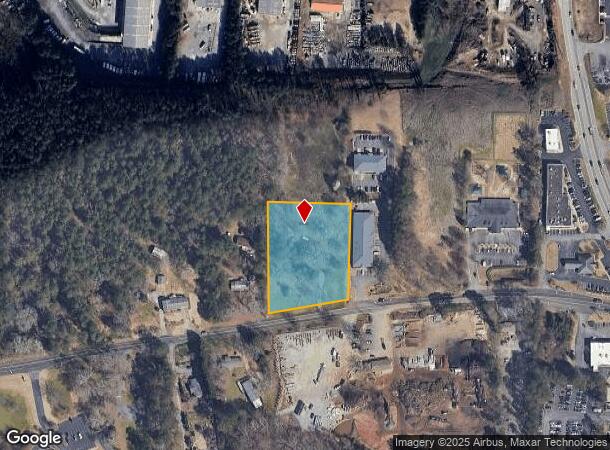
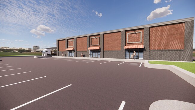
Property Record
3430 Francis Rd, Alpharetta, GA 30004

NEARBY LISTINGS FOR SALE OR LEASE
Property Detail
3430 Francis Rd
018-121
Hwy S Comm Grassland 09 N
Agriculturalland
2-1 612 TR 1 ZON CHG FR HB TO M1 PER ZA4150--2025
X
Forsyth
13121C0019G
Georgia
2024
2.18 AC
2025
N Fulton/Forsyth County
130601
Atlanta
924 SF
Atlanta-Sandy Springs-Roswell, GA
DEMOGRAPHICS near 3430 Francis Rd
1 Mile
3 Mile
5 Mile
2024 Total Population
3,119
43,191
116,730
2029 Population
3,383
48,070
128,894
Pop Growth 2024-2029
+ 8.46%
+ 11.30%
+ 10.42%
Average Age
38
37
38
2024 Total Households
990
14,786
40,216
HH Growth 2024-2029
+ 8.99%
+ 11.09%
+ 10.29%
Median Household Inc
$161,993
$128,254
$137,511
Avg Household Size
3.10
2.90
2.90
2024 Avg HH Vehicles
2.00
2.00
2.00
Median Home Value
$685,152
$469,449
$497,999
Median Year Built
2001
2003
2002
Nearby Places
Map Layers
Map Styles
 Street
 Aerial
- Restaurants
- Banks
- Shops
- Fitness
- Groceries
SALE & LEASE HISTORY
LISTING DATE
SALE/LEASE

Mar 09, 2023
For Sale
Jul 26, 2017
For Sale
Nearby Properties
Address
Land Use
TOTAL SIZE
Lot Size
Zoning
Address
Land Use
TOTAL SIZE
Lot Size
Zoning
406,800 SF
11.61 AC
MP
Address
Land Use
TOTAL SIZE
Lot Size
Zoning
477,112 SF
20.58 AC
MP
Address
Land Use
TOTAL SIZE
Lot Size
Zoning
5,168,439 SF
45 AC
AC
Address
Land Use
TOTAL SIZE
Lot Size
Zoning
328,265 SF
4 AC
MP
Address
Land Use
TOTAL SIZE
Lot Size
Zoning
3,966,282 SF
25.68 AC
R4
Address
Land Use
TOTAL SIZE
Lot Size
Zoning
2,308,770 SF
32 AC
C1C
Address
Land Use
TOTAL SIZE
Lot Size
Zoning
56,313 SF
13.37 AC
MP
Address
Land Use
TOTAL SIZE
Lot Size
Zoning
3,363,714 SF
19.89 AC
TRCON
Address
Land Use
TOTAL SIZE
Lot Size
Zoning
10,908 SF
107.57 AC
RES3
Address
Land Use
TOTAL SIZE
Lot Size
Zoning
309,293 SF
16 AC
CBD
Address
Land Use
TOTAL SIZE
Lot Size
Zoning
2.12 AC
MP
Address
Land Use
TOTAL SIZE
Lot Size
Zoning
90,671 SF
11.03 AC
MP
Address
Land Use
TOTAL SIZE
Lot Size
Zoning
119,926 SF
23.23 AC
M1
Address
Land Use
TOTAL SIZE
Lot Size
Zoning
64.48 AC
AG1
Address
Land Use
TOTAL SIZE
Lot Size
Zoning
83,161 SF
277.43 AC
A1
Address
Land Use
TOTAL SIZE
Lot Size
Zoning
1,121,442 SF
13 AC
A0
Address
Land Use
TOTAL SIZE
Lot Size
Zoning
207,663 SF
60.62 AC
R2R
Address
Land Use
TOTAL SIZE
Lot Size
Zoning
116,640 SF
6.92 AC
MP
Address
Land Use
TOTAL SIZE
Lot Size
Zoning
96,999 SF
10.93 AC
CBD
Address
Land Use
TOTAL SIZE
Lot Size
Zoning
293,211 SF
16.18 AC
M1
Address
Land Use
TOTAL SIZE
Lot Size
Zoning
130,155 SF
17.10 AC
M1
Address
Land Use
TOTAL SIZE
Lot Size
Zoning
91,585 SF
8.77 AC
C1
Address
Land Use
TOTAL SIZE
Lot Size
Zoning
198,235 SF
14.60 AC
M1
Address
Land Use
TOTAL SIZE
Lot Size
Zoning
95,950 SF
14 AC
M1
Address
Land Use
TOTAL SIZE
Lot Size
Zoning
73,120 SF
1.22 AC
AG1
Address
Land Use
TOTAL SIZE
Lot Size
Zoning
6.07 AC
MP
Address
Land Use
TOTAL SIZE
Lot Size
Zoning
1.39 AC
MP
Address
Land Use
TOTAL SIZE
Lot Size
Zoning
102,556 SF
6.92 AC
M1
Address
Land Use
TOTAL SIZE
Lot Size
Zoning
102,556 SF
6.12 AC
M1
Address
Land Use
TOTAL SIZE
Lot Size
Zoning
6.97 AC
M1
The World's #1 Commercial Real Estate Marketplace
Connect with us
© 2026 CoStar Group
The information above has been obtained from sources believed reliable. While we do not doubt its accuracy we have not verified it and make no guarantee, warranty or representation about it. It is your responsibility to independently confirm its accuracy and completeness. Any projections, opinions, assumptions, or estimates used are for example only and do not represent the current or future performance of the property. The value of this transaction to you depends on tax and other factors which should be evaluated by your tax, financial, and legal advisors. You and your advisors should conduct a careful, independent investigation of the property to determine to your satisfaction the suitability of the property for your needs.