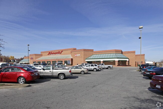
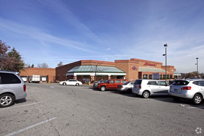
Property Record
3430 S Grand Blvd, Saint Louis, MO 63118


NEARBY LISTINGS FOR SALE OR LEASE
Property Detail
3430 S Grand Blvd
1591-00-0200-0
Bgrand Pl Addn
Commercialnec
CB 1591 S GRAND BLVD 5.771 ACS LOT PT OF BLOCK BGRAND PL ADDN N-CHEROKEE S-POTOMAC
X
St. Louis City
2903850101C
Missouri
2024
5.77 AC
2025
St Louis City South
116400
St. Louis
73,762 SF
St. Louis, MO-IL
DEMOGRAPHICS near 3430 S Grand Blvd
1 Mile
3 Mile
5 Mile
2024 Total Population
28,069
129,267
289,895
2029 Population
26,148
119,973
274,871
Pop Growth 2024-2029
(6.84%)
(7.19%)
(5.18%)
Average Age
37
38
39
2024 Total Households
12,583
61,651
137,826
HH Growth 2024-2029
(6.83%)
(7.15%)
(5.33%)
Median Household Inc
$53,025
$56,679
$54,692
Avg Household Size
2.20
2.00
2.00
2024 Avg HH Vehicles
1.00
1.00
1.00
Median Home Value
$189,953
$191,661
$186,125
Median Year Built
1945
1946
1948
Nearby Places
Map Layers
Map Styles
 Street
 Aerial
- Restaurants
- Banks
- Shops
- Fitness
- Groceries
PUBLIC TRANSPORTATION
COMMUTER RAIL
Grand (Lambert Airport Shiloh-Scott - St. Louis MetroLink (MetroLink), Shrewsbury-Lansdowne I-44 Emerson Park - St. Louis MetroLink (MetroLink))
DRIVE
WALK
Distance
Grand (Lambert Airport Shiloh-Scott - St. Louis MetroLink (MetroLink), Shrewsbury-Lansdowne I-44 Emerson Park - St. Louis MetroLink (MetroLink))
6 min
2.4 mi
Union Station (Lambert Airport Shiloh-Scott - St. Louis MetroLink (MetroLink), Shrewsbury-Lansdowne I-44 Emerson Park - St. Louis MetroLink (MetroLink))
DRIVE
WALK
Distance
Union Station (Lambert Airport Shiloh-Scott - St. Louis MetroLink (MetroLink), Shrewsbury-Lansdowne I-44 Emerson Park - St. Louis MetroLink (MetroLink))
8 min
4.0 mi
AIRPORT
St Louis Lambert International
DRIVE
WALK
Distance
St Louis Lambert International
28 min
15.5 mi
Scott AFB/Midamerica St Louis
DRIVE
WALK
Distance
Scott AFB/Midamerica St Louis
45 min
28.4 mi
Nearby Properties
Address
Land Use
TOTAL SIZE
Lot Size
Zoning
Address
Land Use
TOTAL SIZE
Lot Size
Zoning
5.61 AC
A
Address
Land Use
TOTAL SIZE
Lot Size
Zoning
229.57 AC
B
Address
Land Use
TOTAL SIZE
Lot Size
Zoning
177.77 AC
A
Address
Land Use
TOTAL SIZE
Lot Size
Zoning
624,049 SF
20.78 AC
K
Address
Land Use
TOTAL SIZE
Lot Size
Zoning
1,089,750 SF
8.43 AC
I
Address
Land Use
TOTAL SIZE
Lot Size
Zoning
246,345 SF
4.17 AC
J
Address
Land Use
TOTAL SIZE
Lot Size
Zoning
1.98 AC
H
Address
Land Use
TOTAL SIZE
Lot Size
Zoning
6.05 AC
J
Address
Land Use
TOTAL SIZE
Lot Size
Zoning
423,303 SF
9.97 AC
H
Address
Land Use
TOTAL SIZE
Lot Size
Zoning
360,580 SF
26.13 AC
KJ
Address
Land Use
TOTAL SIZE
Lot Size
Zoning
189,841 SF
4.18 AC
K
Address
Land Use
TOTAL SIZE
Lot Size
Zoning
8.54 AC
H
Address
Land Use
TOTAL SIZE
Lot Size
Zoning
191,584 SF
1.76 AC
K
Address
Land Use
TOTAL SIZE
Lot Size
Zoning
191,352 SF
4.41 AC
K
Address
Land Use
TOTAL SIZE
Lot Size
Zoning
112,656 SF
3.55 AC
HK
Address
Land Use
TOTAL SIZE
Lot Size
Zoning
628,939 SF
2.73 AC
J
Address
Land Use
TOTAL SIZE
Lot Size
Zoning
256,400 SF
3.67 AC
H
Address
Land Use
TOTAL SIZE
Lot Size
Zoning
177,974 SF
2.29 AC
J
Address
Land Use
TOTAL SIZE
Lot Size
Zoning
2.03 AC
HC
Address
Land Use
TOTAL SIZE
Lot Size
Zoning
184,183 SF
1.96 AC
J
Address
Land Use
TOTAL SIZE
Lot Size
Zoning
269,300 SF
4.92 AC
H
Address
Land Use
TOTAL SIZE
Lot Size
Zoning
275,012 SF
4.39 AC
C
Address
Land Use
TOTAL SIZE
Lot Size
Zoning
467,800 SF
1.30 AC
K
Address
Land Use
TOTAL SIZE
Lot Size
Zoning
18.56 AC
H
Address
Land Use
TOTAL SIZE
Lot Size
Zoning
718,644 SF
3.53 AC
I
Address
Land Use
TOTAL SIZE
Lot Size
Zoning
432,844 SF
5.08 AC
JK
Address
Land Use
TOTAL SIZE
Lot Size
Zoning
220,982 SF
2.83 AC
HB
Address
Land Use
TOTAL SIZE
Lot Size
Zoning
136,896 SF
2.22 AC
I
Address
Land Use
TOTAL SIZE
Lot Size
Zoning
406,744 SF
1.95 AC
I
Address
Land Use
TOTAL SIZE
Lot Size
Zoning
739,544 SF
5.59 AC
H
The World's #1 Commercial Real Estate Marketplace
Connect with us
© 2026 CoStar Group
The information above has been obtained from sources believed reliable. While we do not doubt its accuracy we have not verified it and make no guarantee, warranty or representation about it. It is your responsibility to independently confirm its accuracy and completeness. Any projections, opinions, assumptions, or estimates used are for example only and do not represent the current or future performance of the property. The value of this transaction to you depends on tax and other factors which should be evaluated by your tax, financial, and legal advisors. You and your advisors should conduct a careful, independent investigation of the property to determine to your satisfaction the suitability of the property for your needs.