Property Record
3430 S Post Rd, Indianapolis, IN 46239
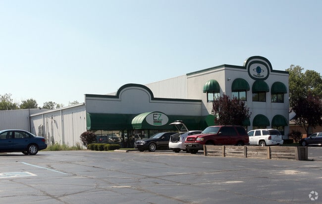

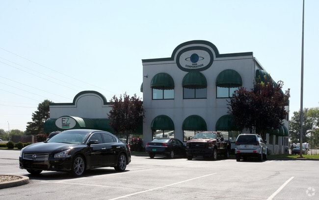
This Property Is For Sale
NEARBY LISTINGS FOR SALE OR LEASE
Property Detail
3430 S Post Rd
Indianapolis-Carmel-Anderson, IN
PT SE1/4 NE1/4 S30 T15 R5 BEG SE COR W 726.89 NW556.5 E 828.82 N 87 E 264 S 120 W 264 S 120E 264 S 100 W 264 S 140 E 264 S 19 TO BEG7.527AC (7.401AC TAX)
49-09-30-109-004.000-300
Marion
Commercialnec
Indiana
2023
7.40 AC
2024
Washington Square
390200
Indianapolis
7,992 SF
DEMOGRAPHICS near 3430 S Post Rd
1 Mile
3 Mile
5 Mile
2024 Total Population
4,315
34,933
110,261
2029 Population
4,240
34,439
108,958
Pop Growth 2024-2029
(1.74%)
(1.41%)
(1.18%)
Average Age
33
36
38
2024 Total Households
1,444
12,074
41,327
HH Growth 2024-2029
(1.80%)
(1.50%)
(1.27%)
Median Household Inc
$78,990
$87,368
$75,673
Avg Household Size
2.90
2.90
2.60
2024 Avg HH Vehicles
2.00
2.00
2.00
Median Home Value
$195,134
$226,444
$201,065
Median Year Built
2001
2001
1980
Nearby Places
Map Layers
Map Styles
 Street
 Aerial
- Restaurants
- Banks
- Shops
- Fitness
- Groceries
PUBLIC TRANSPORTATION
COMMUTER RAIL
Indianapolis (Cardinal - Amtrak)
DRIVE
WALK
Distance
Indianapolis (Cardinal - Amtrak)
14 min
9.4 mi
AIRPORT
Indianapolis International
DRIVE
WALK
Distance
Indianapolis International
35 min
20.8 mi
Freight Ports
Port of Toledo
DRIVE
WALK
Distance
Port of Toledo
271 min
227.8 mi
Nearby Properties
Address
Land Use
TOTAL SIZE
Lot Size
Zoning
Address
Land Use
TOTAL SIZE
Lot Size
Zoning
584,250 SF
42.54 AC
ZO01
Address
Land Use
TOTAL SIZE
Lot Size
Zoning
9,888 SF
124.20 AC
ZO01
Address
Land Use
TOTAL SIZE
Lot Size
Zoning
3,902 SF
26.84 AC
ZO01
Address
Land Use
TOTAL SIZE
Lot Size
Zoning
3,132 SF
20.50 AC
Address
Land Use
TOTAL SIZE
Lot Size
Zoning
133,257 SF
93.03 AC
ZO01
Address
Land Use
TOTAL SIZE
Lot Size
Zoning
198,375 SF
24.52 AC
ZO01
Address
Land Use
TOTAL SIZE
Lot Size
Zoning
1,575 SF
10.24 AC
Address
Land Use
TOTAL SIZE
Lot Size
Zoning
46,800 SF
49.64 AC
ZO01
Address
Land Use
TOTAL SIZE
Lot Size
Zoning
3,832 SF
12.77 AC
ZO01
Address
Land Use
TOTAL SIZE
Lot Size
Zoning
67,252 SF
7.50 AC
ZO01
Address
Land Use
TOTAL SIZE
Lot Size
Zoning
209,756 SF
12.33 AC
ZO01
Address
Land Use
TOTAL SIZE
Lot Size
Zoning
115,550 SF
11.58 AC
ZO01
Address
Land Use
TOTAL SIZE
Lot Size
Zoning
17,972 SF
4.48 AC
ZO01
Address
Land Use
TOTAL SIZE
Lot Size
Zoning
36,144 SF
5.31 AC
Address
Land Use
TOTAL SIZE
Lot Size
Zoning
70,802 SF
17.11 AC
ZO01
Address
Land Use
TOTAL SIZE
Lot Size
Zoning
32,354 SF
75.12 AC
ZO01
Address
Land Use
TOTAL SIZE
Lot Size
Zoning
105,360 SF
10.02 AC
ZO01
Address
Land Use
TOTAL SIZE
Lot Size
Zoning
3,507 SF
28.32 AC
Address
Land Use
TOTAL SIZE
Lot Size
Zoning
131,683 SF
9.52 AC
ZO01
Address
Land Use
TOTAL SIZE
Lot Size
Zoning
130,800 SF
13.69 AC
ZO01
Address
Land Use
TOTAL SIZE
Lot Size
Zoning
70,802 SF
11.28 AC
ZO01
Address
Land Use
TOTAL SIZE
Lot Size
Zoning
11,002 SF
8.76 AC
ZO01
Address
Land Use
TOTAL SIZE
Lot Size
Zoning
172,000 SF
10.50 AC
ZO01
Address
Land Use
TOTAL SIZE
Lot Size
Zoning
76,500 SF
18 AC
ZO01
Address
Land Use
TOTAL SIZE
Lot Size
Zoning
25,019 SF
5.82 AC
Address
Land Use
TOTAL SIZE
Lot Size
Zoning
82,825 SF
6.27 AC
ZO01
Address
Land Use
TOTAL SIZE
Lot Size
Zoning
61,888 SF
8.72 AC
ZO01
Address
Land Use
TOTAL SIZE
Lot Size
Zoning
19,675 SF
5.55 AC
ZO01
Address
Land Use
TOTAL SIZE
Lot Size
Zoning
42,400 SF
4.33 AC
ZO01
Address
Land Use
TOTAL SIZE
Lot Size
Zoning
38,979 SF
3.68 AC
ZO01
The World's #1 Commercial Real Estate Marketplace
Connect with us
© 2026 CoStar Group
The information above has been obtained from sources believed reliable. While we do not doubt its accuracy we have not verified it and make no guarantee, warranty or representation about it. It is your responsibility to independently confirm its accuracy and completeness. Any projections, opinions, assumptions, or estimates used are for example only and do not represent the current or future performance of the property. The value of this transaction to you depends on tax and other factors which should be evaluated by your tax, financial, and legal advisors. You and your advisors should conduct a careful, independent investigation of the property to determine to your satisfaction the suitability of the property for your needs.