Property Record
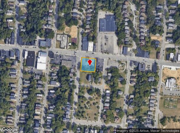
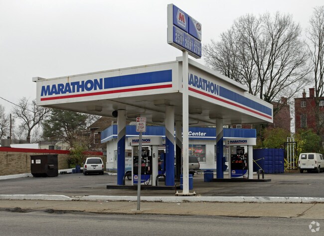
3431 Warsaw Ave, Cincinnati, OH 45205

NEARBY LISTINGS FOR SALE OR LEASE
Property Detail
3431 Warsaw Ave
Cincinnati, OH-KY-IN
Boyles
175-0018-0166
WARSAW AV 146.82X137.67 IR LOT 84-85 PT 83 E BOYLE LOT 47PAR 166-167-168 CON
Servicestation
Hamilton
X
Ohio
21037C0025E
84-85
2024
0.46 AC
2024
Queensgate
009500
Cincinnati/Dayton
1,305 SF
DEMOGRAPHICS near 3431 Warsaw Ave
1 Mile
3 Mile
5 Mile
2024 Total Population
20,123
128,424
317,297
2029 Population
20,180
129,600
320,260
Pop Growth 2024-2029
+ 0.28%
+ 0.92%
+ 0.93%
Average Age
34
36
37
2024 Total Households
7,735
54,759
137,781
HH Growth 2024-2029
+ 0.16%
+ 1.07%
+ 1.02%
Median Household Inc
$30,922
$40,716
$49,658
Avg Household Size
2.40
2.20
2.10
2024 Avg HH Vehicles
1.00
1.00
1.00
Median Home Value
$84,109
$149,782
$181,482
Median Year Built
1948
1957
1956
Nearby Places
Map Layers
Map Styles
 Street
 Aerial
- Restaurants
- Banks
- Shops
- Fitness
- Groceries
PUBLIC TRANSPORTATION
COMMUTER RAIL
Cincinnati Union Terminal (Cardinal - Amtrak)
DRIVE
WALK
Distance
Cincinnati Union Terminal (Cardinal - Amtrak)
7 min
2.8 mi
AIRPORT
Cincinnati/Northern Kentucky International
DRIVE
WALK
Distance
Cincinnati/Northern Kentucky International
30 min
16.4 mi
Freight Ports
Port of Toledo
DRIVE
WALK
Distance
Port of Toledo
245 min
206.9 mi
Nearby Properties
Address
Land Use
TOTAL SIZE
Lot Size
Zoning
Address
Land Use
TOTAL SIZE
Lot Size
Zoning
39.99 AC
MG
Address
Land Use
TOTAL SIZE
Lot Size
Zoning
11.82 AC
Address
Land Use
TOTAL SIZE
Lot Size
Zoning
3.09 AC
Address
Land Use
TOTAL SIZE
Lot Size
Zoning
9,962 SF
712 AC
Address
Land Use
TOTAL SIZE
Lot Size
Zoning
28,160 SF
1 AC
DD
Address
Land Use
TOTAL SIZE
Lot Size
Zoning
9.38 AC
PR
Address
Land Use
TOTAL SIZE
Lot Size
Zoning
1.21 AC
DD
Address
Land Use
TOTAL SIZE
Lot Size
Zoning
2.16 AC
DD
Address
Land Use
TOTAL SIZE
Lot Size
Zoning
12.19 AC
Address
Land Use
TOTAL SIZE
Lot Size
Zoning
10.96 AC
Address
Land Use
TOTAL SIZE
Lot Size
Zoning
Address
Land Use
TOTAL SIZE
Lot Size
Zoning
1.67 AC
Address
Land Use
TOTAL SIZE
Lot Size
Zoning
3 AC
DD
Address
Land Use
TOTAL SIZE
Lot Size
Zoning
3.27 AC
CCA
Address
Land Use
TOTAL SIZE
Lot Size
Zoning
0.77 AC
Address
Land Use
TOTAL SIZE
Lot Size
Zoning
0.62 AC
Address
Land Use
TOTAL SIZE
Lot Size
Zoning
1.94 AC
Address
Land Use
TOTAL SIZE
Lot Size
Zoning
2.10 AC
Address
Land Use
TOTAL SIZE
Lot Size
Zoning
630,410 SF
0.80 AC
DD
Address
Land Use
TOTAL SIZE
Lot Size
Zoning
0.45 AC
DD
Address
Land Use
TOTAL SIZE
Lot Size
Zoning
12.32 AC
Address
Land Use
TOTAL SIZE
Lot Size
Zoning
10,778 SF
0.09 AC
CCM
Address
Land Use
TOTAL SIZE
Lot Size
Zoning
19.03 AC
Address
Land Use
TOTAL SIZE
Lot Size
Zoning
0.46 AC
Address
Land Use
TOTAL SIZE
Lot Size
Zoning
Address
Land Use
TOTAL SIZE
Lot Size
Zoning
2.54 AC
DD
Address
Land Use
TOTAL SIZE
Lot Size
Zoning
Address
Land Use
TOTAL SIZE
Lot Size
Zoning
23.05 AC
Address
Land Use
TOTAL SIZE
Lot Size
Zoning
88,364 SF
3.07 AC
Address
Land Use
TOTAL SIZE
Lot Size
Zoning
10,846 SF
0.27 AC
DD
The World's #1 Commercial Real Estate Marketplace
Connect with us
© 2025 CoStar Group
The information above has been obtained from sources believed reliable. While we do not doubt its accuracy we have not verified it and make no guarantee, warranty or representation about it. It is your responsibility to independently confirm its accuracy and completeness. Any projections, opinions, assumptions, or estimates used are for example only and do not represent the current or future performance of the property. The value of this transaction to you depends on tax and other factors which should be evaluated by your tax, financial, and legal advisors. You and your advisors should conduct a careful, independent investigation of the property to determine to your satisfaction the suitability of the property for your needs.