Property Record
3433 W 159Th St, Markham, IL 60428

NEARBY LISTINGS FOR SALE OR LEASE
Property Detail
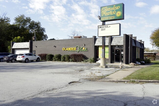
3433 W 159Th St
28-23-202-004-0000
H W Elmores Kedzie Ave Rdg
Taxexempt
Cook
X
Illinois
17031C0727J
4
2023
0.16 AC
2025
Near South Cook
825600
Chicago
2,360 SF
Chicago-Naperville-Elgin, IL-IN
DEMOGRAPHICS near 3433 W 159Th St
1 Mile
3 Mile
5 Mile
2024 Total Population
8,231
95,641
240,042
2029 Population
8,130
94,595
236,149
Pop Growth 2024-2029
(1.23%)
(1.09%)
(1.62%)
Average Age
38
39
40
2024 Total Households
2,638
33,465
89,177
HH Growth 2024-2029
(1.48%)
(1.30%)
(1.91%)
Median Household Inc
$47,373
$53,278
$60,500
Avg Household Size
2.90
2.70
2.60
2024 Avg HH Vehicles
2.00
2.00
2.00
Median Home Value
$101,591
$150,871
$168,921
Median Year Built
1962
1968
1968
Nearby Places
Map Layers
Map Styles
 Street
 Aerial
- Restaurants
- Banks
- Shops
- Fitness
- Groceries
PUBLIC TRANSPORTATION
COMMUTER RAIL
Oak Forest Station (Rock Island District Line - Northeast Illinois Regional Commuter Railroad (Metra))
DRIVE
WALK
Distance
Oak Forest Station (Rock Island District Line - Northeast Illinois Regional Commuter Railroad (Metra))
5 min
2.1 mi
Midlothian Station (Rock Island District Line - Northeast Illinois Regional Commuter Railroad (Metra))
DRIVE
WALK
Distance
Midlothian Station (Rock Island District Line - Northeast Illinois Regional Commuter Railroad (Metra))
6 min
2.9 mi
AIRPORT
Chicago Midway International
DRIVE
WALK
Distance
Chicago Midway International
27 min
15.7 mi
Chicago O'Hare International
DRIVE
WALK
Distance
Chicago O'Hare International
52 min
37.7 mi
Nearby Properties
Address
Land Use
TOTAL SIZE
Lot Size
Zoning
Address
Land Use
TOTAL SIZE
Lot Size
Zoning
1.45 AC
Address
Land Use
TOTAL SIZE
Lot Size
Zoning
Address
Land Use
TOTAL SIZE
Lot Size
Zoning
Address
Land Use
TOTAL SIZE
Lot Size
Zoning
44,184 SF
5 AC
Address
Land Use
TOTAL SIZE
Lot Size
Zoning
203,995 SF
20.27 AC
Address
Land Use
TOTAL SIZE
Lot Size
Zoning
0.98 AC
Address
Land Use
TOTAL SIZE
Lot Size
Zoning
62,380 SF
4.65 AC
Address
Land Use
TOTAL SIZE
Lot Size
Zoning
Address
Land Use
TOTAL SIZE
Lot Size
Zoning
Address
Land Use
TOTAL SIZE
Lot Size
Zoning
49,229 SF
1.31 AC
Address
Land Use
TOTAL SIZE
Lot Size
Zoning
132,322 SF
2 AC
Address
Land Use
TOTAL SIZE
Lot Size
Zoning
Address
Land Use
TOTAL SIZE
Lot Size
Zoning
1.38 AC
Address
Land Use
TOTAL SIZE
Lot Size
Zoning
66,004 SF
7.47 AC
Address
Land Use
TOTAL SIZE
Lot Size
Zoning
90,184 SF
0.65 AC
Address
Land Use
TOTAL SIZE
Lot Size
Zoning
15,150 SF
1.64 AC
Address
Land Use
TOTAL SIZE
Lot Size
Zoning
20,579 SF
1.14 AC
Address
Land Use
TOTAL SIZE
Lot Size
Zoning
59,497 SF
5.10 AC
Address
Land Use
TOTAL SIZE
Lot Size
Zoning
5.42 AC
Address
Land Use
TOTAL SIZE
Lot Size
Zoning
185,463 SF
10.96 AC
Address
Land Use
TOTAL SIZE
Lot Size
Zoning
66,320 SF
12.11 AC
Address
Land Use
TOTAL SIZE
Lot Size
Zoning
90,220 SF
2.21 AC
Address
Land Use
TOTAL SIZE
Lot Size
Zoning
93,559 SF
9.97 AC
Address
Land Use
TOTAL SIZE
Lot Size
Zoning
68,208 SF
1.28 AC
Address
Land Use
TOTAL SIZE
Lot Size
Zoning
2,320 SF
18 AC
Address
Land Use
TOTAL SIZE
Lot Size
Zoning
36,920 SF
14.86 AC
Address
Land Use
TOTAL SIZE
Lot Size
Zoning
28.54 AC
Address
Land Use
TOTAL SIZE
Lot Size
Zoning
Address
Land Use
TOTAL SIZE
Lot Size
Zoning
6,990 SF
0.68 AC
The World's #1 Commercial Real Estate Marketplace
Connect with us
© 2026 CoStar Group
The information above has been obtained from sources believed reliable. While we do not doubt its accuracy we have not verified it and make no guarantee, warranty or representation about it. It is your responsibility to independently confirm its accuracy and completeness. Any projections, opinions, assumptions, or estimates used are for example only and do not represent the current or future performance of the property. The value of this transaction to you depends on tax and other factors which should be evaluated by your tax, financial, and legal advisors. You and your advisors should conduct a careful, independent investigation of the property to determine to your satisfaction the suitability of the property for your needs.