Property Record
3434 Carr Rd, Durham, NC 27703
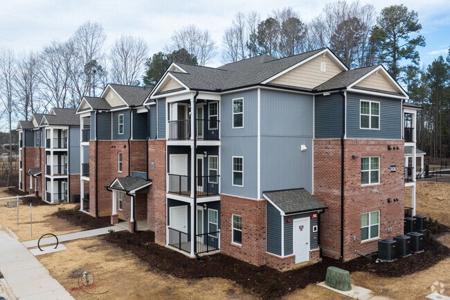

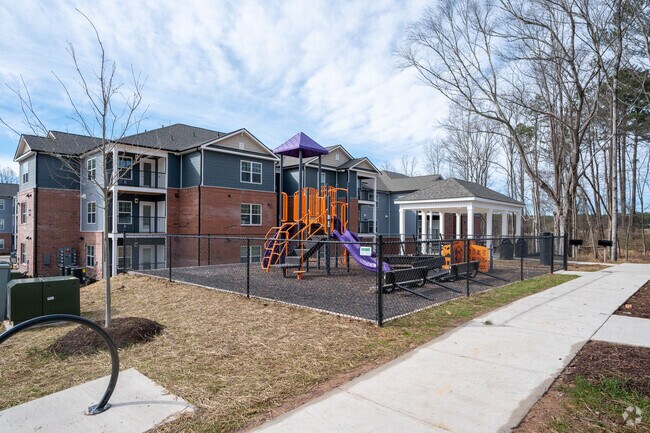
Property Detail
3434 Carr Rd
Durham-Chapel Hill, NC
PROP-EAO, LLC PL:208-114
235057
DURHAM
Commercialacreage
North Carolina
RS-M(D)
15.47 AC
2025
Eastern Durham
2025
Raleigh/Durham
001808
NEARBY LISTINGS FOR SALE OR LEASE
-
-
View all Durham listings for sale on LoopNet.com
DEMOGRAPHICS near 3434 Carr Rd
1 mile
3 mile
5 mile
2025 Total Population
9,536
76,876
172,471
2030 Population
10,197
82,191
183,821
Pop Growth 2025-2030
+ 6.93%
+ 6.91%
+ 6.58%
Average Age
36
36
37
2025 Total Households
3,246
28,504
68,221
HH Growth 2025-2030
+ 7.21%
+ 7.37%
+ 7.05%
Median Household Inc
$64,859
$72,664
$74,967
Avg Household Size
2.80
2.50
2.30
2025 Avg HH Vehicles
2.00
2.00
2.00
Median Home Value
$286,223
$352,143
$392,803
Median Year Built
1987
1993
1992
Nearby Places
Map Layers
Map Styles
 Street
 Aerial
Transit
 Traffic
 Biking
Places
Listings with unknown addresses are not visible on the map
- Restaurants
- Banks
- Shops
- Fitness
- Groceries
PUBLIC TRANSPORTATION
COMMUTER RAIL
Durham Amtrak Station (Carolinian - Amtrak, Piedmont - Amtrak)
Drive
Walk
Distance
Durham Amtrak Station (Carolinian - Amtrak, Piedmont - Amtrak)
9 min
3.8 mi
AIRPORT
Raleigh-Durham International
Drive
Walk
Distance
Raleigh-Durham International
18 min
10.6 mi
Freight Ports
Virginia Port Authority - Richmond
Drive
Walk
Distance
Virginia Port Authority - Richmond
166 min
146.1 mi
Nearby Properties
Address
Land Use
TOTAL SIZE
Lot Size
Zoning
Address
Land Use
TOTAL SIZE
Lot Size
Zoning
839,237 SF
9.84 AC
DD-C
Address
Land Use
TOTAL SIZE
Lot Size
Zoning
29.13 AC
CG(D)
Address
Land Use
TOTAL SIZE
Lot Size
Zoning
310,825 SF
3.20 AC
DD-C
Address
Land Use
TOTAL SIZE
Lot Size
Zoning
3.38 AC
DD-C
Address
Land Use
TOTAL SIZE
Lot Size
Zoning
171,375 SF
3.80 AC
DD-C
Address
Land Use
TOTAL SIZE
Lot Size
Zoning
230,275 SF
2.12 AC
DD-C
Address
Land Use
TOTAL SIZE
Lot Size
Zoning
2,922 SF
30.57 AC
PDR 4.840
Address
Land Use
TOTAL SIZE
Lot Size
Zoning
21.29 AC
CG(D)
Address
Land Use
TOTAL SIZE
Lot Size
Zoning
265,592 SF
2.04 AC
DD-C
Address
Land Use
TOTAL SIZE
Lot Size
Zoning
262,593 SF
2.73 AC
DD-C
Address
Land Use
TOTAL SIZE
Lot Size
Zoning
410,000 SF
31.41 AC
IL
Address
Land Use
TOTAL SIZE
Lot Size
Zoning
28,632 SF
23.64 AC
PDR 3.990
Address
Land Use
TOTAL SIZE
Lot Size
Zoning
144,812 SF
1.44 AC
DD-C
Address
Land Use
TOTAL SIZE
Lot Size
Zoning
10,572 SF
27.56 AC
RS-M(D)
Address
Land Use
TOTAL SIZE
Lot Size
Zoning
5,184 SF
42.28 AC
OI(D)
Address
Land Use
TOTAL SIZE
Lot Size
Zoning
1,524 SF
11.97 AC
CG(D)
Address
Land Use
TOTAL SIZE
Lot Size
Zoning
260,000 SF
35.58 AC
I,IL
Address
Land Use
TOTAL SIZE
Lot Size
Zoning
40.81 AC
IL
Address
Land Use
TOTAL SIZE
Lot Size
Zoning
103,784 SF
0.84 AC
Address
Land Use
TOTAL SIZE
Lot Size
Zoning
305,872 SF
4.51 AC
DD-S1
Address
Land Use
TOTAL SIZE
Lot Size
Zoning
303,996 SF
0.98 AC
DD-S1
Address
Land Use
TOTAL SIZE
Lot Size
Zoning
11,520 SF
1.18 AC
DD-S1
Address
Land Use
TOTAL SIZE
Lot Size
Zoning
293,502 SF
1.46 AC
DD-C
Address
Land Use
TOTAL SIZE
Lot Size
Zoning
274,399 SF
19.36 AC
IL
Address
Land Use
TOTAL SIZE
Lot Size
Zoning
131,100 SF
2.19 AC
DD-C
Address
Land Use
TOTAL SIZE
Lot Size
Zoning
69,258 SF
8.82 AC
DD-S1,DD-S
Address
Land Use
TOTAL SIZE
Lot Size
Zoning
183,892 SF
1.13 AC
DD-C
Address
Land Use
TOTAL SIZE
Lot Size
Zoning
167,337 SF
2.05 AC
DD-C
Address
Land Use
TOTAL SIZE
Lot Size
Zoning
150,752 SF
1.48 AC
DD-C
The World's #1 Commercial Real Estate Marketplace
Connect with us
© 2026 CoStar Group
The information above has been obtained from sources believed reliable. While we do not doubt its accuracy we have not verified it and make no guarantee, warranty or representation about it. It is your responsibility to independently confirm its accuracy and completeness. Any projections, opinions, assumptions, or estimates used are for example only and do not represent the current or future performance of the property. The value of this transaction to you depends on tax and other factors which should be evaluated by your tax, financial, and legal advisors. You and your advisors should conduct a careful, independent investigation of the property to determine to your satisfaction the suitability of the property for your needs.