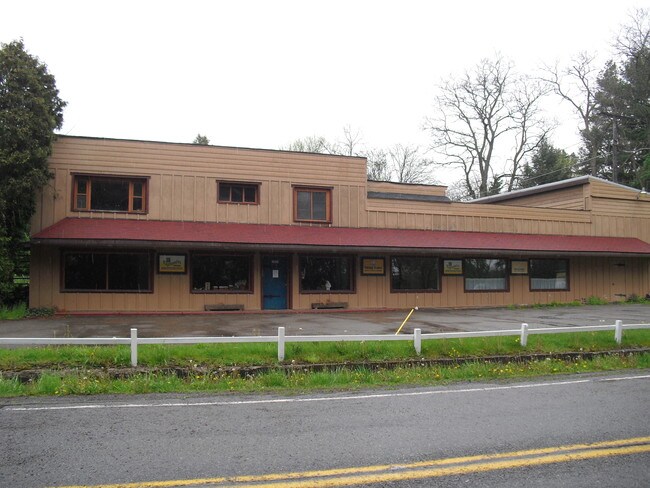
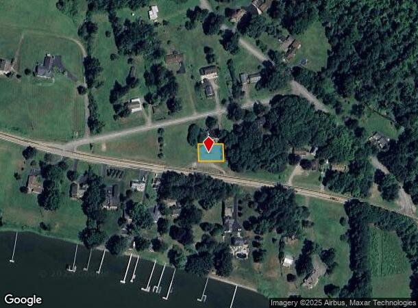
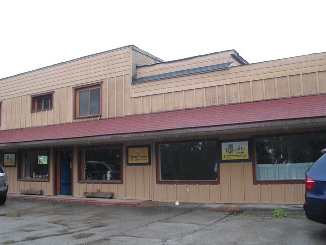
Property Record
3434 Route 430, Bemus Point, NY 14712
NEARBY LISTINGS FOR SALE OR LEASE
-
-
View all Bemus Point listings for sale on LoopNet.com
Property Detail
3434 Route 430
Jamestown-Dunkirk-Fredonia, NY
VIKING TRADER; OLD APN: 063689 38-1-4
063689-351-017-0001-004-000
Chautauqua
Residentialacreage
New York
2025
4.000
2024
0.16 AC
036902
Other Market Areas
DEMOGRAPHICS near 3434 Route 430
1 Mile
3 Mile
5 Mile
2024 Total Population
388
7,451
17,907
2029 Population
396
7,603
17,891
Pop Growth 2024-2029
+ 2.06%
+ 2.04%
(0.09%)
Average Age
49
47
46
2024 Total Households
171
3,373
7,912
HH Growth 2024-2029
+ 1.75%
+ 1.99%
(0.13%)
Median Household Inc
$61,607
$57,080
$55,895
Avg Household Size
2.20
2.20
2.20
2024 Avg HH Vehicles
2.00
2.00
2.00
Median Home Value
$202,564
$153,567
$130,236
Median Year Built
1957
1962
1958
Nearby Places
- Restaurants
- Banks
- Shops
- Fitness
- Groceries
Nearby Properties
Address
Land Use
TOTAL SIZE
Lot Size
Zoning
Address
Land Use
TOTAL SIZE
Lot Size
Zoning
68,967 SF
3.80 AC
05 - COMME
Address
Land Use
TOTAL SIZE
Lot Size
Zoning
90,334 SF
54.50 AC
04 - FARM
Address
Land Use
TOTAL SIZE
Lot Size
Zoning
43,346 SF
15.10 AC
04 - FARM
Address
Land Use
TOTAL SIZE
Lot Size
Zoning
82,116 SF
6.55 AC
05 - COMME
Address
Land Use
TOTAL SIZE
Lot Size
Zoning
2,484 SF
62.50 AC
04 - FARM
Address
Land Use
TOTAL SIZE
Lot Size
Zoning
26,750 SF
10.70 AC
06 - INDUS
Address
Land Use
TOTAL SIZE
Lot Size
Zoning
23,127 SF
6.20 AC
05 - COMME
Address
Land Use
TOTAL SIZE
Lot Size
Zoning
20,476 SF
2.20 AC
05 - COMME
Address
Land Use
TOTAL SIZE
Lot Size
Zoning
910 SF
20.20 AC
05 - COMME
Address
Land Use
TOTAL SIZE
Lot Size
Zoning
51,000 SF
12.28 AC
05 - COMME
Address
Land Use
TOTAL SIZE
Lot Size
Zoning
14,902 SF
10.70 AC
02 - SINGL
Address
Land Use
TOTAL SIZE
Lot Size
Zoning
15,280 SF
5.24 AC
05 - COMME
Address
Land Use
TOTAL SIZE
Lot Size
Zoning
7,511 SF
3.13 AC
02 - SINGL
Address
Land Use
TOTAL SIZE
Lot Size
Zoning
41,240 SF
1.80 AC
05 - COMME
Address
Land Use
TOTAL SIZE
Lot Size
Zoning
16,129 SF
1.50 AC
05 - COMME
Address
Land Use
TOTAL SIZE
Lot Size
Zoning
40,164 SF
10.50 AC
06 - INDUS
Address
Land Use
TOTAL SIZE
Lot Size
Zoning
6,543 SF
0.38 AC
02 - SINGL
Address
Land Use
TOTAL SIZE
Lot Size
Zoning
8,102 SF
2.70 AC
05 - COMME
Address
Land Use
TOTAL SIZE
Lot Size
Zoning
92,721 SF
5.10 AC
05 - COMME
Address
Land Use
TOTAL SIZE
Lot Size
Zoning
7,515 SF
1.10 AC
05 - COMME
Address
Land Use
TOTAL SIZE
Lot Size
Zoning
87,100 SF
4.80 AC
06 - INDUS
Address
Land Use
TOTAL SIZE
Lot Size
Zoning
19,097 SF
4.20 AC
02 - SINGL
Address
Land Use
TOTAL SIZE
Lot Size
Zoning
10,000 SF
0.34 AC
02 - SINGL
Address
Land Use
TOTAL SIZE
Lot Size
Zoning
6,746 SF
1 AC
05 - COMME
Address
Land Use
TOTAL SIZE
Lot Size
Zoning
87,226 SF
3.10 AC
06 - INDUS
Address
Land Use
TOTAL SIZE
Lot Size
Zoning
5,188 SF
0.90 AC
05 - COMME
Address
Land Use
TOTAL SIZE
Lot Size
Zoning
8 AC
07 - MIXED
Address
Land Use
TOTAL SIZE
Lot Size
Zoning
5,460 SF
1.30 AC
05 - COMME
Address
Land Use
TOTAL SIZE
Lot Size
Zoning
4,397 SF
0.10 AC
02 - SINGL
Address
Land Use
TOTAL SIZE
Lot Size
Zoning
6,409 SF
1.20 AC
05 - COMME
The World's #1 Commercial Real Estate Marketplace
Connect with us
© 2025 CoStar Group
The information above has been obtained from sources believed reliable. While we do not doubt its accuracy we have not verified it and make no guarantee, warranty or representation about it. It is your responsibility to independently confirm its accuracy and completeness. Any projections, opinions, assumptions, or estimates used are for example only and do not represent the current or future performance of the property. The value of this transaction to you depends on tax and other factors which should be evaluated by your tax, financial, and legal advisors. You and your advisors should conduct a careful, independent investigation of the property to determine to your satisfaction the suitability of the property for your needs.