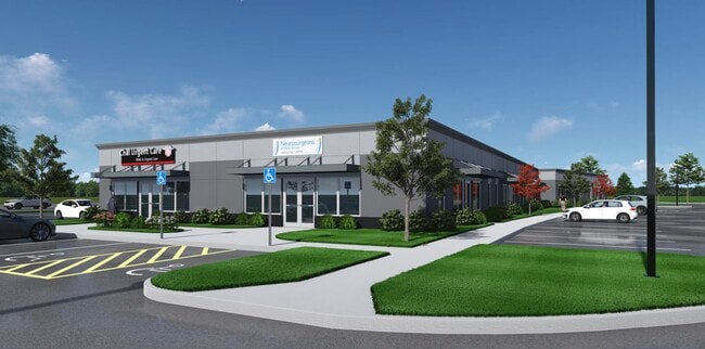
Property Record
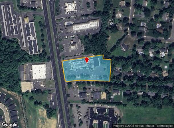
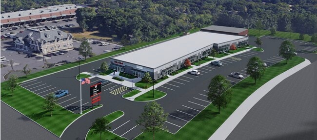
3435 Us Highway 9, Freehold, NJ 07728

NEARBY LISTINGS FOR SALE OR LEASE
Property Detail
3435 Us Highway 9
17-00080-0000-00042
Darby Corp
Officebuilding
Monmouth
X
New Jersey
34025C0282F
42
2024
2.59 AC
2025
Western Monmouth
810501
Northern New Jersey
21,400 SF
New York-Jersey City-White Plains, NY-NJ
DEMOGRAPHICS near 3435 Us Highway 9
1 Mile
3 Mile
5 Mile
2024 Total Population
5,589
46,200
81,398
2029 Population
5,487
45,540
80,478
Pop Growth 2024-2029
(1.83%)
(1.43%)
(1.13%)
Average Age
41
42
42
2024 Total Households
1,894
17,139
28,776
HH Growth 2024-2029
(2.11%)
(1.64%)
(1.34%)
Median Household Inc
$137,147
$96,874
$119,021
Avg Household Size
2.80
2.60
2.70
2024 Avg HH Vehicles
2.00
2.00
2.00
Median Home Value
$504,362
$426,360
$496,926
Median Year Built
1968
1981
1984
Nearby Places
Map Layers
Map Styles
 Street
 Aerial
- Restaurants
- Banks
- Shops
- Fitness
- Groceries
PUBLIC TRANSPORTATION
AIRPORT
Trenton Mercer
DRIVE
WALK
Distance
Trenton Mercer
53 min
36.8 mi
Freight Ports
New York Container Terminal
DRIVE
WALK
Distance
New York Container Terminal
46 min
34.6 mi
SALE & LEASE HISTORY
LISTING DATE
SALE/LEASE

Nov 30, 2016
For Sale
Nov 22, 2024
For Sale
May 24, 2022
For Lease
Mar 21, 2018
For Lease
Aug 20, 2018
For Sale
Aug 20, 2018
For Lease
Apr 23, 2020
For Lease
Nearby Properties
Address
Land Use
TOTAL SIZE
Lot Size
Zoning
Address
Land Use
TOTAL SIZE
Lot Size
Zoning
825,686 SF
151.47 AC
575
Address
Land Use
TOTAL SIZE
Lot Size
Zoning
52.16 AC
H-1
Address
Land Use
TOTAL SIZE
Lot Size
Zoning
4,649 SF
40.27 AC
ML-7
Address
Land Use
TOTAL SIZE
Lot Size
Zoning
904,310 SF
85.13 AC
M2M1
Address
Land Use
TOTAL SIZE
Lot Size
Zoning
36.48 AC
HD-2
Address
Land Use
TOTAL SIZE
Lot Size
Zoning
285,037 SF
40.82 AC
H-1
Address
Land Use
TOTAL SIZE
Lot Size
Zoning
15.69 AC
HMUD
Address
Land Use
TOTAL SIZE
Lot Size
Zoning
267,666 SF
29.06 AC
M-1
Address
Land Use
TOTAL SIZE
Lot Size
Zoning
73,884 SF
37.60 AC
R-40
Address
Land Use
TOTAL SIZE
Lot Size
Zoning
114,738 SF
19.02 AC
M-1
Address
Land Use
TOTAL SIZE
Lot Size
Zoning
182.80 AC
R-E
Address
Land Use
TOTAL SIZE
Lot Size
Zoning
241,399 SF
69.89 AC
R-40
Address
Land Use
TOTAL SIZE
Lot Size
Zoning
42,982 SF
118.30 AC
R-40
Address
Land Use
TOTAL SIZE
Lot Size
Zoning
2.91 AC
RCR
Address
Land Use
TOTAL SIZE
Lot Size
Zoning
278,199 SF
6.92 AC
R-10
Address
Land Use
TOTAL SIZE
Lot Size
Zoning
157.22 AC
R-E
Address
Land Use
TOTAL SIZE
Lot Size
Zoning
246,459 SF
60.38 AC
ROL
Address
Land Use
TOTAL SIZE
Lot Size
Zoning
81,690 SF
42.46 AC
RMZ-
Address
Land Use
TOTAL SIZE
Lot Size
Zoning
13,730 SF
19.29 AC
CM-3
Address
Land Use
TOTAL SIZE
Lot Size
Zoning
19.02 AC
HD
Address
Land Use
TOTAL SIZE
Lot Size
Zoning
176,661 SF
13.04 AC
OB01
Address
Land Use
TOTAL SIZE
Lot Size
Zoning
138.38 AC
R-E
Address
Land Use
TOTAL SIZE
Lot Size
Zoning
82,872 SF
25.58 AC
B-10
Address
Land Use
TOTAL SIZE
Lot Size
Zoning
21 AC
R-40
Address
Land Use
TOTAL SIZE
Lot Size
Zoning
23,260 SF
17.90 AC
B-10
Address
Land Use
TOTAL SIZE
Lot Size
Zoning
200,294 SF
12 AC
R10
Address
Land Use
TOTAL SIZE
Lot Size
Zoning
12.15 AC
P-1
Address
Land Use
TOTAL SIZE
Lot Size
Zoning
7,112 SF
10.01 AC
CM3A
Address
Land Use
TOTAL SIZE
Lot Size
Zoning
13.21 AC
OB01
Address
Land Use
TOTAL SIZE
Lot Size
Zoning
185,237 SF
20.18 AC
VC
The World's #1 Commercial Real Estate Marketplace
Connect with us
© 2025 CoStar Group
The information above has been obtained from sources believed reliable. While we do not doubt its accuracy we have not verified it and make no guarantee, warranty or representation about it. It is your responsibility to independently confirm its accuracy and completeness. Any projections, opinions, assumptions, or estimates used are for example only and do not represent the current or future performance of the property. The value of this transaction to you depends on tax and other factors which should be evaluated by your tax, financial, and legal advisors. You and your advisors should conduct a careful, independent investigation of the property to determine to your satisfaction the suitability of the property for your needs.