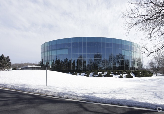
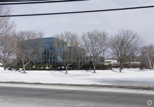
Property Record
344 Route 9W, Glenmont, NY 12077
NEARBY LISTINGS FOR SALE OR LEASE
Property Detail
344 Route 9W
Albany-Schenectady-Troy, NY
Glenmont
012200-097-012-0002-001-000-0000
PARCEL 1 GLENMONT
Officebuilding
Albany
X
New York
36001C0306D
1.000
2025
14 AC
2024
W Outer Albany County
014201
Albany/Schenectady/Troy
30,459 SF
DEMOGRAPHICS near 344 Route 9W
1 Mile
3 Mile
5 Mile
2024 Total Population
3,021
38,296
138,547
2029 Population
3,017
37,774
136,930
Pop Growth 2024-2029
(0.13%)
(1.36%)
(1.17%)
Average Age
42
41
39
2024 Total Households
1,230
15,639
60,652
HH Growth 2024-2029
(0.16%)
(1.39%)
(1.18%)
Median Household Inc
$104,674
$81,740
$68,105
Avg Household Size
2.40
2.30
2.10
2024 Avg HH Vehicles
2.00
2.00
1.00
Median Home Value
$307,668
$259,566
$247,157
Median Year Built
1982
1959
1956
Nearby Places
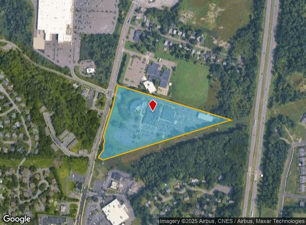
Map Layers
Map Styles
 Street
 Aerial
- Restaurants
- Banks
- Shops
- Fitness
- Groceries
PUBLIC TRANSPORTATION
COMMUTER RAIL
DRIVE
WALK
Distance
12 min
4.8 mi
AIRPORT
Albany International
DRIVE
WALK
Distance
Albany International
27 min
14.6 mi
Freight Ports
Albany, NY Port
DRIVE
WALK
Distance
Albany, NY Port
8 min
3.1 mi
Nearby Properties
Address
Land Use
TOTAL SIZE
Lot Size
Zoning
Address
Land Use
TOTAL SIZE
Lot Size
Zoning
33.88 AC
I2
Address
Land Use
TOTAL SIZE
Lot Size
Zoning
83.50 AC
Address
Land Use
TOTAL SIZE
Lot Size
Zoning
133,984 SF
205.20 AC
C2
Address
Land Use
TOTAL SIZE
Lot Size
Zoning
191.95 AC
LC
Address
Land Use
TOTAL SIZE
Lot Size
Zoning
5,248 SF
200.90 AC
LC
Address
Land Use
TOTAL SIZE
Lot Size
Zoning
78,458 SF
28.70 AC
R1B
Address
Land Use
TOTAL SIZE
Lot Size
Zoning
104,077 SF
6.64 AC
B-2
Address
Land Use
TOTAL SIZE
Lot Size
Zoning
161,972 SF
26.62 AC
OI
Address
Land Use
TOTAL SIZE
Lot Size
Zoning
171,096 SF
18.04 AC
B-2
Address
Land Use
TOTAL SIZE
Lot Size
Zoning
5,776 SF
90.90 AC
M1
Address
Land Use
TOTAL SIZE
Lot Size
Zoning
17,440 SF
4.10 AC
R2A
Address
Land Use
TOTAL SIZE
Lot Size
Zoning
96,554 SF
18.50 AC
R1B
Address
Land Use
TOTAL SIZE
Lot Size
Zoning
73,458 SF
7.90 AC
CO
Address
Land Use
TOTAL SIZE
Lot Size
Zoning
27,612 SF
11.60 AC
M1
Address
Land Use
TOTAL SIZE
Lot Size
Zoning
100,176 SF
3.23 AC
C1
Address
Land Use
TOTAL SIZE
Lot Size
Zoning
20.10 AC
M1
Address
Land Use
TOTAL SIZE
Lot Size
Zoning
203,781 SF
39.30 AC
C
Address
Land Use
TOTAL SIZE
Lot Size
Zoning
0.01 AC
I
Address
Land Use
TOTAL SIZE
Lot Size
Zoning
40,888 SF
31.40 AC
M1
Address
Land Use
TOTAL SIZE
Lot Size
Zoning
115,428 SF
5.90 AC
R3B
Address
Land Use
TOTAL SIZE
Lot Size
Zoning
44,572 SF
2.80 AC
CO
Address
Land Use
TOTAL SIZE
Lot Size
Zoning
260,120 SF
9 AC
CO
Address
Land Use
TOTAL SIZE
Lot Size
Zoning
63,306 SF
2.81 AC
CO
Address
Land Use
TOTAL SIZE
Lot Size
Zoning
204,860 SF
26.40 AC
CR
Address
Land Use
TOTAL SIZE
Lot Size
Zoning
57,830 SF
2.10 AC
CO
Address
Land Use
TOTAL SIZE
Lot Size
Zoning
83,312 SF
0.68 AC
CM
Address
Land Use
TOTAL SIZE
Lot Size
Zoning
45,898 SF
12.91 AC
CH
Address
Land Use
TOTAL SIZE
Lot Size
Zoning
36,046 SF
10.79 AC
R2A
Address
Land Use
TOTAL SIZE
Lot Size
Zoning
57,691 SF
19.70 AC
CO
Address
Land Use
TOTAL SIZE
Lot Size
Zoning
53.70 AC
R2B
The World's #1 Commercial Real Estate Marketplace
Connect with us
© 2026 CoStar Group
The information above has been obtained from sources believed reliable. While we do not doubt its accuracy we have not verified it and make no guarantee, warranty or representation about it. It is your responsibility to independently confirm its accuracy and completeness. Any projections, opinions, assumptions, or estimates used are for example only and do not represent the current or future performance of the property. The value of this transaction to you depends on tax and other factors which should be evaluated by your tax, financial, and legal advisors. You and your advisors should conduct a careful, independent investigation of the property to determine to your satisfaction the suitability of the property for your needs.