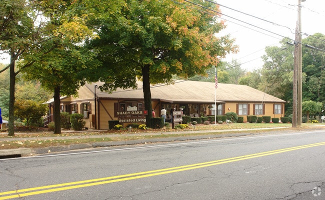
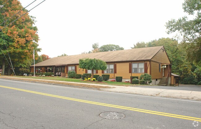
Property Record
344 Stevens St, Bristol, CT 06010

Property Detail
344 Stevens St
BRIS-000052-000000-000004-010707
Naugatuck Vly
Commercialnec
Connecticut
R-15
4-10707
B and X Area of moderate flood hazard, usually the area between the limits of the 100-year and 500-year floods.
1.71 AC
2025
Southwest Outlying
2025
Hartford
406001
Hartford-West Hartford-East Hartford, CT
15,152 SF
NEARBY LISTINGS FOR SALE OR LEASE
-
-
View all Bristol listings for sale on LoopNet.com
DEMOGRAPHICS near 344 Stevens St
1 mile
3 mile
5 mile
2025 Total Population
6,897
50,103
112,590
2030 Population
7,041
51,306
115,351
Pop Growth 2025-2030
+ 2.09%
+ 2.40%
+ 2.45%
Average Age
44
43
42
2025 Total Households
2,786
20,511
47,337
HH Growth 2025-2030
+ 2.08%
+ 2.43%
+ 2.49%
Median Household Inc
$90,624
$91,653
$90,591
Avg Household Size
2.40
2.40
2.30
2025 Avg HH Vehicles
2.00
2.00
2.00
Median Home Value
$309,048
$313,263
$311,385
Median Year Built
1967
1968
1971
Nearby Places
Map Layers
Map Styles
 Street
 Aerial
Layers
 Traffic
 Biking
Places
Listings with unknown addresses are not visible on the map
- Restaurants
- Banks
- Shops
- Fitness
- Groceries
PUBLIC TRANSPORTATION
AIRPORT
Bradley International
Drive
Walk
Distance
Bradley International
50 min
31.1 mi
Tweed/New Haven
Drive
Walk
Distance
Tweed/New Haven
55 min
34.7 mi
Freight Ports
Port of New Haven
Drive
Walk
Distance
Port of New Haven
50 min
32.1 mi
Nearby Properties
Address
Land Use
TOTAL SIZE
Lot Size
Zoning
Address
Land Use
TOTAL SIZE
Lot Size
Zoning
268,369 SF
13.32 AC
B1
Address
Land Use
TOTAL SIZE
Lot Size
Zoning
349,054 SF
12.03 AC
R-15
Address
Land Use
TOTAL SIZE
Lot Size
Zoning
137,242 SF
25.80 AC
R40
Address
Land Use
TOTAL SIZE
Lot Size
Zoning
48.09 AC
CR
Address
Land Use
TOTAL SIZE
Lot Size
Zoning
12,892 SF
20.91 AC
A
Address
Land Use
TOTAL SIZE
Lot Size
Zoning
56,184 SF
19.42 AC
BG
Address
Land Use
TOTAL SIZE
Lot Size
Zoning
24.61 AC
CR
Address
Land Use
TOTAL SIZE
Lot Size
Zoning
199,744 SF
44.70 AC
R-15
Address
Land Use
TOTAL SIZE
Lot Size
Zoning
169,727 SF
23.90 AC
R-25
Address
Land Use
TOTAL SIZE
Lot Size
Zoning
54,904 SF
7.01 AC
A
Address
Land Use
TOTAL SIZE
Lot Size
Zoning
133,673 SF
30.40 AC
R-40
Address
Land Use
TOTAL SIZE
Lot Size
Zoning
4,000 SF
13.78 AC
BG
Address
Land Use
TOTAL SIZE
Lot Size
Zoning
1,700 SF
38.81 AC
A
Address
Land Use
TOTAL SIZE
Lot Size
Zoning
29.05 AC
R-20
Address
Land Use
TOTAL SIZE
Lot Size
Zoning
46,768 SF
40.04 AC
R40
Address
Land Use
TOTAL SIZE
Lot Size
Zoning
143,315 SF
4.50 AC
A
Address
Land Use
TOTAL SIZE
Lot Size
Zoning
42,516 SF
10.40 AC
BG
Address
Land Use
TOTAL SIZE
Lot Size
Zoning
168,296 SF
17.94 AC
C1
Address
Land Use
TOTAL SIZE
Lot Size
Zoning
41,011 SF
8.50 AC
BG
Address
Land Use
TOTAL SIZE
Lot Size
Zoning
118,573 SF
9.75 AC
BG
Address
Land Use
TOTAL SIZE
Lot Size
Zoning
99,576 SF
6.22 AC
CR
Address
Land Use
TOTAL SIZE
Lot Size
Zoning
147,132 SF
12.50 AC
BG
Address
Land Use
TOTAL SIZE
Lot Size
Zoning
52,128 SF
7.20 AC
A
Address
Land Use
TOTAL SIZE
Lot Size
Zoning
122,737 SF
17.20 AC
BG
Address
Land Use
TOTAL SIZE
Lot Size
Zoning
4,209 SF
14.60 AC
A
Address
Land Use
TOTAL SIZE
Lot Size
Zoning
60,935 SF
0.92 AC
BD-1
Address
Land Use
TOTAL SIZE
Lot Size
Zoning
230.65 AC
CR
Address
Land Use
TOTAL SIZE
Lot Size
Zoning
71,531 SF
23.80 AC
R-15
Address
Land Use
TOTAL SIZE
Lot Size
Zoning
68,520 SF
2 AC
BD-1
Address
Land Use
TOTAL SIZE
Lot Size
Zoning
118,424 SF
13 AC
CR
The World's #1 Commercial Real Estate Marketplace
Connect with us
© 2026 CoStar Group
The information above has been obtained from sources believed reliable. While we do not doubt its accuracy we have not verified it and make no guarantee, warranty or representation about it. It is your responsibility to independently confirm its accuracy and completeness. Any projections, opinions, assumptions, or estimates used are for example only and do not represent the current or future performance of the property. The value of this transaction to you depends on tax and other factors which should be evaluated by your tax, financial, and legal advisors. You and your advisors should conduct a careful, independent investigation of the property to determine to your satisfaction the suitability of the property for your needs.