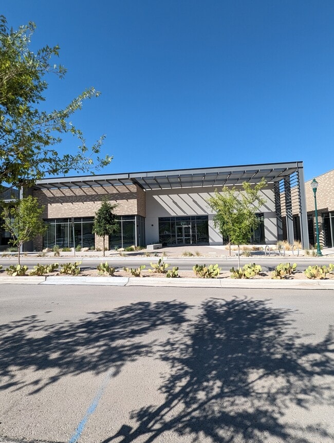
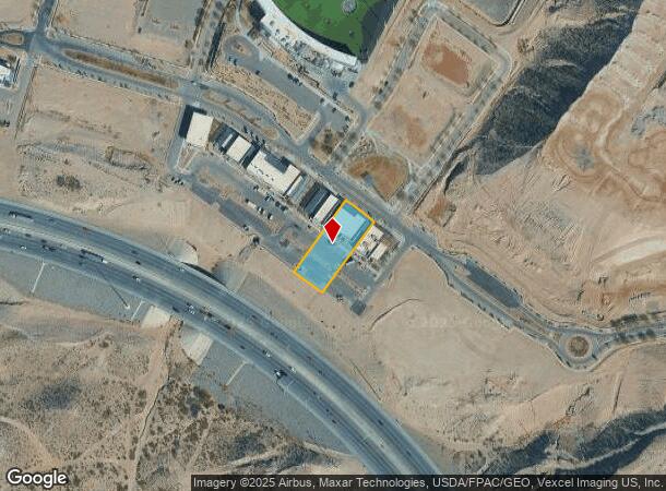
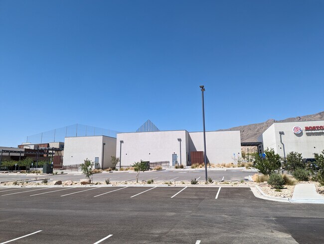
Property Record
344 Vin Rambla, El Paso, TX 79912
Current Lease Availabilities
NEARBY LISTINGS FOR SALE OR LEASE
Property Detail
344 Vin Rambla
El Paso
Montecillo #11 Replat B
El Paso, TX
BLK 43 MONTECILLO #11 REPLAT B LOT 14
M649-999-043B-1400
El Paso
Commercialnec
Texas
2024
14
2025
0.66 AC
001119
West
7,325 SF
DEMOGRAPHICS near 344 Vin Rambla
1 Mile
3 Mile
5 Mile
2024 Total Population
10,680
55,174
175,947
2029 Population
10,954
56,269
179,157
Pop Growth 2024-2029
+ 2.57%
+ 1.98%
+ 1.82%
Average Age
35
38
39
2024 Total Households
5,114
23,592
69,117
HH Growth 2024-2029
+ 1.99%
+ 1.89%
+ 1.88%
Median Household Inc
$39,756
$54,109
$46,616
Avg Household Size
2.10
2.20
2.40
2024 Avg HH Vehicles
1.00
2.00
2.00
Median Home Value
$168,065
$213,820
$185,304
Median Year Built
1987
1979
1976
Nearby Places
Map Layers
Map Styles
 Street
 Aerial
- Restaurants
- Banks
- Shops
- Fitness
- Groceries
PUBLIC TRANSPORTATION
AIRPORT
El Paso International
DRIVE
WALK
Distance
El Paso International
33 min
17.6 mi
Freight Ports
Port of Corpus Christi
DRIVE
WALK
Distance
Port of Corpus Christi
691 min
699.8 mi
Nearby Properties
Address
Land Use
TOTAL SIZE
Lot Size
Zoning
Address
Land Use
TOTAL SIZE
Lot Size
Zoning
1,387,028 SF
65.27 AC
R4
Address
Land Use
TOTAL SIZE
Lot Size
Zoning
859,302 SF
21.17 AC
C2
Address
Land Use
TOTAL SIZE
Lot Size
Zoning
439,669 SF
33.95 AC
A2
Address
Land Use
TOTAL SIZE
Lot Size
Zoning
248,997 SF
14.85 AC
C3S
Address
Land Use
TOTAL SIZE
Lot Size
Zoning
588,864 SF
27.37 AC
AO
Address
Land Use
TOTAL SIZE
Lot Size
Zoning
235,843 SF
11.55 AC
C1
Address
Land Use
TOTAL SIZE
Lot Size
Zoning
246,802 SF
11.08 AC
C3
Address
Land Use
TOTAL SIZE
Lot Size
Zoning
191,148 SF
20.29 AC
C3
Address
Land Use
TOTAL SIZE
Lot Size
Zoning
164,712 SF
4.68 AC
GM
Address
Land Use
TOTAL SIZE
Lot Size
Zoning
226,548 SF
18.50 AC
PR2
Address
Land Use
TOTAL SIZE
Lot Size
Zoning
185,273 SF
11.78 AC
C3S
Address
Land Use
TOTAL SIZE
Lot Size
Zoning
60,057 SF
7.22 AC
SCZ
Address
Land Use
TOTAL SIZE
Lot Size
Zoning
201,291 SF
43.23 AC
R3
Address
Land Use
TOTAL SIZE
Lot Size
Zoning
231,480 SF
12.77 AC
C4S
Address
Land Use
TOTAL SIZE
Lot Size
Zoning
173,552 SF
10.65 AC
A2S
Address
Land Use
TOTAL SIZE
Lot Size
Zoning
227,940 SF
16.41 AC
COP
Address
Land Use
TOTAL SIZE
Lot Size
Zoning
221,370 SF
0.73 AC
GMU
Address
Land Use
TOTAL SIZE
Lot Size
Zoning
119,020 SF
8.56 AC
C3S
Address
Land Use
TOTAL SIZE
Lot Size
Zoning
212,938 SF
9.38 AC
C1
Address
Land Use
TOTAL SIZE
Lot Size
Zoning
289,013 SF
6.84 AC
C3
Address
Land Use
TOTAL SIZE
Lot Size
Zoning
141,711 SF
4.50 AC
C2
Address
Land Use
TOTAL SIZE
Lot Size
Zoning
103,164 SF
4.05 AC
GMU
Address
Land Use
TOTAL SIZE
Lot Size
Zoning
112,692 SF
C4
Address
Land Use
TOTAL SIZE
Lot Size
Zoning
191,445 SF
9.95 AC
A3S
Address
Land Use
TOTAL SIZE
Lot Size
Zoning
640 AC
PMD
Address
Land Use
TOTAL SIZE
Lot Size
Zoning
212,174 SF
8.44 AC
A2S
Address
Land Use
TOTAL SIZE
Lot Size
Zoning
176,816 SF
11.49 AC
C1S
Address
Land Use
TOTAL SIZE
Lot Size
Zoning
110,530 SF
14.19 AC
C1
Address
Land Use
TOTAL SIZE
Lot Size
Zoning
156,261 SF
11.35 AC
C3S
Address
Land Use
TOTAL SIZE
Lot Size
Zoning
134,044 SF
12.04 AC
C3
The World's #1 Commercial Real Estate Marketplace
Connect with us
© 2026 CoStar Group
The information above has been obtained from sources believed reliable. While we do not doubt its accuracy we have not verified it and make no guarantee, warranty or representation about it. It is your responsibility to independently confirm its accuracy and completeness. Any projections, opinions, assumptions, or estimates used are for example only and do not represent the current or future performance of the property. The value of this transaction to you depends on tax and other factors which should be evaluated by your tax, financial, and legal advisors. You and your advisors should conduct a careful, independent investigation of the property to determine to your satisfaction the suitability of the property for your needs.