Property Record
3440 Ne 49Th Pl, Hillsboro, OR 97124

Property Detail
3440 Ne 49Th Pl
R2091144
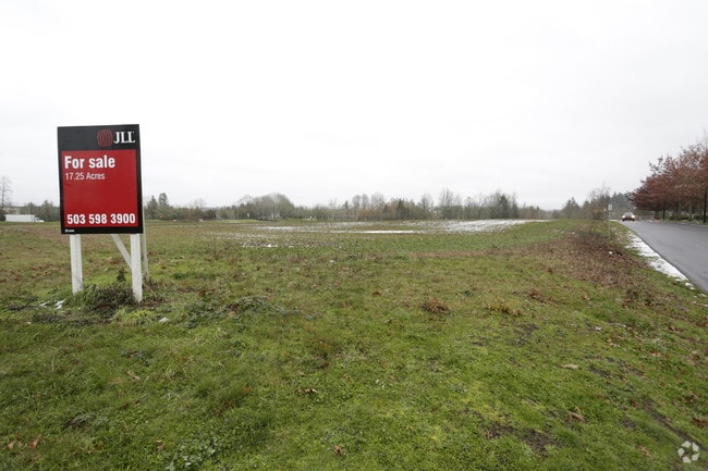
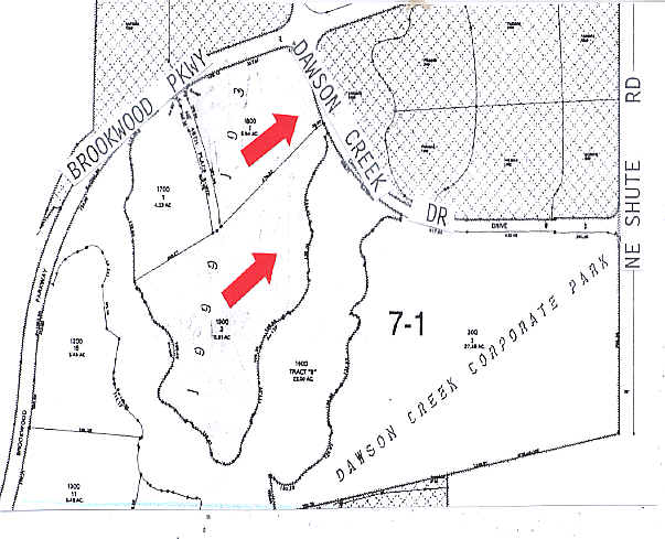
1999-103 PARTITION PLAT, LOT 2,3, ACRES 16.91, POTENTIAL ADDL TAX LIABILITY
Commercialbuilding
WASHINGTON
I-P
Oregon
B and X Area of moderate flood hazard, usually the area between the limits of the 100-year and 500-year floods.
2,3
2024
16.91 AC
2026
Sunset Corridor/Hillsboro
032608
Portland
526,204 SF
Portland-Vancouver-Hillsboro, OR-WA
NEARBY LISTINGS FOR SALE OR LEASE
DEMOGRAPHICS near 3440 Ne 49Th Pl
1 mile
3 mile
5 mile
2025 Total Population
2,541
92,025
208,152
2030 Population
2,569
92,779
210,796
Pop Growth 2025-2030
+ 1.10%
+ 0.82%
+ 1.27%
Average Age
41
38
38
2025 Total Households
1,136
35,437
77,713
HH Growth 2025-2030
+ 1.23%
+ 0.98%
+ 1.40%
Median Household Inc
$105,625
$105,155
$106,930
Avg Household Size
2.20
2.50
2.60
2025 Avg HH Vehicles
2.00
2.00
2.00
Median Home Value
$615,285
$573,601
$584,820
Median Year Built
1992
1995
1994
Nearby Places
Map Layers
Map Styles
 Street
 Aerial
Transit
 Traffic
 Biking
Places
Listings with unknown addresses are not visible on the map
- Restaurants
- Banks
- Shops
- Fitness
- Groceries
PUBLIC TRANSPORTATION
AIRPORT
Portland International
Drive
Walk
Distance
Portland International
43 min
27.4 mi
Freight Ports
Port of Portland
Drive
Walk
Distance
Port of Portland
26 min
16.4 mi
SALE & LEASE HISTORY
LISTING DATE
SALE/LEASE

Sep 24, 2016
For Sale
Nearby Properties
Address
Land Use
TOTAL SIZE
Lot Size
Zoning
Address
Land Use
TOTAL SIZE
Lot Size
Zoning
21.21 AC
I-P
Address
Land Use
TOTAL SIZE
Lot Size
Zoning
0.13 AC
I-P
Address
Land Use
TOTAL SIZE
Lot Size
Zoning
4,603 SF
90.28 AC
I-S
Address
Land Use
TOTAL SIZE
Lot Size
Zoning
337.91 AC
I-P
Address
Land Use
TOTAL SIZE
Lot Size
Zoning
14.02 AC
Address
Land Use
TOTAL SIZE
Lot Size
Zoning
1,619,885 SF
115.71 AC
I-P
Address
Land Use
TOTAL SIZE
Lot Size
Zoning
35.87 AC
SSID
Address
Land Use
TOTAL SIZE
Lot Size
Zoning
37.93 AC
I-S
Address
Land Use
TOTAL SIZE
Lot Size
Zoning
1,004,655 SF
24.55 AC
SCR-V
Address
Land Use
TOTAL SIZE
Lot Size
Zoning
3,126 SF
11.38 AC
FD-20
Address
Land Use
TOTAL SIZE
Lot Size
Zoning
47.85 AC
I-P
Address
Land Use
TOTAL SIZE
Lot Size
Zoning
Address
Land Use
TOTAL SIZE
Lot Size
Zoning
0.10 AC
IS
Address
Land Use
TOTAL SIZE
Lot Size
Zoning
2,016 SF
0.10 AC
I-S
Address
Land Use
TOTAL SIZE
Lot Size
Zoning
0.05 AC
I-S
Address
Land Use
TOTAL SIZE
Lot Size
Zoning
0.17 AC
I-P
Address
Land Use
TOTAL SIZE
Lot Size
Zoning
Address
Land Use
TOTAL SIZE
Lot Size
Zoning
292,000 SF
53.23 AC
I-G
Address
Land Use
TOTAL SIZE
Lot Size
Zoning
0.03 AC
I-P
Address
Land Use
TOTAL SIZE
Lot Size
Zoning
248,332 SF
4.26 AC
SCC-DT
Address
Land Use
TOTAL SIZE
Lot Size
Zoning
4,603 SF
0.09 AC
I-S
Address
Land Use
TOTAL SIZE
Lot Size
Zoning
316,321 SF
0.11 AC
I-P
Address
Land Use
TOTAL SIZE
Lot Size
Zoning
20.33 AC
I-S
Address
Land Use
TOTAL SIZE
Lot Size
Zoning
174,233 SF
14.74 AC
I-P
Address
Land Use
TOTAL SIZE
Lot Size
Zoning
791,581 SF
22.58 AC
MFR-3
Address
Land Use
TOTAL SIZE
Lot Size
Zoning
53.13 AC
SC-BP
Address
Land Use
TOTAL SIZE
Lot Size
Zoning
2,822 SF
13.23 AC
Address
Land Use
TOTAL SIZE
Lot Size
Zoning
53.49 AC
SCFI
Address
Land Use
TOTAL SIZE
Lot Size
Zoning
482,173 SF
14.99 AC
C-G
The World's #1 Commercial Real Estate Marketplace
Connect with us
© 2026 CoStar Group
The information above has been obtained from sources believed reliable. While we do not doubt its accuracy we have not verified it and make no guarantee, warranty or representation about it. It is your responsibility to independently confirm its accuracy and completeness. Any projections, opinions, assumptions, or estimates used are for example only and do not represent the current or future performance of the property. The value of this transaction to you depends on tax and other factors which should be evaluated by your tax, financial, and legal advisors. You and your advisors should conduct a careful, independent investigation of the property to determine to your satisfaction the suitability of the property for your needs.