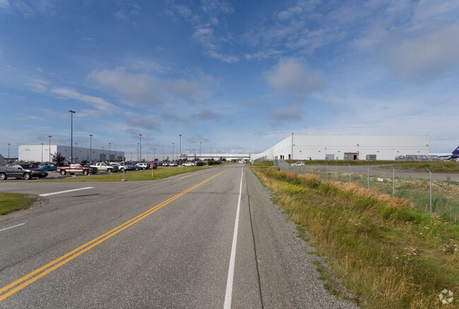
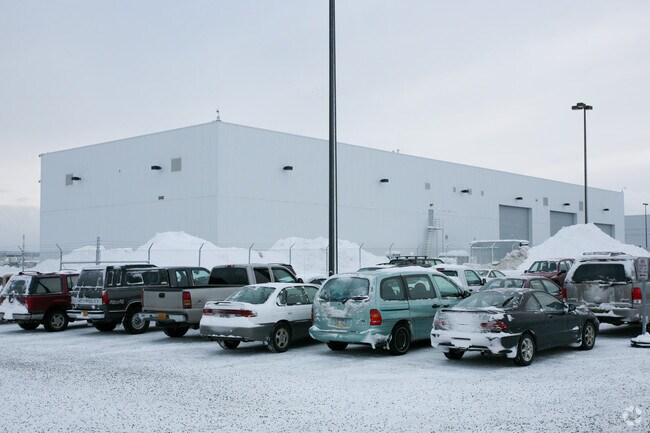
Property Record
3440 Postmark Dr, Anchorage, AK 99502

Property Detail
3440 Postmark Dr
01044101001
ADA 32416 INTL ARPT BLK 21 LT 1
Warehouse
ANCHORAGE
TR
Alaska
B and X Area of moderate flood hazard, usually the area between the limits of the 100-year and 500-year floods.
1
2024
63.70 AC
2025
Spenard-10
002304
Anchorage
91,034 SF
Anchorage, AK
NEARBY LISTINGS FOR SALE OR LEASE
DEMOGRAPHICS near 3440 Postmark Dr
1 mile
3 mile
5 mile
2025 Total Population
96
24,878
89,213
2030 Population
97
24,998
89,521
Pop Growth 2025-2030
+ 1.04%
+ 0.48%
+ 0.35%
Average Age
39
40
39
2025 Total Households
38
10,225
36,696
HH Growth 2025-2030
+ 2.63%
+ 0.52%
+ 0.38%
Median Household Inc
$143,749
$104,054
$93,979
Avg Household Size
2.30
2.30
2.30
2025 Avg HH Vehicles
2.00
2.00
2.00
Median Home Value
$325,000
$415,911
$388,411
Median Year Built
1983
1978
1978
Nearby Places
Map Layers
Map Styles
 Street
 Aerial
Transit
 Traffic
 Biking
Places
Listings with unknown addresses are not visible on the map
- Restaurants
- Banks
- Shops
- Fitness
- Groceries
PUBLIC TRANSPORTATION
AIRPORT
Ted Stevens Anchorage International
Drive
Walk
Distance
Ted Stevens Anchorage International
9 min
2.7 mi
Merrill Field
Drive
Walk
Distance
Merrill Field
22 min
9.6 mi
Freight Ports
Port of Anchorage
Drive
Walk
Distance
Port of Anchorage
22 min
9.7 mi
Nearby Properties
Address
Land Use
TOTAL SIZE
Lot Size
Zoning
Address
Land Use
TOTAL SIZE
Lot Size
Zoning
195,079 SF
44.79 AC
PLI
Address
Land Use
TOTAL SIZE
Lot Size
Zoning
191.79 AC
PLI
Address
Land Use
TOTAL SIZE
Lot Size
Zoning
65,314 SF
111.15 AC
PLI
Address
Land Use
TOTAL SIZE
Lot Size
Zoning
134.97 AC
TR
Address
Land Use
TOTAL SIZE
Lot Size
Zoning
341,267 SF
5.51 AC
TR
Address
Land Use
TOTAL SIZE
Lot Size
Zoning
79.26 AC
PLI
Address
Land Use
TOTAL SIZE
Lot Size
Zoning
103,442 SF
3.50 AC
B3
Address
Land Use
TOTAL SIZE
Lot Size
Zoning
3,813 SF
31.29 AC
PLIP
Address
Land Use
TOTAL SIZE
Lot Size
Zoning
97,524 SF
6.85 AC
TR
Address
Land Use
TOTAL SIZE
Lot Size
Zoning
45,105 SF
10.96 AC
B3
Address
Land Use
TOTAL SIZE
Lot Size
Zoning
Address
Land Use
TOTAL SIZE
Lot Size
Zoning
54,285 SF
3.47 AC
B3SL
Address
Land Use
TOTAL SIZE
Lot Size
Zoning
23,800 SF
20.01 AC
I2
Address
Land Use
TOTAL SIZE
Lot Size
Zoning
73,200 SF
11.19 AC
TR
Address
Land Use
TOTAL SIZE
Lot Size
Zoning
41,406 SF
4.20 AC
B3SL
Address
Land Use
TOTAL SIZE
Lot Size
Zoning
27,522 SF
3.49 AC
B3
Address
Land Use
TOTAL SIZE
Lot Size
Zoning
42,649 SF
2.15 AC
B3
Address
Land Use
TOTAL SIZE
Lot Size
Zoning
32,764 SF
2.24 AC
R4
Address
Land Use
TOTAL SIZE
Lot Size
Zoning
1,200 SF
20 AC
PLIP
Address
Land Use
TOTAL SIZE
Lot Size
Zoning
41,756 SF
6.78 AC
I1
Address
Land Use
TOTAL SIZE
Lot Size
Zoning
79,714 SF
10.66 AC
TR
Address
Land Use
TOTAL SIZE
Lot Size
Zoning
240 AC
PLI
Address
Land Use
TOTAL SIZE
Lot Size
Zoning
15,600 SF
3.44 AC
R3
Address
Land Use
TOTAL SIZE
Lot Size
Zoning
273,094 SF
22.69 AC
TR
Address
Land Use
TOTAL SIZE
Lot Size
Zoning
27,326 SF
10.93 AC
I1
Address
Land Use
TOTAL SIZE
Lot Size
Zoning
92,766 SF
7.61 AC
B3
Address
Land Use
TOTAL SIZE
Lot Size
Zoning
70,350 SF
8 AC
PLI
Address
Land Use
TOTAL SIZE
Lot Size
Zoning
63,164 SF
6.83 AC
RO
Address
Land Use
TOTAL SIZE
Lot Size
Zoning
10,680 SF
8.72 AC
PLI
The World's #1 Commercial Real Estate Marketplace
Connect with us
© 2026 CoStar Group
The information above has been obtained from sources believed reliable. While we do not doubt its accuracy we have not verified it and make no guarantee, warranty or representation about it. It is your responsibility to independently confirm its accuracy and completeness. Any projections, opinions, assumptions, or estimates used are for example only and do not represent the current or future performance of the property. The value of this transaction to you depends on tax and other factors which should be evaluated by your tax, financial, and legal advisors. You and your advisors should conduct a careful, independent investigation of the property to determine to your satisfaction the suitability of the property for your needs.