Property Record
3441 Route 9, Cold Spring, NY 10516
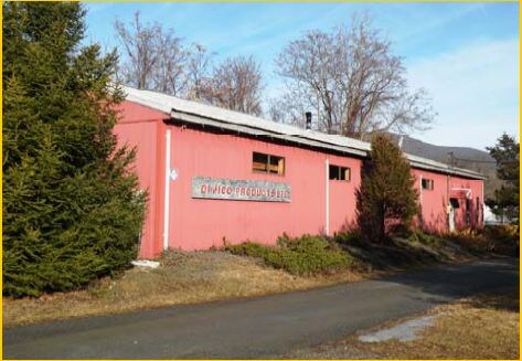


Property Detail
3441 Route 9
372689-016-016-0001-021-000-0000
LAND & COMM BLDG
Commercialnec
Putnam
I
New York
B and X Area of moderate flood hazard, usually the area between the limits of the 100-year and 500-year floods.
21.00
2024
1 AC
2025
Carmel
010600
Westchester/So Connecticut
5,000 SF
New York-Jersey City-White Plains, NY-NJ
NEARBY LISTINGS FOR SALE OR LEASE
DEMOGRAPHICS near 3441 Route 9
1 mile
3 mile
5 mile
2025 Total Population
1,007
8,472
39,891
2030 Population
1,021
8,473
40,153
Pop Growth 2025-2030
+ 1.39%
+ 0.01%
+ 0.66%
Average Age
47
44
44
2025 Total Households
407
3,446
16,454
HH Growth 2025-2030
+ 0.98%
(0.12%)
+ 0.63%
Median Household Inc
$145,689
$115,072
$98,016
Avg Household Size
2.40
2.40
2.20
2025 Avg HH Vehicles
2.00
2.00
2.00
Median Home Value
$717,948
$516,863
$471,276
Median Year Built
1980
1965
1974
Nearby Places
Map Layers
Map Styles
 Street
 Aerial
Layers
 Traffic
 Biking
Places
Listings with unknown addresses are not visible on the map
- Restaurants
- Banks
- Shops
- Fitness
- Groceries
PUBLIC TRANSPORTATION
COMMUTER RAIL
Breakneck Ridge Station (Hudson Line - Metro-North Commuter Railroad Company (Metro-North))
Drive
Walk
Distance
Breakneck Ridge Station (Hudson Line - Metro-North Commuter Railroad Company (Metro-North))
12 min
8.0 mi
Beacon Station (Hudson Line - Metro-North Commuter Railroad Company (Metro-North))
Drive
Walk
Distance
Beacon Station (Hudson Line - Metro-North Commuter Railroad Company (Metro-North))
14 min
10.0 mi
AIRPORT
New York Stewart International
Drive
Walk
Distance
New York Stewart International
28 min
18.5 mi
Freight Ports
Port of New Haven
Drive
Walk
Distance
Port of New Haven
95 min
70.6 mi
SALE & LEASE HISTORY
LISTING DATE
SALE/LEASE

Sep 25, 2016
For Lease
Sep 23, 2016
For Sale
Nearby Properties
Address
Land Use
TOTAL SIZE
Lot Size
Zoning
Address
Land Use
TOTAL SIZE
Lot Size
Zoning
36.65 AC
R1-20
Address
Land Use
TOTAL SIZE
Lot Size
Zoning
12 AC
R1-10
Address
Land Use
TOTAL SIZE
Lot Size
Zoning
27,472 SF
0.67 AC
LI
Address
Land Use
TOTAL SIZE
Lot Size
Zoning
32,347 SF
17.10 AC
R20
Address
Land Use
TOTAL SIZE
Lot Size
Zoning
2.69 AC
HI
Address
Land Use
TOTAL SIZE
Lot Size
Zoning
47,474 SF
8.07 AC
HI
Address
Land Use
TOTAL SIZE
Lot Size
Zoning
1.30 AC
RD-3
Address
Land Use
TOTAL SIZE
Lot Size
Zoning
494.40 AC
R4A
Address
Land Use
TOTAL SIZE
Lot Size
Zoning
300 AC
R4A
Address
Land Use
TOTAL SIZE
Lot Size
Zoning
141,082 SF
39.33 AC
PSC
Address
Land Use
TOTAL SIZE
Lot Size
Zoning
73,224 SF
464.99 AC
R80
Address
Land Use
TOTAL SIZE
Lot Size
Zoning
25.30 AC
R4A
Address
Land Use
TOTAL SIZE
Lot Size
Zoning
15,873 SF
2.20 AC
RMF3
Address
Land Use
TOTAL SIZE
Lot Size
Zoning
308.79 AC
GB/R4
Address
Land Use
TOTAL SIZE
Lot Size
Zoning
6.10 AC
RD-3
Address
Land Use
TOTAL SIZE
Lot Size
Zoning
271.30 AC
R4A
Address
Land Use
TOTAL SIZE
Lot Size
Zoning
57.30 AC
R1-20
Address
Land Use
TOTAL SIZE
Lot Size
Zoning
2.07 AC
R120
Address
Land Use
TOTAL SIZE
Lot Size
Zoning
583.48 AC
R4A
Address
Land Use
TOTAL SIZE
Lot Size
Zoning
32,976 SF
2 AC
RMF3
Address
Land Use
TOTAL SIZE
Lot Size
Zoning
51.25 AC
R1-20
Address
Land Use
TOTAL SIZE
Lot Size
Zoning
15,873 SF
2.60 AC
RMF3
Address
Land Use
TOTAL SIZE
Lot Size
Zoning
34,200 SF
1.70 AC
RMF3
Address
Land Use
TOTAL SIZE
Lot Size
Zoning
33,900 SF
2.20 AC
RMF5
Address
Land Use
TOTAL SIZE
Lot Size
Zoning
33,096 SF
2.30 AC
RMF3
Address
Land Use
TOTAL SIZE
Lot Size
Zoning
8.30 AC
RD-3
Address
Land Use
TOTAL SIZE
Lot Size
Zoning
10,395 SF
0.12 AC
GB
Address
Land Use
TOTAL SIZE
Lot Size
Zoning
477.17 AC
R4A
Address
Land Use
TOTAL SIZE
Lot Size
Zoning
8,982 SF
1.40 AC
HI
Address
Land Use
TOTAL SIZE
Lot Size
Zoning
520.21 AC
R80
The World's #1 Commercial Real Estate Marketplace
Connect with us
© 2026 CoStar Group
The information above has been obtained from sources believed reliable. While we do not doubt its accuracy we have not verified it and make no guarantee, warranty or representation about it. It is your responsibility to independently confirm its accuracy and completeness. Any projections, opinions, assumptions, or estimates used are for example only and do not represent the current or future performance of the property. The value of this transaction to you depends on tax and other factors which should be evaluated by your tax, financial, and legal advisors. You and your advisors should conduct a careful, independent investigation of the property to determine to your satisfaction the suitability of the property for your needs.