Property Record
3443 Fenkell St, Detroit, MI 48238


Save to a Folder
{{folder.Name}}
{{folder.ListingIds.length}} Properties
{{folder.ListingIds.length}} Property
Create a New Folder
Property Detail
3443 Fenkell St
12-0052915
S FENKELL 292-286 DEXTER PARK SUB L33 P17 PLATS, W C R 12/227 140 X 97
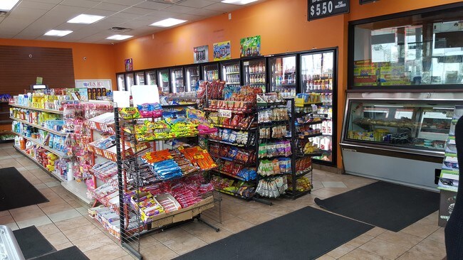
Conveniencestore
Wayne
B2
Michigan
B and X Area of moderate flood hazard, usually the area between the limits of the 100-year and 500-year floods.
0.31 AC
2025
Detroit W of Woodward
2025
Detroit
530300
Detroit-Warren-Dearborn, MI
2,263 SF
NEARBY LISTINGS FOR SALE OR LEASE
DEMOGRAPHICS near 3443 Fenkell St
1 mile
3 mile
5 mile
2025 Total Population
18,093
154,800
447,250
2030 Population
18,833
160,025
454,929
Pop Growth 2025-2030
+ 4.09%
+ 3.38%
+ 1.72%
Average Age
38
39
38
2025 Total Households
7,357
62,774
175,514
HH Growth 2025-2030
+ 4.35%
+ 3.52%
+ 1.97%
Median Household Inc
$31,531
$38,270
$42,129
Avg Household Size
2.30
2.40
2.40
2025 Avg HH Vehicles
1.00
1.00
1.00
Median Home Value
$77,148
$93,734
$111,433
Median Year Built
1947
1947
1948
Nearby Places
Map Layers
Map Styles
 Street
 Aerial
Layers
 Traffic
 Biking
Places
Listings with unknown addresses are not visible on the map
- Restaurants
- Banks
- Shops
- Fitness
- Groceries
PUBLIC TRANSPORTATION
COMMUTER RAIL
Detroit (Wolverine - Amtrak)
Drive
Walk
Distance
Detroit (Wolverine - Amtrak)
9 min
4.9 mi
AIRPORT
Windsor International
Drive
Walk
Distance
Windsor International
34 min
17.2 mi
Detroit Metro Wayne County
Drive
Walk
Distance
Detroit Metro Wayne County
38 min
25.6 mi
Freight Ports
Port of Toledo
Drive
Walk
Distance
Port of Toledo
83 min
65.7 mi
SALE & LEASE HISTORY
LISTING DATE
SALE/LEASE

Sep 15, 2020
For Sale
Nov 21, 2017
For Sale
May 17, 2017
For Sale
Nearby Properties
Address
Land Use
TOTAL SIZE
Lot Size
Zoning
Address
Land Use
TOTAL SIZE
Lot Size
Zoning
925,367 SF
12.82 AC
R6
Address
Land Use
TOTAL SIZE
Lot Size
Zoning
3,529,575 SF
84.46 AC
B4
Address
Land Use
TOTAL SIZE
Lot Size
Zoning
446,500 SF
27.90 AC
Address
Land Use
TOTAL SIZE
Lot Size
Zoning
165,829 SF
5.56 AC
R5
Address
Land Use
TOTAL SIZE
Lot Size
Zoning
292,032 SF
20.25 AC
B4
Address
Land Use
TOTAL SIZE
Lot Size
Zoning
353,800 SF
15.70 AC
Address
Land Use
TOTAL SIZE
Lot Size
Zoning
54,672 SF
1.37 AC
R6
Address
Land Use
TOTAL SIZE
Lot Size
Zoning
301,000 SF
Address
Land Use
TOTAL SIZE
Lot Size
Zoning
150,689 SF
4.87 AC
R5
Address
Land Use
TOTAL SIZE
Lot Size
Zoning
500,072 SF
12.50 AC
SD2
Address
Land Use
TOTAL SIZE
Lot Size
Zoning
181,798 SF
10.48 AC
B4
Address
Land Use
TOTAL SIZE
Lot Size
Zoning
63,216 SF
2.87 AC
R5
Address
Land Use
TOTAL SIZE
Lot Size
Zoning
66,870 SF
2.77 AC
Address
Land Use
TOTAL SIZE
Lot Size
Zoning
23,852 SF
130.56 AC
R1
Address
Land Use
TOTAL SIZE
Lot Size
Zoning
2,216,908 SF
44.80 AC
Address
Land Use
TOTAL SIZE
Lot Size
Zoning
217,000 SF
11.91 AC
Address
Land Use
TOTAL SIZE
Lot Size
Zoning
315,973 SF
12.18 AC
M4
Address
Land Use
TOTAL SIZE
Lot Size
Zoning
110,000 SF
1.36 AC
Address
Land Use
TOTAL SIZE
Lot Size
Zoning
64,566 SF
3.64 AC
PD
Address
Land Use
TOTAL SIZE
Lot Size
Zoning
147,717 SF
8.61 AC
PD
Address
Land Use
TOTAL SIZE
Lot Size
Zoning
7.10 AC
Address
Land Use
TOTAL SIZE
Lot Size
Zoning
300,000 SF
17.73 AC
Address
Land Use
TOTAL SIZE
Lot Size
Zoning
91,233 SF
11.36 AC
Address
Land Use
TOTAL SIZE
Lot Size
Zoning
Address
Land Use
TOTAL SIZE
Lot Size
Zoning
155,532 SF
1.72 AC
Address
Land Use
TOTAL SIZE
Lot Size
Zoning
84,453 SF
4.58 AC
Address
Land Use
TOTAL SIZE
Lot Size
Zoning
351,731 SF
1.93 AC
M4
Address
Land Use
TOTAL SIZE
Lot Size
Zoning
74,029 SF
6.44 AC
B3
Address
Land Use
TOTAL SIZE
Lot Size
Zoning
68,729 SF
0.52 AC
B4
Address
Land Use
TOTAL SIZE
Lot Size
Zoning
451,000 SF
21.59 AC
The World's #1 Commercial Real Estate Marketplace
Connect with us
© 2026 CoStar Group
The information above has been obtained from sources believed reliable. While we do not doubt its accuracy we have not verified it and make no guarantee, warranty or representation about it. It is your responsibility to independently confirm its accuracy and completeness. Any projections, opinions, assumptions, or estimates used are for example only and do not represent the current or future performance of the property. The value of this transaction to you depends on tax and other factors which should be evaluated by your tax, financial, and legal advisors. You and your advisors should conduct a careful, independent investigation of the property to determine to your satisfaction the suitability of the property for your needs.