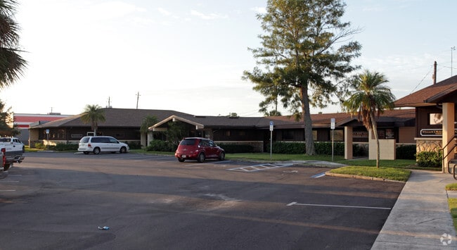
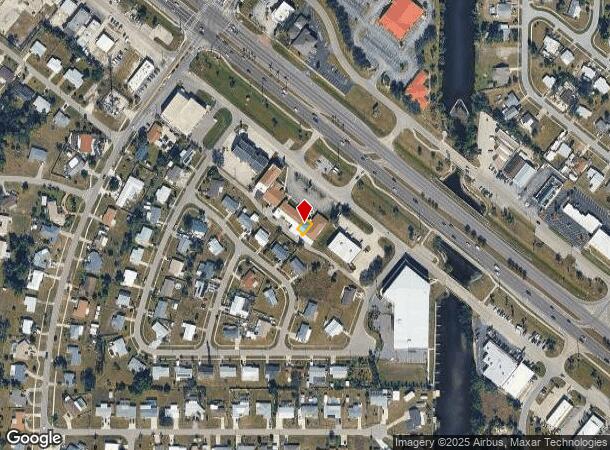
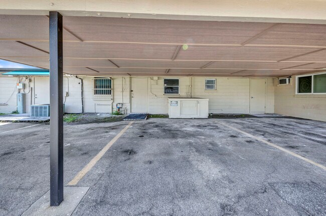
Property Record
3443 Tamiami Trl, Port Charlotte, FL 33952

Current Lease Availabilities
NEARBY LISTINGS FOR SALE OR LEASE
Property Detail
3443 Tamiami Trl
402222802001
Professional Gardens Ph 1
Commercialnec
PROFESSIONAL GARDENS PH 1 UN 1 1320/1663 AFF3077056 DC3077057-CDM AFF3416346 3416347
AE
Charlotte
12015C0226G
Florida
2024
0.15 AC
2025
Charlotte County
020602
Southwest Florida
1,706 SF
Punta Gorda, FL
DEMOGRAPHICS near 3443 Tamiami Trl
1 Mile
3 Mile
5 Mile
2024 Total Population
10,203
50,478
94,260
2029 Population
12,151
59,910
112,393
Pop Growth 2024-2029
+ 19.09%
+ 18.69%
+ 19.24%
Average Age
48
48
51
2024 Total Households
4,587
22,119
42,310
HH Growth 2024-2029
+ 19.49%
+ 19.04%
+ 19.63%
Median Household Inc
$38,757
$52,796
$57,427
Avg Household Size
2.10
2.20
2.10
2024 Avg HH Vehicles
2.00
2.00
2.00
Median Home Value
$158,340
$201,902
$239,495
Median Year Built
1972
1980
1985
Nearby Places
Map Layers
Map Styles
 Street
 Aerial
- Restaurants
- Banks
- Shops
- Fitness
- Groceries
PUBLIC TRANSPORTATION
AIRPORT
Punta Gorda
DRIVE
WALK
Distance
Punta Gorda
18 min
8.6 mi
Nearby Properties
Address
Land Use
TOTAL SIZE
Lot Size
Zoning
Address
Land Use
TOTAL SIZE
Lot Size
Zoning
333,027 SF
9.79 AC
CHRW
Address
Land Use
TOTAL SIZE
Lot Size
Zoning
156,350 SF
12.49 AC
OMI
Address
Land Use
TOTAL SIZE
Lot Size
Zoning
129,475 SF
16.04 AC
OMI
Address
Land Use
TOTAL SIZE
Lot Size
Zoning
172,298 SF
37.42 AC
OMI
Address
Land Use
TOTAL SIZE
Lot Size
Zoning
789,392 SF
31.39 AC
RMF15
Address
Land Use
TOTAL SIZE
Lot Size
Zoning
238,852 SF
26.63 AC
CG
Address
Land Use
TOTAL SIZE
Lot Size
Zoning
119,749 SF
12.90 AC
RSF3.5
Address
Land Use
TOTAL SIZE
Lot Size
Zoning
40,430 SF
5.63 AC
RMF12
Address
Land Use
TOTAL SIZE
Lot Size
Zoning
141,647 SF
20.29 AC
CG
Address
Land Use
TOTAL SIZE
Lot Size
Zoning
128,594 SF
25.54 AC
PD
Address
Land Use
TOTAL SIZE
Lot Size
Zoning
70,518 SF
2.08 AC
PD
Address
Land Use
TOTAL SIZE
Lot Size
Zoning
102,337 SF
10.43 AC
RSF3.5
Address
Land Use
TOTAL SIZE
Lot Size
Zoning
98,599 SF
9.75 AC
CG
Address
Land Use
TOTAL SIZE
Lot Size
Zoning
91,281 SF
10 AC
CG
Address
Land Use
TOTAL SIZE
Lot Size
Zoning
50,970 SF
9.74 AC
RSF3.5
Address
Land Use
TOTAL SIZE
Lot Size
Zoning
88,259 SF
4.71 AC
CG
Address
Land Use
TOTAL SIZE
Lot Size
Zoning
12,101 SF
15.92 AC
ES
Address
Land Use
TOTAL SIZE
Lot Size
Zoning
135,717 SF
10.55 AC
CG
Address
Land Use
TOTAL SIZE
Lot Size
Zoning
1,296 SF
14.46 AC
CG
Address
Land Use
TOTAL SIZE
Lot Size
Zoning
34,975 SF
2.90 AC
RMF15
Address
Land Use
TOTAL SIZE
Lot Size
Zoning
35,587 SF
6.27 AC
RMF15
Address
Land Use
TOTAL SIZE
Lot Size
Zoning
81,167 SF
5.63 AC
CG
Address
Land Use
TOTAL SIZE
Lot Size
Zoning
95,056 SF
9.51 AC
CG
Address
Land Use
TOTAL SIZE
Lot Size
Zoning
448 SF
16.37 AC
PD
Address
Land Use
TOTAL SIZE
Lot Size
Zoning
33,093 SF
1.95 AC
PD
Address
Land Use
TOTAL SIZE
Lot Size
Zoning
82,865 SF
19.74 AC
RMF12
Address
Land Use
TOTAL SIZE
Lot Size
Zoning
11.50 AC
CHRW
Address
Land Use
TOTAL SIZE
Lot Size
Zoning
88,721 SF
7.77 AC
CG
Address
Land Use
TOTAL SIZE
Lot Size
Zoning
12,039 SF
1.69 AC
PD
Address
Land Use
TOTAL SIZE
Lot Size
Zoning
18,645 SF
2.63 AC
CG
The World's #1 Commercial Real Estate Marketplace
Connect with us
© 2026 CoStar Group
The information above has been obtained from sources believed reliable. While we do not doubt its accuracy we have not verified it and make no guarantee, warranty or representation about it. It is your responsibility to independently confirm its accuracy and completeness. Any projections, opinions, assumptions, or estimates used are for example only and do not represent the current or future performance of the property. The value of this transaction to you depends on tax and other factors which should be evaluated by your tax, financial, and legal advisors. You and your advisors should conduct a careful, independent investigation of the property to determine to your satisfaction the suitability of the property for your needs.